Rabbit Ears Campsite
Campground
Campground · 2.4 mi from the trail
Alert in the area
The Forest Service lists 4 alerts for Canyon Lakes Ranger District.
Salt Cabin Prescribed (RX) Fire Closure
Agency alert covering Canyon Lakes Ranger District · Order 02-10-05-26-11 · USFS · Canyon Lakes Ranger District
Fire Restrictions
Agency alert covering Arapaho and Roosevelt National Forests · USFS · Arapaho and Roosevelt National Forests
West Crystal A - Mechanical Fuelbreak Area and Road Closure
Agency alert covering Canyon Lakes Ranger District · Order 02-10-05-26-04 · USFS · Canyon Lakes Ranger District
Cameron Peak Fire Road Closures
Agency alert covering Canyon Lakes Ranger District · Order 02-10-05-26-01 · USFS · Canyon Lakes Ranger District
As of · Source: USFS · Canyon Lakes Ranger District. Agencies don't list every closure — check before you go.
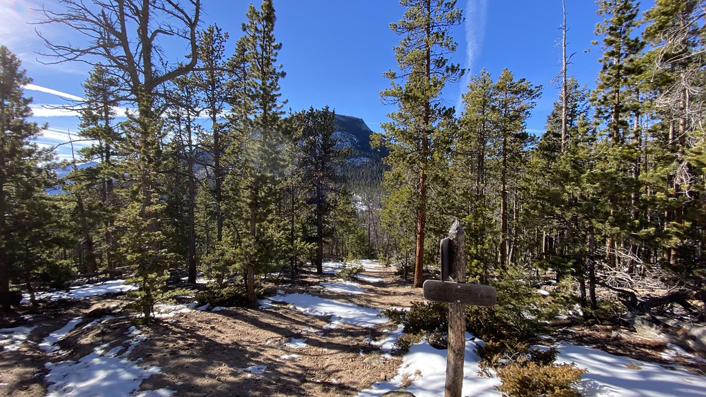
Fox Creek is an easy out-and-back hike in Colorado's Comanche Peak Wilderness, within the Canyon Lakes Ranger District of the Arapaho and Roosevelt National Forests. The trail is about 5 miles long, with an 800-foot elevation gain from a low point of 7,543 feet to a high of 8,524 feet. The Forest Service manages the land, and the route is natural-surfaced and open year-round. The trail is rated easy, and horses are allowed. Bikes are not. The climb is steady, and the route works well as a day hike or a longer outing with time to explore the surrounding wilderness. Summer is the most comfortable time to go. Typical averages from a nearby weather station in Estes Park show July highs around 80°F with lows near 48°F, while winter highs stay in the mid-30s. The Ridge Trail and Husted Trail both start within a mile. Climbers can find the Second Pew and Pulpit Rock Massif about a mile and a half away.
Rabbit Ears Campsite
Campground
Almost East Gemstone Peak
Viewpoint
Places © OpenStreetMap contributors, Places © Overture Maps Foundation
More in Estes ParkNot on Roamze yet. Their page has how to reach them.
 Ridge TrailHikingPhoto: Jesse James — CC BY 2.0 (via Flickr)0.5 mi
 North Fork Big Thompson RiverCanoeingPhoto: Unknown author, Public domain (via Wikimedia Commons)1.9 mi
Source: Roamze catalog (indexable pages within 10 miles, PostGIS distance)
Ridge TrailHiking · Next doorPhoto: Jesse James — CC BY 2.0 (via Flickr) North BoundaryHiking · ~2 min drivePhoto: lamblukas, CC BY 2.0 (via Flickr)
 Black Canyon TrailHiking · ~7 min drivePhoto: lamblukas, CC BY 2.0 (via Flickr)Cow Creek TrailHiking · ~3 min drivePhoto: lamblukas, CC BY 2.0 (via Flickr)
 Lumpy Ridge Climber Access TrailsHiking · ~6 min drivePhoto: lamblukas, CC BY 2.0 (via Flickr)
 Deer Mountain TrailHiking · ~10 min drivePhoto: NPS, Public domain (via Wikimedia Commons)Cow Creek TrailHiking · ~3 min drivePhoto: Jesse James — CC BY 2.0 (via Flickr)
 Lumpy Ridge Climber AccessHiking · ~7 min drivePhoto: lamblukas, CC BY 2.0 (via Flickr)
 North Fox TrailHiking · ~4 min drivePhoto: christinejwarner, CC BY 2.0 (via Flickr)
Best months: May–June and September. Best months have typical highs of 55–85 °F, lows of 30 °F or warmer (32 °F where the station doesn't record snow), at most one snowy day and no more than 12 wet days.
Jan
37° / 16°
7 wet
Feb
38° / 16°
8 wet
Mar
45° / 21°
9 wet
Apr
52° / 26°
10 wet
May
61° / 35°
12 wet
Jun
74° / 43°
10 wet
Jul
80° / 48°
13 wet
Aug
78° / 46°
13 wet
Sep
70° / 39°
9 wet
Oct
57° / 30°
7 wet
Nov
44° / 23°
6 wet
Dec
36° / 16°
7 wet
Typical high / low (°F) and days with rain or snow, 1991–2020. Measured at Estes Park 3 Sse, CO, 7.4 mi away at 7,812 ft. The station sits about 700 ft lower than this place, so expect it a little cooler here. This station doesn't record snowfall. Source: NOAA NCEI U.S. Climate Normals 1991–2020.

