Rabbit Ears Campsite
Campground
Campground · 4.7 mi from the trail
Alert in the area
The Forest Service lists 4 alerts for Canyon Lakes Ranger District.
Salt Cabin Prescribed (RX) Fire Closure
Agency alert covering Canyon Lakes Ranger District · Order 02-10-05-26-11 · USFS · Canyon Lakes Ranger District
Fire Restrictions
Agency alert covering Arapaho and Roosevelt National Forests · USFS · Arapaho and Roosevelt National Forests
West Crystal A - Mechanical Fuelbreak Area and Road Closure
Agency alert covering Canyon Lakes Ranger District · Order 02-10-05-26-04 · USFS · Canyon Lakes Ranger District
Cameron Peak Fire Road Closures
Agency alert covering Canyon Lakes Ranger District · Order 02-10-05-26-01 · USFS · Canyon Lakes Ranger District
As of · Source: USFS · Canyon Lakes Ranger District. Agencies don't list every closure — check before you go.
Crosier Mountain is a hard out-and-back hike in Colorado's Arapaho and Roosevelt National Forests, on the Canyon Lakes Ranger District. The trail is about 16 miles long, with a one-way elevation gain of 3,018 feet from the low point at 6,414 feet to the high point at 8,744 feet. The Forest Service manages the land, and the route is on natural surface with biking and horseback riding allowed. Summer is the most comfortable season. Typical averages from a nearby weather station in Estes Park put July highs around 80°F with lows near 48°F, and the station sits about 900 feet lower, so temperatures on the mountain run cooler. The parking is at the Crosier Mountain Garden Gate Trailhead, and the trail is open year-round. Several other routes start close by, including the Crosier Mountain Summit and H Bar G Ranch Trail, and Switchback Crags offers climbing about 1.4 miles away.
Rabbit Ears Campsite
Campground
Hunter's Chop House
Restaurant
Almost East Gemstone Peak
Viewpoint
Places © OpenStreetMap contributors
More in Estes ParkNot on Roamze yet. Their page has how to reach them.
Best months: May–June and September. Best months have typical highs of 55–85 °F, lows of 30 °F or warmer (32 °F where the station doesn't record snow), at most one snowy day and no more than 12 wet days.
Jan
37° / 16°
7 wet
Feb
38° / 16°
8 wet
Mar
45° / 21°
9 wet
Apr
52° / 26°
10 wet
May
61° / 35°
12 wet
Jun
74° / 43°
10 wet
Jul
80° / 48°
13 wet
Aug
78° / 46°
13 wet
Sep
70° / 39°
9 wet
Oct
57° / 30°
7 wet
Nov
44° / 23°
6 wet
Dec
36° / 16°
7 wet
Typical high / low (°F) and days with rain or snow, 1991–2020. Measured at Estes Park 3 Sse, CO, 7.6 mi away at 7,812 ft. The station sits about 900 ft lower than this place, so expect it a little cooler here. This station doesn't record snowfall. Source: NOAA NCEI U.S. Climate Normals 1991–2020.
 Photo: christinejwarner, CC BY 2.0 (via Flickr)
Crosier Mountain H-G
~1 min drive
1.2-mile out-and-back trail in Colorado with 138 ft elevation gain.
 Photo: Jesse James — CC BY 2.0 (via Flickr)
Crosier Mountain Rainbow Trail
~2 min drive
Crosier Mountain Rainbow Trail is a 1.96-mile trail in Colorado with 800 feet of elevation gain.
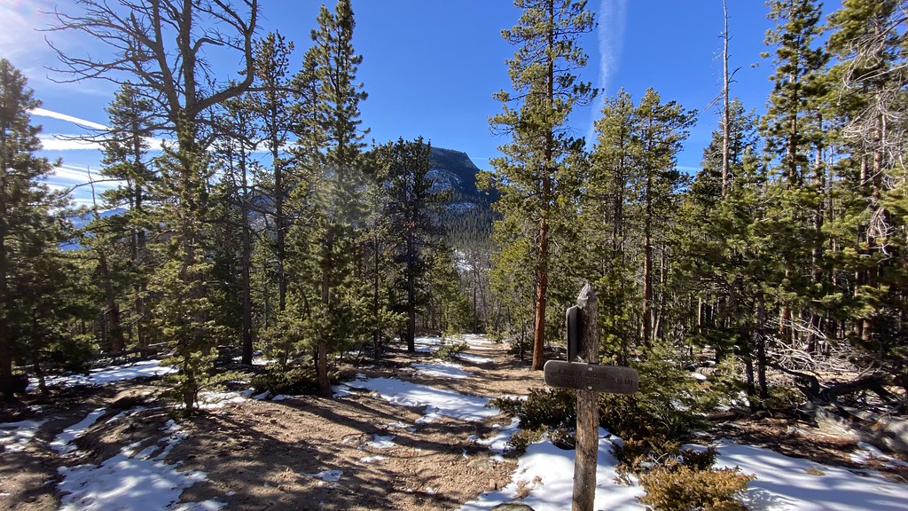 Photo: lamblukas, CC BY 2.0 (via Flickr)
Black Canyon Trail
~12 min drive
7.57-mile trail in Colorado with 800 ft elevation gain.
 Photo: christinejwarner, CC BY 2.0 (via Flickr)
North Fox Trail
~5 min drive
1.16-mile out-and-back hike in Colorado with 516 ft gain and loss.
 Photo: christinejwarner, CC BY 2.0 (via Flickr)
Miller Fork
~5 min drive
6.28-mile out-and-back trail in Colorado with 860 ft gain and 8,597 ft max elevation.
HIKE
Storm Mountain
~6 min drive
8.50-mile out-and-back trail to Storm Mountain in Colorado, 1,144 ft gain.
 Photo: lamblukas, CC BY 2.0 (via Flickr)
Cow Creek Trail
~6 min drive
1.32-mile out-and-back trail in Colorado with 264 ft elevation gain
Photo: lamblukas, CC BY 2.0 (via Flickr)North Boundary
~6 min drive
4.9 mi · Moderate
HIKE
Danner Pass
~9 min drive
6.77-mile out-and-back trail in Colorado reaching 10,090 feet.
Photo: Jesse James — CC BY 2.0 (via Flickr)Gem Lake Trail
~7 min drive
4.05-mile out-and-back hike with 500 ft gain to Gem Lake at 8,800 ft in Colorado.


