Four Mile Creek Campground
Campground
Campground · 4.5 mi from the trail
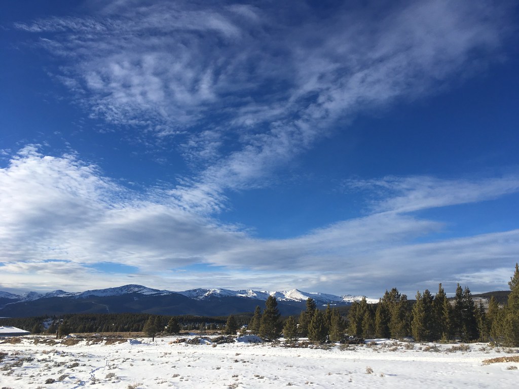 Photo: christinejwarner, CC BY 2.0 (via Flickr)
Dyer Mountain rises to 13,825 ft in Colorado. This route starts at Upper Iowa Gulch (end of CR 2B) and covers 3.3 miles round trip with about 2,000 ft of climbing.
Four Mile Creek Campground
Campground
Casa Blanca Restaurant
Restaurant
 If it rainsPlazak, CC BY 3.0 · Wikimedia Commons
Matchless Mine
Attraction
Places © OpenStreetMap contributors · Photos: Plazak, CC BY 3.0 (commons)
More in LeadvilleDaily highs and lows, wind and the chance of precipitation at the summit and route start for the next 7 days, from the Open-Meteo model.
West Dyer MountainHikingPhoto: christinejwarner, CC BY 2.0 (via Flickr)0.1 mi Tennessee CreekCanoeingPhoto: Jeffrey Beall, CC BY 3.0 (via Wikimedia Commons)4.7 mi
Source: Roamze catalog (indexable pages within 10 miles, PostGIS distance)
 Mount Sherman from Iowa GulchHiking · ~1 min drivePhoto: foto3116, CC BY 2.0 (via Flickr)
 Pennsylvania MountainHiking · ~7 min drivePhoto: QKC, CC BY-SA 3.0 (via Wikimedia Commons)
 Mount EvansHiking · ~9 min drivePhoto: QKC, CC BY-SA 3.0 (via Wikimedia Commons)
 Beaver CreekHiking · ~16 min drivePhoto: ikewinski, CC BY 2.0 (via Flickr)
 Pennsylvania Mountain TrailHiking · ~7 min drivePhoto: Thomas Elliott from Alma, USA, CC0 (via Wikimedia Commons)
 Limber GroveHiking · ~8 min drivePhoto: Ben Mason, CC BY 2.0 (via Flickr)West Dyer MountainHiking · ~10 min drivePhoto: christinejwarner, CC BY 2.0 (via Flickr)
 BodfishHiking · ~16 min drivePhoto: markbyzewski, CC BY 2.0 (via Flickr)London MountainHiking · ~9 min drivePhoto: QKC, CC BY-SA 3.0 (via Wikimedia Commons)
 Mount BrossHiking · ~13 min drivePhoto: jl_2, CC BY-SA 2.0 (via Flickr)
Also worth it near here
 Mount ShermanSummit · ~1 min drivePhoto: Stargazer7121, Public domain (via Wikimedia Commons)
 SwoopCross-country skiing · ~10 min drivePhoto: Famartin, CC BY-SA 4.0 (via Wikimedia Commons)
About 3.3 mi round trip from Upper Iowa Gulch (end of CR 2B).
About 2,000 ft of climbing round trip.
It is rated moderate.
Upper Iowa Gulch (end of CR 2B).
© openrouteservice.org by HeiGIT | Map data © OpenStreetMap contributors
