Crag Crest National Recreation Trail
 Photo: iagoarchangel, CC BY-SA 2.0 (via Flickr)
- 10.4 mi
- loop
- 826 ft
- climb
- 11,192 ft
- high point
- Loop
- route
- Jun–Sep
- best months
Is Crag Crest National Recreation Trail open right now?
Closure in the area
There's a closure order in Grand Mesa, Uncompahgre and Gunnison National Forests. It doesn't name Crag Crest National Recreation Trail, so check the source for the area it covers (2 listed).
Gold Mountain Wildfire Roads and Trails Closure Order v 4.0
Agency closure covering Grand Mesa, Uncompahgre and Gunnison National Forests · USFS · Grand Mesa, Uncompahgre and Gunnison National Forests
Ophir Pass Road Closure
Agency closure covering Grand Mesa, Uncompahgre and Gunnison National Forests · USFS · Grand Mesa, Uncompahgre and Gunnison National Forests
Potter Basin Road Closure Order
Agency alert covering Grand Mesa, Uncompahgre and Gunnison National Forests · USFS · Grand Mesa, Uncompahgre and Gunnison National Forests
Beaver Park Road Closure Order
Agency alert covering Grand Mesa, Uncompahgre and Gunnison National Forests · USFS · Grand Mesa, Uncompahgre and Gunnison National Forests
TERMINATION OF ORDER - FIRE RESTRICTIONS
Agency alert covering Grand Mesa, Uncompahgre and Gunnison National Forests · USFS · Grand Mesa, Uncompahgre and Gunnison National Forests
As of · Source: USFS · Grand Mesa, Uncompahgre and Gunnison National Forests. Agencies don't list every closure — check before you go.
Crag Crest National Recreation Trail is a 10.4-mile loop located in Colorado. This trail offers a scenic route suitable for hikers seeking a moderate-distance day hike in the state. The loop format allows hikers to experience varied terrain and scenery without backtracking, making it an efficient way to explore the area. The trail is managed as part of the National Recreation Trail system, indicating it is well-maintained and officially recognized for public use. Its location in Colorado places it within a region known for diverse landscapes, from forested areas to alpine terrain. The 10.4-mile distance makes this trail accessible to hikers with moderate fitness levels who want a full-day outing. The loop configuration is ideal for those preferring circular routes that return to the starting point without retracing their steps. While specific details about elevation gain and particular features are not documented, the trail's official designation and length suggest it provides a substantive hiking experience in Colorado's outdoor recreation system. Hikers should verify current conditions and bring appropriate gear for Colorado's variable mountain weather before setting out.
Local outfitters
- RV Ranch at Grand Junction25 mi away
- Cedar Creek RV Park and Lodging40 mi away
Not on Roamze yet. Their page has how to reach them.
- CottonwoodHikingPhoto: iagoarchangel, CC BY-SA 2.0 (via Flickr)0.1 mi
- Crag Crest NrtMountain biking0.6 mi
- Cobbett CampgroundCamping0.9 mi
- Cobbett LakeCamping0.9 mi
- Grand MesaPier fishing1.1 mi
- Ward CreekCanoeing6.9 mi
- Flowing ParkRock climbing9.4 mi
- Bionut WallRock climbing9.4 mi
Source: Roamze catalog (indexable pages within 10 miles, PostGIS distance)
 Island LakeHiking · ~2 min drivePhoto: ecksunderscore, CC BY-SA 2.0 (via Flickr)
- Cobbett LakeHiking · ~2 min drivePhoto: ecksunderscore, CC BY-SA 2.0 (via Flickr)
 GRIFFITH SKI LOOPHiking · ~7 min drivePhoto: Moo.The.Cow, CC BY 2.0 (via Flickr)
 Baron LakeHiking · ~2 min drivePhoto: jaygannett, CC BY-SA 2.0 (via Flickr)
- Cobbett to Ward TrailHiking · ~2 min drivePhoto: ecksunderscore, CC BY-SA 2.0 (via Flickr)
 Mesa TopHiking · ~7 min drivePhoto: KimonBerlin, CC BY-SA 2.0 (via Flickr)
 Grand Mesa National Scenic & Historic BywayHiking · ~2 min drivePhoto: iagoarchangel, CC BY-SA 2.0 (via Flickr)
- Grand Mesa Discovery TrailHiking · ~2 min drivePhoto: iagoarchangel, CC BY-SA 2.0 (via Flickr)
- Palisade PlungeHiking · ~7 min drivePhoto: KimonBerlin, CC BY-SA 2.0 (via Flickr)
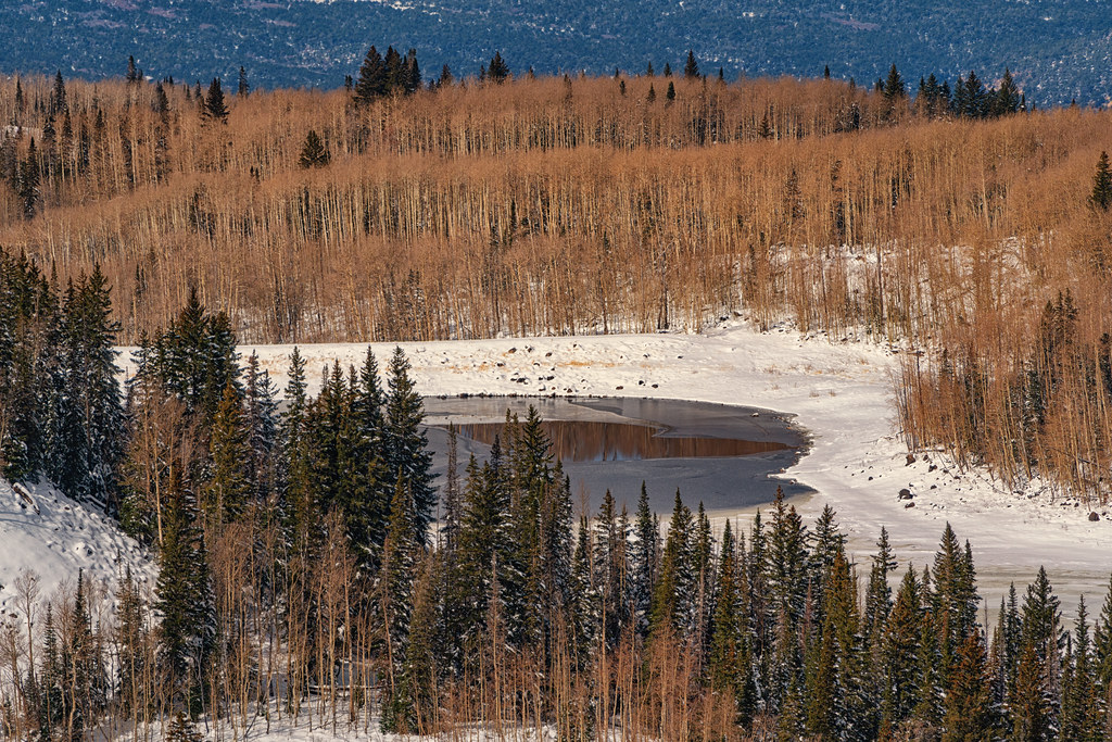 Kannah CrossingHiking · ~7 min drivePhoto: Tony Webster, CC BY 2.0 (via Flickr)
Best time to visit Crag Crest National Recreation Trail
Best months: June–September. Best months have typical highs of 55–85 °F, lows of 30 °F or warmer (32 °F where the station doesn't record snow), at most one snowy day and no more than 12 wet days.
Jan
26° / 6°
Feb
27° / 4°
Mar
34° / 12°
Apr
40° / 17°
May
49° / 27°
Jun
62° / 37°
Jul
68° / 42°
Aug
64° / 40°
Sep
57° / 34°
Oct
45° / 24°
Nov
34° / 14°
Dec
26° / 5°
Typical high / low (°F) and days with rain or snow, 1991–2020. Measured at Bonham Rsvr, CO, 5.6 mi away at 9,852 ft. The station sits about 1,300 ft lower than this place, so expect it a little cooler here. This station doesn't record snowfall. Source: NOAA NCEI U.S. Climate Normals 1991–2020.

Map and trail data © OpenStreetMap contributors
