Conundrum Trail
- 0.4 mi
- round trip
- 460 ft
- climb
- 11,445 ft
- high point
- Out and back
- route
Is Conundrum Trail open right now?
Closure in the area
There's a closure order in Grand Mesa, Uncompahgre and Gunnison National Forests. It doesn't name Conundrum Trail, so check the source for the area it covers (2 listed).
Gold Mountain Wildfire Roads and Trails Closure Order v 4.0
Agency closure covering Grand Mesa, Uncompahgre and Gunnison National Forests · USFS · Grand Mesa, Uncompahgre and Gunnison National Forests
Ophir Pass Road Closure
Agency closure covering Grand Mesa, Uncompahgre and Gunnison National Forests · USFS · Grand Mesa, Uncompahgre and Gunnison National Forests
Potter Basin Road Closure Order
Agency alert covering Grand Mesa, Uncompahgre and Gunnison National Forests · USFS · Grand Mesa, Uncompahgre and Gunnison National Forests
Beaver Park Road Closure Order
Agency alert covering Grand Mesa, Uncompahgre and Gunnison National Forests · USFS · Grand Mesa, Uncompahgre and Gunnison National Forests
TERMINATION OF ORDER - FIRE RESTRICTIONS
Agency alert covering Grand Mesa, Uncompahgre and Gunnison National Forests · USFS · Grand Mesa, Uncompahgre and Gunnison National Forests
As of · Source: USFS · Grand Mesa, Uncompahgre and Gunnison National Forests. Agencies don't list every closure — check before you go.
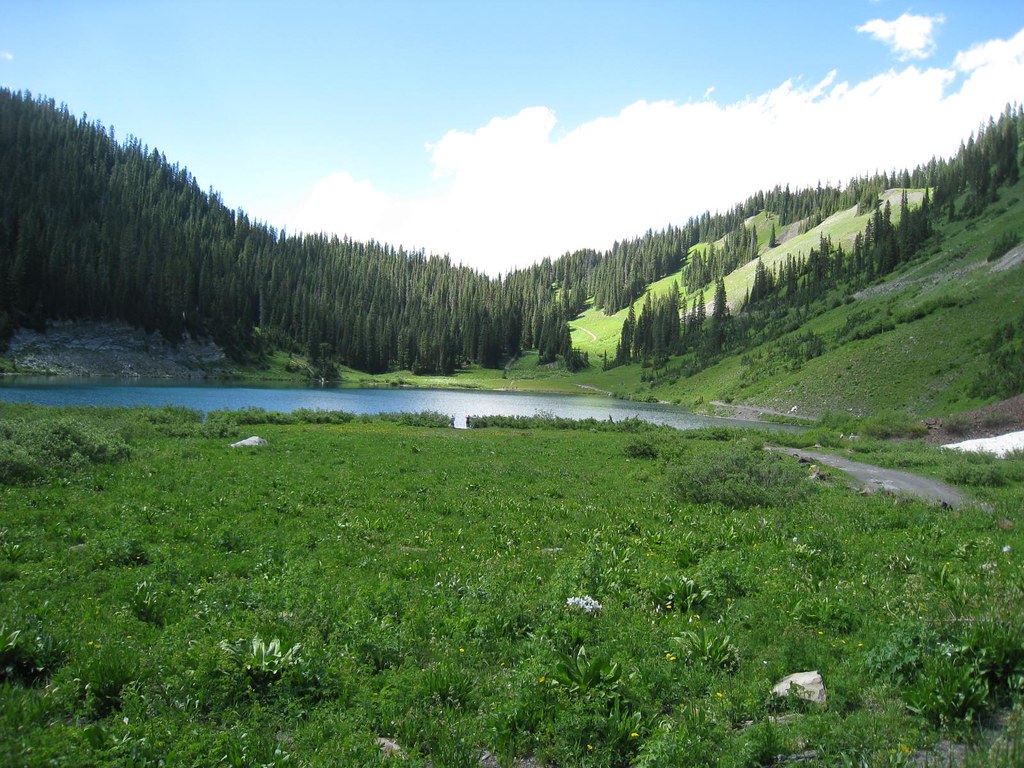
Conundrum Trail is an easy, short out-and-back hike in Colorado's Maroon Bells-Snowmass Wilderness, within the Gunnison Ranger District of the Grand Mesa, Uncompahgre and Gunnison National Forests. The route starts at about 11,176 feet and reaches a high point of 11,445 feet, with a rolling climb of about 460 feet over a round-trip distance of roughly 0.84 miles. The steepest stretch comes near the start, where the trail climbs about 18 percent. The Forest Service manages the land, and the trail lies entirely within designated wilderness. Because the route is short and the climb is gentle, it works well as a quick outing from a base in the area. The estimated trip takes about half an hour, so plan for a short stop rather than a full day on the trail. For more time in the wilderness, East Maroon and the Copper Pass Spur Trail both lie within about 1.6 miles. Gothic Campground, about 3.6 miles away, offers a place to stay. Climbers can head to Crested Butte, roughly 3.9 miles off.
Go with a guide
- Mineral Belt Trail Guided WalkNexPM AI · $25 per person · 39 mi away
- Maroon Bells Guide and Outfitters12 mi away
- East MaroonHiking1.5 mi
- Copper Pass Spur TrailHiking1.6 mi
- Gothic CampgroundCamping3.6 mi
 Campsites GC 4-8CampingPhoto: James St. John, CC BY 2.0 (via Wikimedia Commons)3.7 mi
- Crested ButteRock climbing3.9 mi
- East RiverCanoeing5.7 mi
- Maroon Lake ScenicLake fishing7 mi
- Skyland BouldersRock climbing7.8 mi
Source: Roamze catalog (indexable pages within 10 miles, PostGIS distance)
 Copper CreekHiking · ~6 min drivePhoto: Charlie DeTar, CC BY-SA 3.0 (via Wikimedia Commons)
- Judd FallsHiking · ~6 min drivePhoto: Charlie DeTar, CC BY-SA 3.0 (via Wikimedia Commons)
 Precarious PeakHiking · ~6 min drivePhoto: Jeffrey Pang from Berkeley, CA, USA, CC BY 2.0 (via Wikimedia Commons)
 Schofield TrailHiking · ~9 min drivePhoto: GSEC, CC BY 2.0 (via Flickr)
- Gothic Mountain TrailHiking · ~8 min drivePhoto: Jeffrey Pang from Berkeley, CA, USA, CC BY 2.0 (via Wikimedia Commons)
 Snodgrass Spur 2AHiking · ~9 min drivePhoto: Kyle Watson Photography, CC BY-SA 2.0 (via Flickr)
- Pearl MountainHiking · ~12 min drive
 Teddy's TrailHiking · ~9 min drivePhoto: Alissa Walker, CC BY-SA 2.0 (via Wikimedia Commons)
- Snodgrass Trail #590Hiking · ~10 min drivePhoto: Alissa Walker, CC BY-SA 2.0 (via Wikimedia Commons)
- Snodgrass Spur 590.2A TrailHiking · ~10 min drivePhoto: Kyle Watson Photography, CC BY-SA 2.0 (via Flickr)

Map and trail data © OpenStreetMap contributors
