Copper Creek
 Photo: Charlie DeTar, CC BY-SA 3.0 (via Wikimedia Commons)
- 9.6 mi
- round trip
- 2,818 ft
- climb
- 11,837 ft
- high point
- Out and back
- route
Is Copper Creek open right now?
Closure in the area
There's a closure order in Grand Mesa, Uncompahgre and Gunnison National Forests. It doesn't name Copper Creek, so check the source for the area it covers (2 listed).
Gold Mountain Wildfire Roads and Trails Closure Order v 4.0
Agency closure covering Grand Mesa, Uncompahgre and Gunnison National Forests · USFS · Grand Mesa, Uncompahgre and Gunnison National Forests
Ophir Pass Road Closure
Agency closure covering Grand Mesa, Uncompahgre and Gunnison National Forests · USFS · Grand Mesa, Uncompahgre and Gunnison National Forests
Potter Basin and Beaver Park Roads Emergency Closures
Agency alert covering Grand Mesa, Uncompahgre and Gunnison National Forests · USFS · Grand Mesa, Uncompahgre and Gunnison National Forests
TERMINATION OF ORDER - FIRE RESTRICTIONS
Agency alert covering Grand Mesa, Uncompahgre and Gunnison National Forests · USFS · Grand Mesa, Uncompahgre and Gunnison National Forests
Dallas Area Closure order
Agency alert covering Grand Mesa, Uncompahgre and Gunnison National Forests · USFS · Grand Mesa, Uncompahgre and Gunnison National Forests
As of · Source: USFS · Grand Mesa, Uncompahgre and Gunnison National Forests. Agencies don't list every closure — check before you go.
Copper Creek is a hard hike in Colorado's Maroon Bells-Snowmass Wilderness, part of the Gunnison Ranger District of the Grand Mesa, Uncompahgre and Gunnison National Forests. The trail is an out-and-back that climbs from about 9,800 feet to about 11,800 feet, a total gain of 2,818 feet over roughly 9.6 miles. The Forest Service manages the land, and the route is open from about June 15 to October 15. The trail is long and steep, and horses are allowed. The parking area for the Judd Falls - Copper Creek trailhead sits about 0.6 miles from the falls, which makes it the natural starting point for the hike. Judd Falls is the closest neighbor, and Gothic Campground is about 2.1 miles away. The trailriders 401 trail for mountain biking is about 1.6 miles off, and the Crested Butte climbing area is about 2.4 miles away.
Go with a guide
- Mineral Belt Trail Guided WalkRoamze · $25 per person · 42 mi away
- Maroon Bells Guide and Outfitters15 mi away
Keep exploring — more trails worth the drive
Photo: Charlie DeTar, CC BY-SA 3.0 (via Wikimedia Commons)Judd Falls
~1 min drive
1.08-mile out-and-back trail with 528 ft elevation gain and loss in Colorado.
 Photo: Alissa Walker, CC BY-SA 2.0 (via Wikimedia Commons)
Snodgrass Trail #590
~5 min drive
4.72-mile out-and-back trail in Colorado with 2,378 ft elevation gain and loss.
Photo: Alissa Walker, CC BY-SA 2.0 (via Wikimedia Commons)Teddy's Trail
~5 min drive
4.32-mile out-and-back trail in Colorado with 1,229 ft elevation gain.
 Photo: Jeffrey Pang from Berkeley, CA, USA, CC BY 2.0 (via Wikimedia Commons)
Precarious Peak
~5 min drive
Route to the summit of Precarious Peak (13,104 ft) from Rustler Gulch Trailhead.
 Photo: Kyle Watson Photography, CC BY-SA 2.0 (via Flickr)
Snodgrass Spur 2A
~4 min drive
1.26-mile out-and-back trail with 554 ft elevation gain in Colorado.
Photo: Jeffrey Pang from Berkeley, CA, USA, CC BY 2.0 (via Wikimedia Commons)Gothic Mountain Trail
~5 min drive
2.84-mile out-and-back hike in Colorado with 1,872 ft elevation gain and loss.
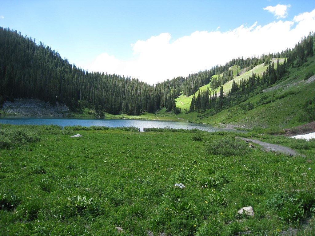 Photo: GSEC, CC BY 2.0 (via Flickr)
Schofield Trail
~8 min drive
2.94-mile out-and-back trail in Colorado with 1,024 ft gain and 11,355 ft max elevation.
Photo: Kyle Watson Photography, CC BY-SA 2.0 (via Flickr)Snodgrass Spur 590.2A Trail
~5 min drive
1.14-mile out-and-back trail in Colorado with 390 ft elevation gain and loss.
 Photo: supercraigtalbert, CC BY 2.0 (via Flickr)
Oh-Be-Joyful
~8 min drive
9.17-mile out-and-back trail in Colorado with 1,258 ft elevation gain.
 Photo: GSEC, CC BY 2.0 (via Flickr)
Yule Pass
~9 min drive
Yule Pass is a 4.68-mile out-and-back trail in Colorado with 442 ft of elevation gain.


