Black Ridge Trail
- 2.7 mi
- round trip
- 1,314 ft
- climb
- 7,059 ft
- high point
- Out and back
- route
- Apr–May, Sep–Oct
- best months
Black Ridge Trail is a moderate out-and-back hike on Bureau of Land Management land in the Uncompahgre Field Office of Colorado, about 3 miles from Montrose. The route is roughly 5.4 miles long, and the round-trip climb totals about 1,300 feet, with the high point at 7,059 feet. The trail's steepest stretch comes early, around the 0.8-mile mark, where the grade reaches about 25%. Summer is the warmest time to go. Typical averages from a nearby weather station at Montrose run to highs around 90°F in July, while September cools to about 79°F with lows near 48°F. That station sits roughly 1,300 feet below the trail, so temperatures on the ridge run cooler. The trip takes about 2.5 hours. Horse Trail and Moonlight Mesa Trail both start within a mile. Chukar campground is about 3 miles away, and Black Canyon of the Gunnison offers climbing about 6 miles off.
Local outfitters
- Cedar Creek RV Park and Lodging7 mi away
- Peak Mountain Guides39 mi away
Not on Roamze yet. Their page has how to reach them.
- Horse TrailHiking0.7 mi
- Moonlight Mesa TrailHiking0.8 mi
- ChukarCamping2.9 mi
- Peach Valley OHV AreaCamping3 mi
 Black Canyon of the GunnisonRock climbingPhoto: scostello22, CC BY 2.0 (via Flickr)6.1 mi
- MontroseRock climbing6.3 mi
- Gunnison RiverRiver fishing7.8 mi
- Gunnison Gorge Wilderness FloatCanoeing8.5 mi
Source: Roamze catalog (indexable pages within 10 miles, PostGIS distance)
- High Point OverlookHiking · ~9 min drive
 Warner Point Nature TrailHiking · ~9 min drivePhoto: joannapoe, CC BY-SA 2.0 (via Flickr)
 Chasm View TrailHiking · ~12 min drivePhoto: Frans-Banja Mulder, CC BY 3.0 (via Wikimedia Commons)
- Red Rocks-Nighthorse TrailHiking · ~9 min drive
- Ute TrailHiking · ~12 min drive
- Sunset View Overlook at Black CanyonHiking · ~10 min drive
- Cedar Point OverlookHiking · ~11 min drive
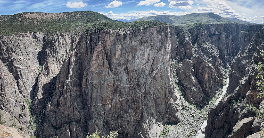 North Vista TrailHiking · ~12 min drivePhoto: joannapoe, CC BY-SA 2.0 (via Flickr)
- Dragon Point OverlookHiking · ~10 min drive
- Painted Wall OverlookHiking · ~11 min drive
Also worth it near here
Best time to visit Black Ridge Trail
Best months: April–May and September–October. Best months have typical highs of 55–85 °F, lows of 30 °F or warmer (32 °F where the station doesn't record snow), at most one snowy day and no more than 12 wet days.
Jan
38° / 16°
5 wet
Feb
45° / 22°
6 wet
Mar
55° / 29°
7 wet
Apr
63° / 35°
7 wet
May
74° / 43°
6 wet
Jun
86° / 52°
4 wet
Jul
90° / 58°
7 wet
Aug
87° / 56°
7 wet
Sep
79° / 48°
7 wet
Oct
65° / 36°
6 wet
Nov
51° / 25°
5 wet
Dec
39° / 16°
5 wet
Typical high / low (°F) and days with rain or snow, 1991–2020. Measured at Montrose Rgnl Ap, CO, 6.1 mi away at 5,759 ft. The station sits about 1,300 ft lower than this place, so expect it a little cooler here. This station doesn't record snowfall. Source: NOAA NCEI U.S. Climate Normals 1991–2020.

Map and trail data © OpenStreetMap contributors
