Breckenridge Area
Campground
Campground · 2.8 mi from the trail
Alert in the area
The Forest Service lists 6 alerts for White River National Forest.
FSR 286, Radical Hill, is closed due to washouts and unsafe conditions
Agency alert covering White River National Forest · USFS · White River National Forest
Limited parking at Snowmass Creek Trailhead
Agency alert covering White River National Forest · USFS · White River National Forest
Grizzly Creek Trail Closure
Agency alert covering White River National Forest · Order 2026-02 · USFS · White River National Forest
Ruedi Marina Day Use area Dump Station is CLOSED
Agency alert covering White River National Forest · USFS · White River National Forest
Asbestos safety closure - Camp Hale
Agency alert covering White River National Forest · USFS · White River National Forest
As of · Source: USFS · White River National Forest. Agencies don't list every closure — check before you go.
Bald Mountain is a hard hike in Colorado's White River National Forest, within the Dillon Ranger District. The route is an out-and-back of about 5.6 miles, with a total elevation gain of 2,823 feet and a high point of 13,698 feet. The climb is steep, and the trail is rated hard. The hike starts close to two other destinations. Webber Gulch Trail is about 0.1 mile away, and the Nightmare on Baldy mountain biking route is the same distance off. For a change of pace, the Blue River offers canoeing about 3.2 miles away, and Raspberry Boulders, a climbing area, is about 3.5 miles away.
Breckenridge Area
Campground
Traverse Restaurant and Bar
Restaurant
 If it rainsJeremy Olson, CC BY-SA 4.0 · Wikimedia Commons
Places © OpenStreetMap contributors · Photos: Jeremy Olson, CC BY-SA 4.0 (commons)
More in LeadvilleDaily highs and lows, wind and the chance of precipitation at the summit and route start for the next 7 days, from the Open-Meteo model.
Source: Roamze catalog (indexable pages within 10 miles, PostGIS distance)
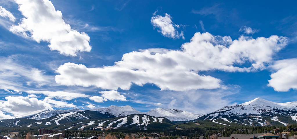 ProspectHiking · ~4 min drivePhoto: TerryDOtt, CC BY 2.0 (via Flickr)
Also worth it near here
 Mount Baldy RoadSki touring · ~1 min drivePhoto: QKC, CC BY-SA 3.0 (via Wikimedia Commons)Upper TurksCross-country skiing · ~1 min drivePhoto: QKC, CC BY-SA 3.0 (via Wikimedia Commons)
 Mineral HillSummit · ~2 min drivePhoto: Clyde Charles Brown, CC BY-SA 4.0 (via Wikimedia Commons)
 Baker's Tank TrailMountain biking · ~3 min drivePhoto: Nan Palmero from San Antonio, TX, USA, CC BY 2.0 (via Wikimedia Commons)
About 5.6 mi round trip from Hannah's Way Trailhead.
About 2,823 ft of climbing round trip.
It is rated hard.
Hannah's Way Trailhead.
© openrouteservice.org by HeiGIT | Map data © OpenStreetMap contributors
