Garlic Falls
- 1,880 ft
- elevation
- Forest Service
- managed by
- Feb–Jun, Oct–Nov
- best months
Is Garlic Falls open right now?
Closure in the area
There's a closure order in Sierra National Forest. It doesn't name Garlic Falls, so check the source for the area it covers (3 listed).
Safety Tips for Burned Areas: Garnet Fire Area
Agency closure covering Sierra National Forest · USFS · Sierra National Forest
Wilderness Food and Refuse Storage
Agency closure covering Sierra National Forest · Order 05-15-00-26-03 · USFS · Sierra National Forest
Food and Refuse Storage
Agency closure covering Sierra National Forest · Order 05-15-00-26-02 · USFS · Sierra National Forest
Forest Order removes Fish Camp, Soda Springs, and Little Jackass from closure list
Agency alert covering Sierra National Forest · Order 05-15-00-26-11 · USFS · Sierra National Forest
Ansel Adams and John Muir Wilderness Campfire Restrictions
Agency alert covering Sierra National Forest · Order 05-15-00-26-09 · USFS · Sierra National Forest
As of · Source: USFS · Sierra National Forest. Agencies don't list every closure — check before you go.
Garlic Falls is a waterfall in the High Sierra Ranger District of Sierra National Forest in California, about 9 miles from the town of Wilsonia. The Forest Service manages the surrounding land, and the falls sit at roughly 1,900 feet. The most comfortable times to visit are spring and fall. Typical averages from a nearby weather station show May highs around 77°F and October highs around 77°F, while July and August average highs near 93°F. Several other outings lie close by. The Kings River Nrt is about 1.6 miles away, and Fox Canyon Trail is about 4 miles away. Princess campground is about 4 miles off, and Hume Lake is about 5.5 miles away.
- Elevation
- 1,880 ft
- Land manager
- Forest Service
Elevation from USGS 3D Elevation Program terrain data (about 10 m resolution).
- Kings River NrtHiking1.6 mi
- Fox Canyon TrailHiking4 mi
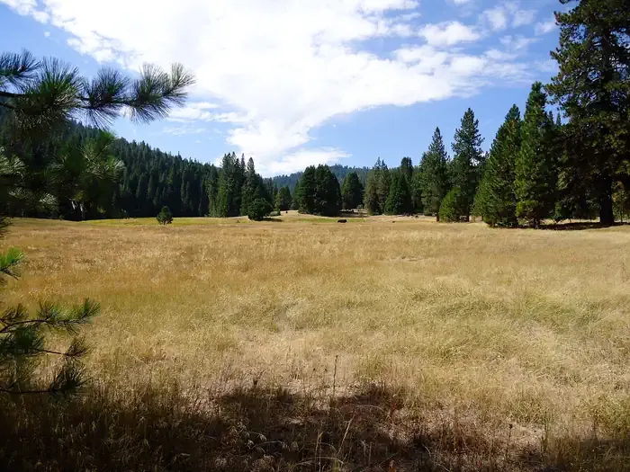 PrincessCampingPhoto: Recreation.gov (RIDB) / public domain4.1 mi
- Chicago StumpCamping5 mi
- Hume LakeLake fishing5.5 mi
- Patterson BluffRock climbing5.9 mi
- Rancheria CreekCanoeing6.2 mi
- Grant GroveRock climbing8.4 mi
Source: Roamze catalog (indexable pages within 10 miles, PostGIS distance)
 Roaring River FallsWaterfall · ~33 min drivePhoto: ogwen, CC BY-SA 3.0 (via Wikimedia Commons)
 Tokopah FallsWaterfall · ~39 min drivePhoto: JERRYE AND ROY KLOTZ MD, CC BY-SA 3.0 (via Wikimedia Commons)
- Ella FallsWaterfall · ~16 min drive
- Silver Spray FallsWaterfall · ~17 min drive
- Blue Canyon FallsWaterfall · ~21 min drive
- Mist FallsWaterfall · ~39 min drive
- Marble FallsWaterfall · ~39 min drive
- Triple FallsWaterfall · ~40 min drive
- Second FallsWaterfall · ~57 min drive
- First FallsWaterfall · ~57 min drive
Best time to visit Garlic Falls
Best months: February–June and October–November. Best months have typical highs of 55–85 °F, lows of 30 °F or warmer (32 °F where the station doesn't record snow), at most one snowy day and no more than 12 wet days.
Jan
52° / 39°
Feb
56° / 40°
Mar
63° / 43°
Apr
68° / 47°
May
77° / 53°
Jun
85° / 61°
Jul
93° / 69°
Aug
93° / 69°
Sep
88° / 64°
Oct
77° / 54°
Nov
60° / 45°
Dec
51° / 38°
Typical high / low (°F) and days with rain or snow, 1991–2020. Measured at Balch Pwr House, CA, 8.2 mi away at 1,735 ft. This station doesn't record snowfall. Source: NOAA NCEI U.S. Climate Normals 1991–2020.


