Glacier Lodge Campground
Campground
Campground · 3.2 mi from the trail
 Photo: Justin.Johnsen (Justin at Flickr), CC BY 2.0 (via Wikimedia Commons)
Alert in the area
The Forest Service lists 3 alerts for Inyo National Forest.
Help Halt Golden Mussel Invasion
Agency alert covering Inyo National Forest · USFS · Inyo National Forest
Ansel Adams and John Muir Wilderness Campfire Restrictions
Agency alert covering Inyo National Forest · Order 05-04-50-25-04 · USFS · Inyo National Forest
Golden Trout and Hoover Wilderness Campfire Restrictions
Agency alert covering Inyo National Forest · Order 05-04-50-25-05 · USFS · Inyo National Forest
As of · Source: USFS · Inyo National Forest. Agencies don't list every closure — check before you go.
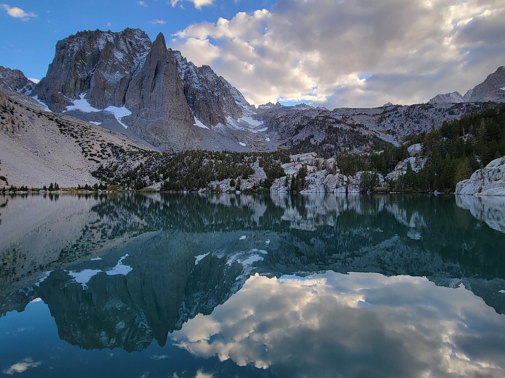
Temple Crag is a summit of about 12,978 feet in Inyo County, California, inside the John Muir Wilderness. The surrounding land is part of the White Mountain Ranger District of Inyo National Forest, managed by the Forest Service, and the nearest town is Big Pine, about 11 miles away. The Palisade Glacier Trail and the North Fork Big Pine Creek hike both start within about a mile and a half. Climbers can head to the Palisades & Surrounding Peaks area, and Big Pine Creek Campground is about 3.4 miles away.
Glacier Lodge Campground
Campground
Parchers Resort Cafe
Restaurant
Keough Hot Ditch
Hot spring
Places © OpenStreetMap contributors
More in BishopDaily highs and lows, wind and the chance of precipitation at the summit for the next 7 days, from the Open-Meteo model.
Elevation from USGS 3D Elevation Program terrain data (about 10 m resolution).
We don't know of a mapped trail or route to the summit of Temple Crag. Plan the approach with local maps, a guidebook or a local guide, and check conditions before you go.
12,978 ft (3,956 m).
We don't know of a mapped trail or route to the summit. Plan the approach with local maps, a guidebook or a local guide.


 NORTH FORK BIG PINE CREEKHikingPhoto: Moo.The.Cow, CC BY 2.0 (via Flickr)1.1 miPalisade Glacier TrailHikingPhoto: Moo.The.Cow, CC BY 2.0 (via Flickr)1.3 mi
 Table MountainRiver fishing8 mi
 Big Pine CreekCanoeingPhoto: Justin.Johnsen (talk · contribs) (Justin at Flickr), CC BY 2.0 (via Wikimedia Commons)8.4 mi
Source: Roamze catalog (indexable pages within 10 miles, PostGIS distance)
Mount SillSummit · ~2 min drivePhoto: Jonathan Fox, CC BY-SA 2.0 (via Wikimedia Commons) Mount JepsonSummit · ~2 min drivePhoto: Tim Berger, CC BY 2.0 (via Wikimedia Commons)Thunderbolt PeakSummit · ~3 min drivePhoto: Jonathan Fox from Carson City, United States, CC BY-SA 2.0 (via Wikimedia Commons)
 Palisade CrestSummit · ~3 min drivePhoto: Jonathan Fox from Carson City, United States, CC BY-SA 2.0 (via Wikimedia Commons)Mount AgassizSummit · ~4 min drivePhoto: Justin, CC BY 2.0 (via Wikimedia Commons)Aperture PeakSummit · ~4 min drivePhoto: Jonathan Fox, CC BY-SA 2.5 (via Wikimedia Commons)Norman Clyde PeakSummit · ~4 min drivePhoto: Justin.Johnsen (talk · contribs) (Justin at Flickr), CC BY 2.0 (via Wikimedia Commons)
 Middle PalisadeSummit · ~5 min drivePhoto: GarconN2 (talk · contribs), Public domain (via Wikimedia Commons)
 Columbine PeakSummit · ~5 min drivePhoto: Sebastian Werner, CC BY 2.0 (via Wikimedia Commons)
 Mount GoodeSummit · ~7 min drivePhoto: Dan Nevill, CC BY 2.0 (via Wikimedia Commons)
