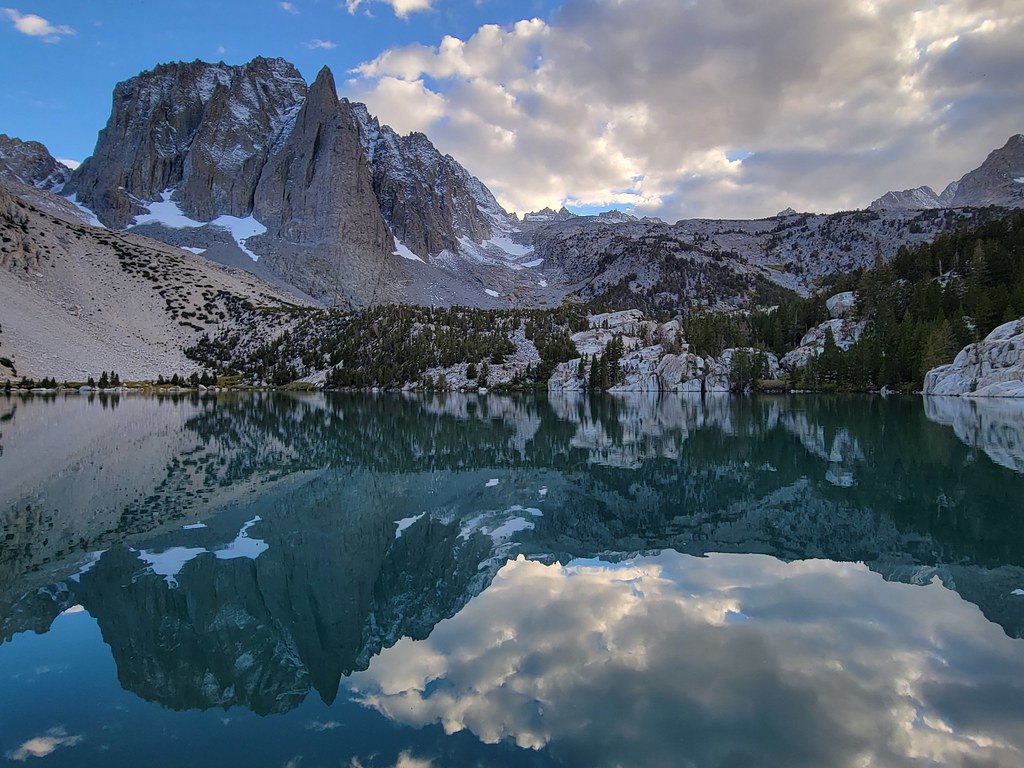
Palisades & Surrounding Peaks
Palisades & Surrounding Peaks in California has 29 climbing routes.
- 29 routes
- 5.2 – 5.10
- Alpine · Bouldering
Is Palisades & Surrounding Peaks open right now?
Alert in the area
The Forest Service lists 4 alerts for Inyo National Forest.
Stage 1 Fire Restrictions in Effect
Agency alert covering Inyo National Forest · Order 05-04-50-26-23 · USFS · Inyo National Forest
Help Halt Golden Mussel Invasion
Agency alert covering Inyo National Forest · USFS · Inyo National Forest
Ansel Adams and John Muir Wilderness Campfire Restrictions
Agency alert covering Inyo National Forest · Order 05-04-50-25-04 · USFS · Inyo National Forest
Golden Trout and Hoover Wilderness Campfire Restrictions
Agency alert covering Inyo National Forest · Order 05-04-50-25-05 · USFS · Inyo National Forest
As of · Source: USFS · Inyo National Forest. Agencies don't list every closure — check before you go.
Palisades & Surrounding Peaks is a climbing area in California's John Muir Wilderness, within the White Mountain Ranger District of Inyo National Forest. The Forest Service manages the land, and the area sits among a cluster of named peaks and crags, with Thunderbolt Peak and Temple Crag each about 1.3 miles away. The area offers a range of climbing styles, with 29 routes in total. Alpine climbing dominates, with 23 alpine routes, and the grades run from 5.2 up to 5.10 on the YDS scale. Ice climbing is also present, with Starlight Buttress at 5.7. For bouldering, three routes sit at V0 through V3. Several other destinations lie within a few miles. The Palisade Glacier Trail and North Fork Big Pine Creek are both hikes about 2.5 miles off, and Big Pine Creek Campground is about 4.2 miles away.
Routes (29)
Alley, The(3)
Columbine Peak(2)
Middle Palisade(1)
Mt. Gayley(1)
Norman Clyde Peak(3)
North Palisade(3)
Peak 11,880(1)
Split Mountain(2)
Starlight Peak(2)
Two Eagle Peak(1)
Keep exploring — more climbs worth the drive
 Photo: daveynin from United States, CC BY 2.0 (via Wikimedia Commons)
Hurd Lake
~10 min drive
Hurd Lake in California has 24 climbing routes with bouldering pads and alpine no fixed protection.
Thunderbolt Peak
~7 min drive
Route to the summit of Thunderbolt Peak (14,003 ft) from Big Pine Creek Trailhead.
 Photo: inkknife_2000 (14 million views), CC BY-SA 2.0 (via Flickr)
Wild Rose Buttress
~12 min drive
Wild Rose Buttress in California has 8 routes across 5 grades, offering sport and trad climbing.
Mount Sill
~7 min drive
Route to the summit of Mount Sill (14,160 ft) from Big Pine Creek Trailhead.
 Photo: jfdervin, CC BY-SA 2.0 (via Flickr)
Bishop Pass & Evolution
~13 min drive
Bishop Pass & Evolution in California has 36 routes with alpine no fixed protection.
 Photo: RuggyBearLA, CC BY 2.0 (via Flickr)
Roadside Fire Boulder
~17 min drive
8 bouldering routes at Roadside Fire Boulder in California, 7 difficulty grades.
 Photo: RuggyBearLA, CC BY 2.0 (via Flickr)
Frontier Right
~25 min drive
Frontier Right in California has 9 climbing routes with 6 difficulty grades.
Photo: RuggyBearLA, CC BY 2.0 (via Flickr)Frontier Left
~25 min drive
Frontier Left in California has 6 climbing routes across 5 grades, offering sport and trad styles.
Photo: RuggyBearLA, CC BY 2.0 (via Flickr)Little Egypt
~25 min drive
Little Egypt in California has 16 climbing routes across 12 difficulty grades.
Thunderbolt Peak
~2 min drive
Thunderbolt Peak in California has 6 climbing routes with alpine no fixed protection.