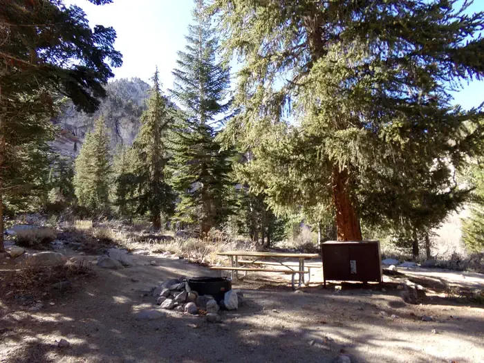
Screwball Camp
Campground
Campground · 2.7 mi from the trail
 Photo: Justin, CC BY 2.0 (via Wikimedia Commons)
No closures listed
The National Park Service lists no closures for Kings Canyon National Park.
As of · Source: NPS · Kings Canyon National Park. Agencies don't list every closure — check before you go.
Mount Farquhar is a summit in Tulare County, California, at about 12,865 feet. It sits in Kings Canyon National Park and the Sequoia-Kings Canyon Wilderness.
Screwball Camp
Campground
 If it rainsDavid Fulmer, CC BY 2.0 · Wikimedia Commons
Giant Forest Museum
Museum
Places © OpenStreetMap contributors · Photos: David Fulmer, CC BY 2.0 (commons)
More in Silver CityDaily highs and lows, wind and the chance of precipitation at the summit for the next 7 days, from the Open-Meteo model.
Elevation from USGS 3D Elevation Program terrain data (about 10 m resolution).
We don't know of a mapped trail or route to the summit of Mount Farquhar. Plan the approach with local maps, a guidebook or a local guide, and check conditions before you go.
12,865 ft (3,921 m).
We don't know of a mapped trail or route to the summit. Plan the approach with local maps, a guidebook or a local guide.


 North BeachRock climbingPhoto: Tom Hilton, CC BY 2.0 (via Flickr)6.7 mi
 Onion ValleyCampingPhoto: Recreation.gov (RIDB) / public domain9.1 mi
Source: Roamze catalog (indexable pages within 10 miles, PostGIS distance)
 Mount BrewerSummit · ~3 min drivePhoto: Matthes, F.E., Public domain (via Wikimedia Commons)
 Charlotte DomeSummit · ~7 min drivePhoto: Original by Will Keightley (feverblue), cropped by user:Droll, CC BY-SA 2.0 (via Wikimedia Commons)
 Thunder MountainSummit · ~7 min drivePhoto: glenngould, CC BY 2.0 (via Wikimedia Commons)
 Mount BagoSummit · ~8 min drivePhoto: Tom Hilton, CC BY 2.0 (via Wikimedia Commons)
 Table MountainSummit · ~8 min drivePhoto: F. Webb, Public domain (via Wikimedia Commons)
 Deerhorn MountainSummit · ~9 min drivePhoto: Tom Hilton, CC BY 2.5 (via Wikimedia Commons)
 Mount GardinerSummit · ~10 min drivePhoto: Will Keightley, CC BY-SA 2.0 (via Wikimedia Commons)
 Mount StanfordSummit · ~10 min drivePhoto: Justin, CC BY 2.0 (via Wikimedia Commons)
 Milestone MountainSummit · ~11 min drivePhoto: W.L. Huber, Public domain (via Wikimedia Commons)Caltech PeakSummit · ~11 min drivePhoto: Dcrjsr, CC BY 3.0 (via Wikimedia Commons)
Also worth it near here


