Mount Baxter
About
Mount Baxter is a summit of about 13,125 feet in Inyo County, California, inside Kings Canyon National Park and the John Muir Wilderness. The land is managed by the National Park Service, and the nearest town is Independence, about 9 miles away. The peak sits within a cluster of protected areas, including the Sequoia-Kings Canyon Wilderness, the Mt. Whitney Ranger District of Inyo National Forest, and the park's own boundaries. Sawmill Pass and Baxter Pass are both within a few miles, and Woods Creek offers canoeing about 5 miles out. For an overnight base, Onion Valley campground is about 6 miles away.
Summit Facts
Summit elevation
13,125 ft
Land manager
National Park Service
Elevation from USGS 3D Elevation Program terrain data (about 10 m resolution).
Location
Mount Baxter
California
Name and location: U.S. Geological Survey, Geographic Names Information System (GNIS). Elevation: USGS 3D Elevation Program. View the GNIS record.
Facts about this place
Where it is
- John Muir Wilderness · Wilderness
- Sequoia-Kings Canyon Wilderness · Wilderness
- Mt. Whitney Ranger District · Ranger district
- Kings Canyon National Park · National Park Service
- Inyo National Forest · National forest
- Nearest town
- Independence, California · 8.8 mi
- Managed by
- National Park Service
Conditions
Active alerts for Inyo National Forest as of Oct 9, 2026:
Southern California Edison - Road work in Silver and Wyman Canyon
information · posted Sep 9, 2026
Food and Refuse Storage Restrictions
information · posted Aug 24, 2026
Eastern Sierra Climate and Communities Resilience Project Area Closure
information · posted Aug 24, 2026
Ansel Adams and John Muir Wilderness Campfire Restrictions
fire-restriction · posted Aug 24, 2026
Golden Trout and Hoover Wilderness Campfire Restrictions
fire-restriction · posted Aug 24, 2026
information · posted Aug 24, 2026
Mount Whitney Zone Access Restrictions
information · posted Aug 24, 2026
Stay Limits, Parking, and Developed Recreation Site Use
information · posted Aug 24, 2026
Help Halt Golden Mussel Invasion
caution · posted Aug 24, 2026
information · posted Aug 24, 2026
Source: USFS forest alerts
Nearby
 Sawmill PassHikingPhoto: Tetsuo Fukuchi, Copyrighted free use (via Wikimedia Commons)1.5 mi
- Baxter PassHiking2.3 mi
 Woods Creek Crossing - Dollar LakeHikingPhoto: Matt Lavin, CC BY-SA 2.0 (via Flickr)3.1 mi
- Woods CreekCanoeing5 mi
- Kearsarge Pass to Cedar GroveRock climbing5.6 mi
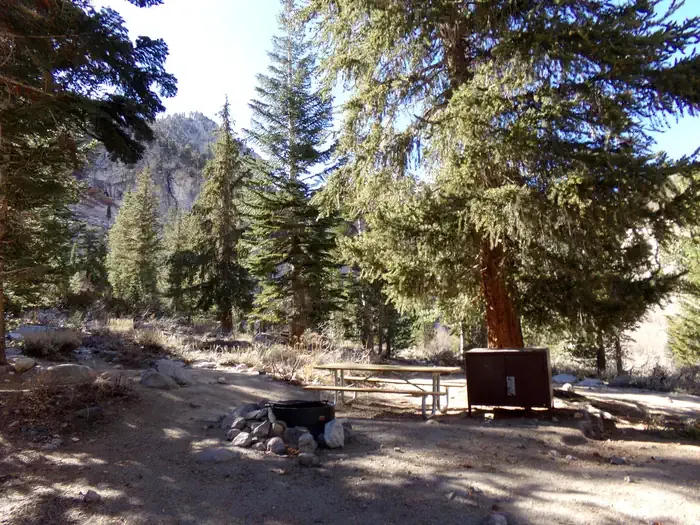 Onion ValleyCampingPhoto: Recreation.gov (RIDB) / public domain6.1 mi
- Grays Meadow CgCamping7 mi
- Grays MeadowsCamping7.4 mi
Source: Roamze catalog (indexable pages within 10 miles, PostGIS distance)
Is Mount Baxter open right now?
Alert in the area
The Forest Service lists 4 alerts for Inyo National Forest.
Stage 1 Fire Restrictions in Effect
Agency alert covering Inyo National Forest · Order 05-04-50-26-23 · USFS · Inyo National Forest
Help Halt Golden Mussel Invasion
Agency alert covering Inyo National Forest · USFS · Inyo National Forest
Ansel Adams and John Muir Wilderness Campfire Restrictions
Agency alert covering Inyo National Forest · Order 05-04-50-25-04 · USFS · Inyo National Forest
Golden Trout and Hoover Wilderness Campfire Restrictions
Agency alert covering Inyo National Forest · Order 05-04-50-25-05 · USFS · Inyo National Forest
As of · Source: USFS · Inyo National Forest. Agencies don't list every closure — check before you go.
