Eureka Dunes
 Photo: G. Thomas at English Wikipedia, Public domain (via Wikimedia Commons)
- 3,523 ft
- summit
- National Park Service
- managed by
- Feb–May, Oct–Nov
- best months
Is Eureka Dunes open right now?
No closures listed
The National Park Service lists no closures for Death Valley National Park.
As of · Source: NPS · Death Valley National Park. Agencies don't list every closure — check before you go.
Eureka Dunes is a summit in Inyo County, California, within Death Valley National Park and the Death Valley Wilderness. The National Park Service manages the land, and the nearest town is Crater, about 8 miles away. Spring and fall are the most comfortable times to go. Typical averages from the weather station at Independence, California, show April highs around 76°F with lows near 44°F and October highs around 81°F. July averages climb past 100°F. Because the summit sits inside designated wilderness, plan for a trip with no services on site.
Conditions and forecast
Daily highs and lows, wind and the chance of precipitation at the summit for the next 7 days, from the Open-Meteo model.
- Summit elevation
- 3,523 ft
- Land manager
- National Park Service
Elevation from USGS 3D Elevation Program terrain data (about 10 m resolution).
We don't know of a mapped trail or route to the summit of Eureka Dunes. Plan the approach with local maps, a guidebook or a local guide, and check conditions before you go.
Questions about Eureka Dunes
How tall is Eureka Dunes?
3,523 ft (1,074 m).
Is there a trail to the top of Eureka Dunes?
We don't know of a mapped trail or route to the summit. Plan the approach with local maps, a guidebook or a local guide.
- Ubehebe Peak5,676 ft · California1 route28 mi away
- Thimble Peak6,372 ft · California1 route40 mi away
- Striped Mountain13,178 ft · California1 route41 mi away
 Mount Pinchot13,489 ft · California1 route42 mi awayPhoto: Martin Stiburek, CC BY-SA 4.0 (via Wikimedia Commons)
- Mount Wynne13,174 ft · California1 route42 mi away
- Acrodectes Peak13,176 ft · California1 route42 mi away
 Tin MountainSummit · ~32 min drivePhoto: David Stone, CC BY-SA 2.0 (via Wikimedia Commons)
 Waucoba MountainSummit · ~33 min drivePhoto: Adorabutton, CC BY-SA 4.0 (via Wikimedia Commons)
 The GrandstandSummit · ~49 min drivePhoto: Manoseca, Public domain (via Wikimedia Commons)
 Mount TinemahaSummit · ~1h 9m drivePhoto: Eggbones, CC BY-SA 4.0 (via Wikimedia Commons)
 Cardinal MountainSummit · ~1h 11m drivePhoto: David Bakken, CC BY-SA 2.5 (via Wikimedia Commons)
 Mount Cedric WrightSummit · ~1h 11m drivePhoto: fredsharples, CC BY 2.0 (via Wikimedia Commons)
 Split MountainSummit · ~1h 11m drivePhoto: Jonathan Fox, CC BY-SA 2.0 (via Wikimedia Commons)
- Mount PinchotSummit · ~1h 11m drivePhoto: Martin Stiburek, CC BY-SA 4.0 (via Wikimedia Commons)
 Crater MountainSummit · ~1h 14m drivePhoto: fredsharples, CC BY 2.0 (via Wikimedia Commons)
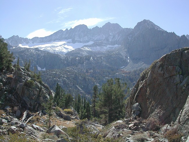 Middle PalisadeSummit · ~1h 15m drivePhoto: GarconN2 (talk · contribs), Public domain (via Wikimedia Commons)
Best time to visit Eureka Dunes
Best months: February–May and October–November. Best months have typical highs of 55–85 °F, lows of 30 °F or warmer (32 °F where the station doesn't record snow), at most one snowy day and no more than 12 wet days.
Jan
58° / 30°
4 wet
Feb
61° / 33°
4 wet
Mar
69° / 39°
3 wet
Apr
76° / 44°
1 wet
May
85° / 53°
1 wet
Jun
96° / 62°
1 wet
Jul
102° / 67°
1 wet
Aug
101° / 65°
1 wet
Sep
93° / 58°
1 wet
Oct
81° / 48°
1 wet
Nov
67° / 36°
2 wet
Dec
57° / 29°
4 wet
Typical high / low (°F) and days with rain or snow, 1991–2020. Measured at Independence, CA, 35.7 mi away at 3,950 ft. This station doesn't record snowfall. Source: NOAA NCEI U.S. Climate Normals 1991–2020.

