Sunset Trail Camp
Campground
Campground · 1.8 mi from the trail
Chalk Mountain is a summit in California's San Mateo-Santa Cruz Unit, about 7 miles from the town of Loma Mar. It sits at 1,608 feet, and several trails pass within a short distance of it, making it a natural anchor for a day of hiking in the surrounding area. Late spring and early fall are the most comfortable times to visit. Typical averages from a nearby weather station show May highs around 67°F and September highs near 79°F, with only a few wet days in each month. That station sits about 660 feet higher than the summit, so temperatures on the mountain run a little warmer than those figures suggest. The closest trails are the Whitehouse Ridge Trail, about 1.3 miles away, and the Skyline To The Sea Trail and Chalks Truck Trail, each roughly 1.4 miles off. Big Basin State Park, a climbing area, is about 3.8 miles away.
Sunset Trail Camp
Campground
Pine Tent
Restaurant
 If it rainsMrwrite, CC BY-SA 3.0 · Wikimedia Commons
Places © OpenStreetMap contributors · Photos: Mrwrite, CC BY-SA 3.0 (commons)
More in PescaderoDaily highs and lows, wind and the chance of precipitation at the summit and route start for the next 7 days, from the Open-Meteo model.
Elevation from USGS 3D Elevation Program terrain data (about 10 m resolution).
1,608 ft (490 m).
One: Westridge Trail.
 Whitehouse Ridge TrailHikingPhoto: sk1546, CC BY-SA 3.0 (via Wikimedia Commons)1.3 mi
 Skyline To The Sea TrailHikingPhoto: Vadim Manuylov, CC BY-SA 3.0 (via Wikimedia Commons)1.4 miChalks Truck TrailHikingPhoto: sk1546, CC BY-SA 3.0 (via Wikimedia Commons)1.4 miHoward King TrailHikingPhoto: Vadim Manuylov, CC BY-SA 3.0 (via Wikimedia Commons)1.4 mi
 Henry Creek TrailHikingPhoto: Vadim Manuylov, CC BY-SA 3.0 (via Wikimedia Commons)1.6 mi
Source: Roamze catalog (indexable pages within 10 miles, PostGIS distance)
 Borel HillSummit · ~21 min drivePhoto: Seberin, CC BY-SA 4.0 (via Wikimedia Commons)
 Black MountainSummit · ~23 min drivePhoto: Trovatore at English Wikipedia, Public domain (via Wikimedia Commons)
 Mount ThayerSummit · ~35 min drivePhoto: Thomson200, CC BY-SA 4.0 (via Wikimedia Commons)
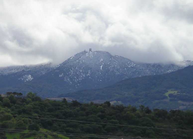 Mount UmunhumSummit · ~37 min drivePhoto: CC BY-SA 3.0 (via Wikimedia Commons)
 Loma PrietaSummit · ~43 min drivePhoto: DrHonzik, CC0 (via Wikimedia Commons)
 Sugarloaf HillSummit · ~43 min drivePhoto: mliu92 from San Mateo, CC BY-SA 2.0 (via Wikimedia Commons)
 Montara MountainSummit · ~45 min drivePhoto: Mike Weston from La Honda, CA, CC BY 2.0 (via Wikimedia Commons)
 North PeakSummit · ~51 min drivePhoto: Clyde Charles Brown, CC BY-SA 4.0 (via Wikimedia Commons)
 Tulare HillSummit · ~51 min drivePhoto: Wahn, CC BY-SA 3.0 (via Wikimedia Commons)
Best months: April–November. Best months have typical highs of 55–85 °F, lows of 30 °F or warmer (32 °F where the station doesn't record snow), at most one snowy day and no more than 12 wet days.
Jan
55° / 41°
14 wet
Feb
55° / 40°
14 wet
Mar
58° / 41°
13 wet
Apr
62° / 43°
10 wet
May
67° / 47°
7 wet
Jun
75° / 52°
3 wet
Jul
81° / 58°
1 wet
Aug
81° / 59°
1 wet
Sep
79° / 57°
2 wet
Oct
71° / 52°
6 wet
Nov
60° / 44°
11 wet
Dec
54° / 40°
15 wet
Typical high / low (°F) and days with rain or snow, 1991–2020. Measured at Skyline Ridge Preserve, CA, 12.1 mi away at 2,270 ft. The station sits about 700 ft higher than this place, so expect it a little warmer here. This station doesn't record snowfall. Source: NOAA NCEI U.S. Climate Normals 1991–2020.

