Benbow State Recreation Area
- State Park and Recreation
- managed by
- Mar–Jun, Sep–Nov
- best months
Benbow State Recreation Area is a 1,138-acre state park in California, about 2 miles from the town of Benbow. The land is managed by the state park agency, and the park holds one campground within its boundaries. Late spring and early fall tend to be the most comfortable times to visit. Typical averages from a nearby weather station show May highs around 72°F with only about six wet days, and October highs near 70°F with about five wet days. Summer is warmer, with July and August highs averaging about 86°F and almost no wet days. Several trails lie within a few miles, including the Woodland Trail at about 3 miles and the Grove Interpretive Trail at about 3 miles. Paddlers can head to Sproul Creek, about 3 miles away, or the East Branch South Fork Eel River, about 6.5 miles away.
Park size
1,138 acres
Inside this park
Campgrounds
 Woodland TrailHikingPhoto: MARELBU, CC BY 3.0 (via Wikimedia Commons)2.8 mi
 Grove Interpretive TrailHikingPhoto: lamblukas, CC BY 2.0 (via Flickr)3 mi
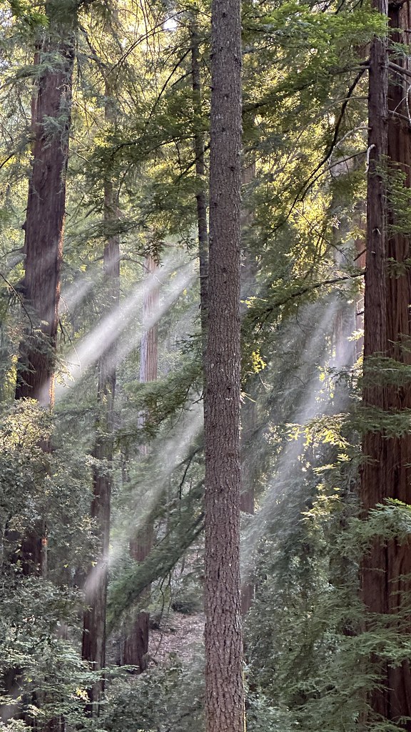 Durphy Creek TrailHikingPhoto: lamblukas, CC BY 2.0 (via Flickr)3.2 mi
- Lookout Point TrailHikingPhoto: MARELBU, CC BY 3.0 (via Wikimedia Commons)3.2 mi
- Sproul CreekCanoeing3.3 mi
- Redwood CreekCanoeing5.4 mi
- Jones CreekCanoeing5.6 mi
- East Branch South Fork Eel RiverCanoeing6.5 mi
Source: Roamze catalog (indexable pages within 10 miles, PostGIS distance)
 Richardson Grove State ParkState park · ~5 min drivePhoto: Mike Fernwood, CC BY-SA 2.0 (via Wikimedia Commons)
 Humboldt Redwoods State ParkState park · ~31 min drivePhoto: Jason Sturner, CC BY 2.0 (via Wikimedia Commons)
 Westport-Union Landing State BeachState park · ~46 min drivePhoto: Sequoiasempervirenssssssssss, CC BY-SA 4.0 (via Wikimedia Commons)
 Grizzly Creek Redwoods State ParkState park · ~51 min drivePhoto: Jason Hollinger, CC BY 2.0 (via Wikimedia Commons)
 Jug Handle State Natural ReserveState park · ~1h 21m drivePhoto: David Eppstein, CC BY-SA 3.0 (via Wikimedia Commons)
 Caspar Headlands State BeachState park · ~1h 23m drivePhoto: CasparGirl, CC BY 2.0 (via Wikimedia Commons)
 Standish-Hickey State Recreation AreaState park · ~23 min drivePhoto: Punk Toad, CC BY 2.0 (via Wikimedia Commons)
 MacKerricher State ParkState park · ~1h 6m drivePhoto: J.smith, CC BY-SA 3.0 (via Wikimedia Commons)
 Point Cabrillo Light StationState park · ~1h 25m drivePhoto: Missvain, CC BY 4.0 (via Wikimedia Commons)
- John B. Dewitt Redwoods State Natural ReserveState park · ~8 min drive
Also worth it near here
Best time to visit Benbow State Recreation Area
Best months: March–June and September–November. Best months have typical highs of 55–85 °F, lows of 30 °F or warmer (32 °F where the station doesn't record snow), at most one snowy day and no more than 12 wet days.
Jan
50° / 39°
16 wet
Feb
53° / 40°
14 wet
Mar
59° / 41°
12 wet
Apr
64° / 42°
9 wet
May
72° / 47°
6 wet
Jun
77° / 51°
2 wet
Jul
86° / 54°
0 wet
Aug
86° / 54°
0 wet
Sep
83° / 50°
1 wet
Oct
70° / 45°
5 wet
Nov
55° / 41°
12 wet
Dec
49° / 38°
14 wet
Typical high / low (°F) and days with rain or snow, 1991–2020. Measured at Richardson Gr Sp, CA, 2.7 mi away at 503 ft. We don't have this place's elevation, so higher spots nearby can run cooler. Source: NOAA NCEI U.S. Climate Normals 1991–2020.

