Tiny Tots Rock
7 climbing routes in California, grades 5.7 to 5.12a, mixed, sport, and trad styles.
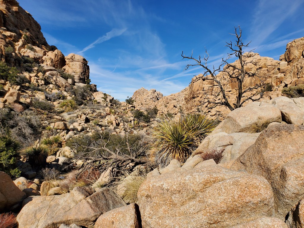 Photo: cifraser1, CC BY 2.0 (via Flickr)
- 7 routes
- 5.7 – 5.11c
- Trad · Sport · Mixed
Is Tiny Tots Rock open right now?
Alert in the area
The National Park Service lists 3 alerts for Joshua Tree National Park.
Partial Trail Closure of West Side Loop
Park alert covering Joshua Tree National Park · NPS · Joshua Tree National Park
Inaccurate Third-Party Apps
Park alert covering Joshua Tree National Park · NPS · Joshua Tree National Park
Oasis of Mara Trail Partial Closure
Park alert covering Joshua Tree National Park · NPS · Joshua Tree National Park
As of · Source: NPS · Joshua Tree National Park. Agencies don't list every closure — check before you go.
Best time to visit Tiny Tots Rock
Best months: October–May. Best months have typical highs of 55–85 °F, lows of 30 °F or warmer (32 °F where the station doesn't record snow), at most one snowy day and no more than 12 wet days.
Jan
58° / 38°
4 wet
Feb
61° / 39°
3 wet
Mar
67° / 40°
3 wet
Apr
73° / 46°
2 wet
May
82° / 52°
1 wet
Jun
91° / 59°
0 wet
Jul
96° / 66°
2 wet
Aug
96° / 68°
2 wet
Sep
89° / 60°
2 wet
Oct
80° / 50°
1 wet
Nov
66° / 41°
2 wet
Dec
58° / 34°
4 wet
Typical high / low (°F) and days with rain or snow, 1991–2020. Measured at Yucca Valley, CA, 14.1 mi away at 3,249 ft. The station sits about 1,000 ft lower than this place, so expect it a little cooler here. This station doesn't record snowfall. Source: NOAA NCEI U.S. Climate Normals 1991–2020.
Tiny Tots Rock is a climbing area in Joshua Tree National Park in California, managed by the National Park Service. It sits among a cluster of other climbing areas, with Copenhagen Wall, Hemingway Buttress and IRS Wall all about 0.1 mile away. The park charges a fee for visits. Spring and fall are the most comfortable times to go. Typical averages from a nearby weather station in Yucca Valley show April highs around 73°F and October highs around 80°F, while July and August average about 96°F. The area has seven routes, five of which are trad and one each of mixed and sport. Grades run from 5.7 to 5.11c. Cole Lewis is a 5.7 trad route, and Spontaneous Human Combustion is a 5.11c trad route. The Quail Springs Historic Trail is about 0.2 mile away, and Sheep Pass Group campground is about 3.8 miles off.
Routes (7)
Facts about this crag
Keep exploring — more climbs worth the drive
 Photo: Tony Webster, CC BY 2.0 (via Flickr)
Hemingway Buttress
~0 min drive
Hemingway Buttress in California has 10 climbing routes across 8 grades, offering bouldering, sport, and trad.
Photo: cifraser1, CC BY 2.0 (via Flickr)Upper Freeway Wall
~0 min drive
Upper Freeway Wall in California has 13 climbing routes across 10 grades, offering mixed, sport, and trad styles.
 Photo: blachswan, CC BY 2.0 (via Flickr)
Hemingway Buttress (East Face Left)
~0 min drive
26-route climbing area in California with sport and trad options.
 Photo: blachswan, CC BY 2.0 (via Flickr)
Papa Boulder
~0 min drive
Papa Boulder is a California bouldering crag with 8 routes across 6 grades.
Photo: Tony Webster, CC BY 2.0 (via Flickr)Rock Garden Valley - Middle
~0 min drive
Rock Garden Valley - Middle in California has 11 climbing routes across 7 grades.
Photo: blachswan, CC BY 2.0 (via Flickr)Hemingway Buttress (East Face Center)
~0 min drive
12-route climbing area in California with sport and trad options.
Photo: Tony Webster, CC BY 2.0 (via Flickr)Rock Garden Valley - Right Side
~0 min drive
13-route climbing area in California with sport and trad options, 8 difficulty grades.
 Photo: Joseph from Cabin On The Road, USA, CC BY-SA 2.0 (via Wikimedia Commons)
Dairy Queen Wall - Right Side
~0 min drive
Dairy Queen Wall - Right Side in California has 16 climbing routes across 10 grades, offering sport and trad options.
 Photo: David Balmer, CC BY 3.0 (via Wikimedia Commons)
Lost Horse Wall - Right Side
~0 min drive
12 traditional climbing routes on the right side of Lost Horse Wall in California.
 Photo: Ed Dunens, CC BY 2.0 (via Wikimedia Commons)
Dairy Queen Wall - Upper Left Side
~0 min drive
7 traditional climbing routes at Dairy Queen Wall - Upper Left Side in California.
Also worth it near here
