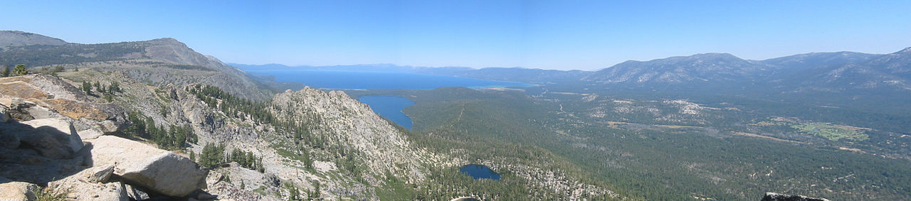
Gold Finger Area
Gold Finger Area in California has 5 climbing routes ranging across 5 difficulty grades.
 Photo: brewbooks from near Seattle, USA, CC BY-SA 2.0 (via Wikimedia Commons)
- 5 routes
- 5.10b – 5.12d
- Sport · Trad
Is Gold Finger Area open right now?
Closure in the area
There's a closure order in Lake Tahoe Basin Management Unit. It doesn't name Gold Finger Area, so check the source for the area it covers.
Harmful Algal Blooms
Agency closure covering Lake Tahoe Basin Management Unit · USFS · Lake Tahoe Basin Management Unit
Desolation Wilderness Food and Refuse Storage (Bear Canister) Restriction
Agency alert covering Lake Tahoe Basin Management Unit · Order 19-25-06 · USFS · Lake Tahoe Basin Management Unit
Meyers Landfill Area Closure
Agency alert covering Lake Tahoe Basin Management Unit · Order 19-25-01 · USFS · Lake Tahoe Basin Management Unit
Campfire Restrictions
Agency alert covering Lake Tahoe Basin Management Unit · Order 19-24-04 · USFS · Lake Tahoe Basin Management Unit
Camping/Overnight Stay Restriction
Agency alert covering Lake Tahoe Basin Management Unit · Order 19-24-05 · USFS · Lake Tahoe Basin Management Unit
As of · Source: USFS · Lake Tahoe Basin Management Unit. Agencies don't list every closure — check before you go.
Best time to visit Gold Finger Area
Best months: May–October. Best months have typical highs of 55–85 °F, lows of 30 °F or warmer (32 °F where the station doesn't record snow), at most one snowy day and no more than 12 wet days.
Jan
36° / 23°
9 wet
Feb
37° / 23°
8 wet
Mar
42° / 26°
7 wet
Apr
48° / 29°
5 wet
May
56° / 35°
4 wet
Jun
66° / 42°
2 wet
Jul
75° / 49°
2 wet
Aug
74° / 49°
1 wet
Sep
67° / 44°
2 wet
Oct
55° / 36°
3 wet
Nov
43° / 28°
5 wet
Dec
35° / 23°
7 wet
Typical high / low (°F) and days with rain or snow, 1991–2020. Measured at Dagget Pass, NV, 13 mi away at 7,334 ft. The station sits about 600 ft lower than this place, so expect it a little cooler here. This station doesn't record snowfall. Source: NOAA NCEI U.S. Climate Normals 1991–2020.
Gold Finger Area is a climbing area in California's Lake Tahoe Basin Management Unit, managed by the Forest Service. It sits within the Lake Tahoe Basin, and two other climbing areas, Gangsta Wall and Billy Land, both lie about 0.1 mile away, making it easy to pair with a visit to either. The climbing here is sport and trad, with five routes in all. The Gold Finger route is the only trad, graded 5.10b. The rest are sport, and they climb from 5.11b up to 5.12d. Among them are Rage for Order, first climbed by Dave and Mike Hatchett and Dave Griffith in 1990, and Metallarete, a 5.12d first ascended by Dan Osman. Summer is the most comfortable time to go. A nearby weather station at Dagget Pass records typical July highs around 75°F with lows near 49°F, while winter highs there hover in the mid-30s. The Saucer Lake Trail is about 0.6 mile away, and the Triangle Lateral Trail is about 1.2 mile off. Lovers Leap Campground is roughly 5 miles away for an overnight stay, and the Upper Truckee River, about 3.5 miles away, offers canoeing.
Routes (5)
Keep exploring — more climbs worth the drive
Photo: brewbooks from near Seattle, USA, CC BY-SA 2.0 (via Wikimedia Commons)Gangsta Wall
~0 min drive
Gangsta Wall is a climbing crag in California with 10 routes.
 Photo: brewbooks, CC BY-SA 2.0 (via Flickr)
Billy Land
~0 min drive
Billy Land in California has 3 trad routes on 3 difficulty grades.
Photo: brewbooks, CC BY-SA 2.0 (via Flickr)Old Peculiar
~0 min drive
Old Peculiar in California has 8 climbing routes with mixed and traditional styles.
 Photo: brewbooks from near Seattle, USA, CC BY-SA 2.0 (via Wikimedia Commons)
Blind Man's Bluff
~1 min drive
Blind Man's Bluff in California has 7 climbing routes across 6 grades.
 Photo: brewbooks, CC BY-SA 2.0 (via Flickr)
Echo Lakes
~1 min drive
Echo Lakes is a climbing area in California with 3 routes.
Photo: brewbooks, CC BY-SA 2.0 (via Flickr)Flagpole Peak Area
~1 min drive
Flagpole Peak Area in California has 6 traditional climbing routes across 4 grades.
Photo: brewbooks, CC BY-SA 2.0 (via Flickr)Corkscrew Area
~1 min drive
Corkscrew Area in California has 5 trad routes on 4 difficulty grades.
 Photo: brewbooks, CC BY-SA 2.0 (via Flickr)
Echo Edge
~2 min drive
Echo Edge in California has 6 climbing routes across 5 grades.
Photo: brewbooks, CC BY-SA 2.0 (via Flickr)Cal Trans Wall
~2 min drive
Cal Trans Wall is a California climbing crag with 6 sport routes.
 Photo: Missvain, CC BY 4.0 (via Wikimedia Commons)
Berkeley Camp Rocks
~3 min drive
Berkeley Camp Rocks in California has 13 climbing routes across 12 grades, offering sport and trad options.