All You Can Eat
All You Can Eat is a California climbing crag with 15 routes.
 Photo: Ben Chun, CC BY-SA 2.0 (via Flickr)
- 15 routes
- 5.6 – 5.13a
- Sport · Trad
Is All You Can Eat open right now?
Alert in the area
The Forest Service lists 4 alerts for Inyo National Forest.
Stage 1 Fire Restrictions in Effect
Agency alert covering Inyo National Forest · Order 05-04-50-26-23 · USFS · Inyo National Forest
Help Halt Golden Mussel Invasion
Agency alert covering Inyo National Forest · USFS · Inyo National Forest
Ansel Adams and John Muir Wilderness Campfire Restrictions
Agency alert covering Inyo National Forest · Order 05-04-50-25-04 · USFS · Inyo National Forest
Golden Trout and Hoover Wilderness Campfire Restrictions
Agency alert covering Inyo National Forest · Order 05-04-50-25-05 · USFS · Inyo National Forest
As of · Source: USFS · Inyo National Forest. Agencies don't list every closure — check before you go.
Best time to visit All You Can Eat
Best months: April–May and September–October. Best months have typical highs of 55–85 °F, lows of 30 °F or warmer (32 °F where the station doesn't record snow), at most one snowy day and no more than 12 wet days.
Jan
47° / 18°
3 wet
Feb
52° / 22°
4 wet
Mar
60° / 28°
3 wet
Apr
67° / 33°
2 wet
May
76° / 42°
3 wet
Jun
87° / 50°
2 wet
Jul
94° / 56°
2 wet
Aug
91° / 53°
2 wet
Sep
84° / 45°
2 wet
Oct
71° / 33°
2 wet
Nov
57° / 23°
2 wet
Dec
46° / 16°
2 wet
Typical high / low (°F) and days with rain or snow, 1991–2020. Measured at Dyer 5s, NV, 32 mi away at 4,900 ft. The station sits about 1,000 ft lower than this place, so expect it a little cooler here. This station doesn't record snowfall. Source: NOAA NCEI U.S. Climate Normals 1991–2020.
All You Can Eat is a climbing area in California's Inyo National Forest, within the White Mountain Ranger District. It sits on city land, and two other climbing areas, Sanitarium and Upper Elbow Room, lie just 0.1 mile away, making this a cluster of crags rather than a single route. The climbing here is sport-based, with 13 sport routes and two trad routes among the 15 listed. Grades run from 5.6 up to 5.13a, with the median at 5.10b. Some of the named routes include Crotalulsley Challenged (5.6), Stay Hungry (5.10b) and Honey Mess (5.13a). Spring and fall are the most comfortable times to visit. Typical averages from a nearby weather station show May highs around 76°F and October highs around 71°F, while July averages climb to about 94°F. That station sits roughly 1,000 feet lower than the crags, so temperatures on the rock run cooler. Lower Rock Creek Trail, Section 3, is about 2.6 miles away, and Lower Rock Creek offers canoeing at 2.8 miles. Tuff Campground and Holiday Campground are both within about 6 miles.
Routes (15)
Keep exploring — more climbs worth the drive
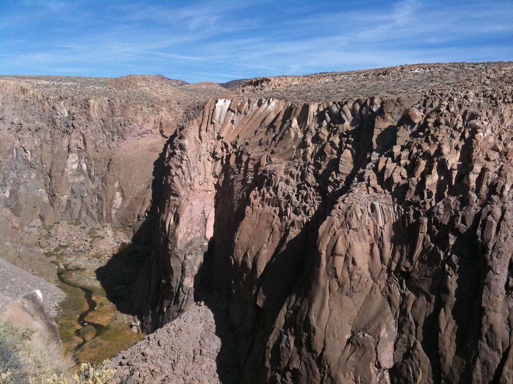 Photo: Ben Chun, CC BY-SA 2.0 (via Flickr)
Upper Elbow Room
~0 min drive
Upper Elbow Room in California has 12 climbing routes across 9 grades, offering sport and trad styles.
Photo: Ben Chun, CC BY-SA 2.0 (via Flickr)Sanitarium
~0 min drive
Sanitarium in California has 6 sport climbing routes across 4 grades.
 Photo: GSEC, CC BY 2.0 (via Flickr)
Junior Area
~0 min drive
5 sport climbing routes at Junior Area in California.
Photo: GSEC, CC BY 2.0 (via Flickr)Trestle Wall
~0 min drive
Trestle Wall is a California climbing crag with 8 sport routes across 8 difficulty grades.
 Photo: GSEC, CC BY 2.0 (via Flickr)
Gotham City
~0 min drive
Gotham City, California has 21 climbing routes ranging across 13 grades, offering sport and trad options.
Photo: GSEC, CC BY 2.0 (via Flickr)Warm Out Wall
~0 min drive
Warm Out Wall is a California climbing crag with 7 routes.
Photo: Ben Chun, CC BY-SA 2.0 (via Flickr)Cracked Towers
~0 min drive
12 mixed climbing routes at Cracked Towers in California, grades 5.5 to 5.12a.
Photo: Ben Chun, CC BY-SA 2.0 (via Flickr)Upper Gorge
~0 min drive
Upper Gorge in California has 11 climbing routes across 10 difficulty grades, featuring sport and trad styles.
Photo: GSEC, CC BY 2.0 (via Flickr)Dihedrals
~0 min drive
Dihedrals in California has 27 climbing routes across 16 grades, featuring sport and trad styles.
 Photo: GSEC, CC BY 2.0 (via Flickr)
Middle Elbow Room
~0 min drive
Middle Elbow Room in California has 8 climbing routes with 5 difficulty grades.

