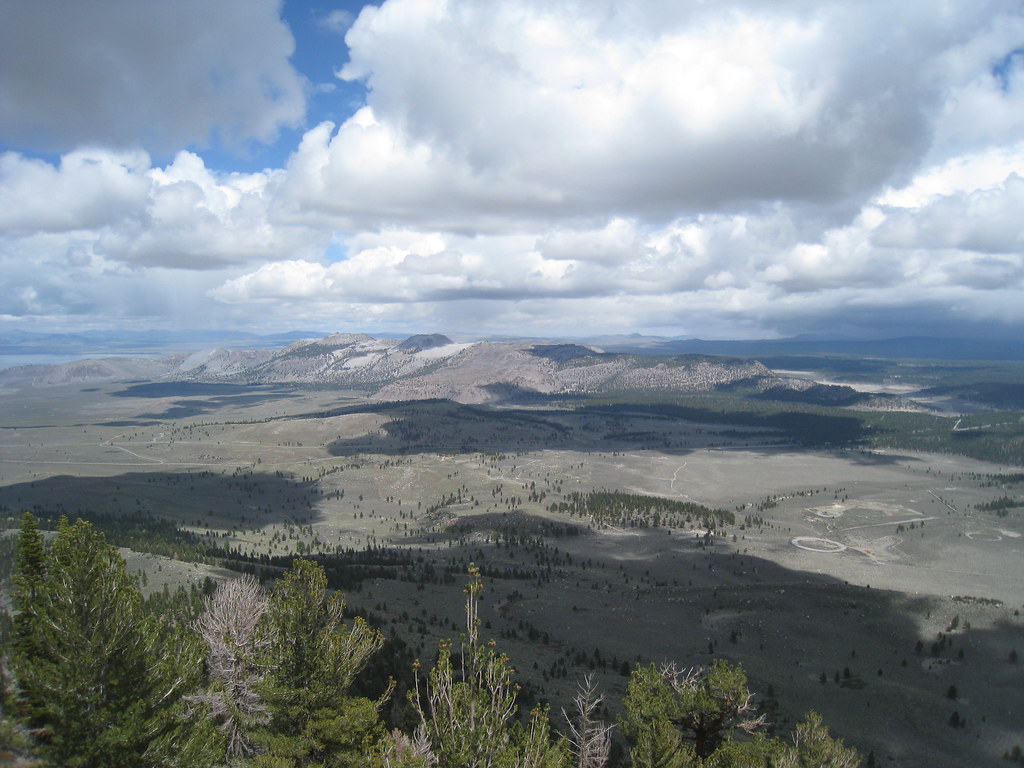
8-Dostie
8-Dostie is a California climbing crag with 23 routes across 14 grades, featuring mixed, sport, and trad styles.
- 23 routes
- 5.2 – 5.11a
- Sport · Mixed · Trad
Is 8-Dostie open right now?
Alert in the area
The Forest Service lists 4 alerts for Inyo National Forest.
Stage 1 Fire Restrictions in Effect
Agency alert covering Inyo National Forest · Order 05-04-50-26-23 · USFS · Inyo National Forest
Help Halt Golden Mussel Invasion
Agency alert covering Inyo National Forest · USFS · Inyo National Forest
Ansel Adams and John Muir Wilderness Campfire Restrictions
Agency alert covering Inyo National Forest · Order 05-04-50-25-04 · USFS · Inyo National Forest
Golden Trout and Hoover Wilderness Campfire Restrictions
Agency alert covering Inyo National Forest · Order 05-04-50-25-05 · USFS · Inyo National Forest
As of · Source: USFS · Inyo National Forest. Agencies don't list every closure — check before you go.
Best time to visit 8-Dostie
Best months: April–October. Best months have typical highs of 55–85 °F, lows of 30 °F or warmer (32 °F where the station doesn't record snow), at most one snowy day and no more than 12 wet days.
Jan
41° / 21°
6 wet
Feb
44° / 23°
7 wet
Mar
51° / 28°
6 wet
Apr
58° / 32°
4 wet
May
66° / 40°
4 wet
Jun
77° / 47°
3 wet
Jul
84° / 54°
3 wet
Aug
83° / 52°
3 wet
Sep
76° / 45°
2 wet
Oct
65° / 36°
3 wet
Nov
53° / 28°
4 wet
Dec
42° / 22°
6 wet
Typical high / low (°F) and days with rain or snow, 1991–2020. Measured at Lee Vining, CA, 10.1 mi away at 6,797 ft. This station doesn't record snowfall. Source: NOAA NCEI U.S. Climate Normals 1991–2020.
8-Dostie is a climbing area in the Mono Lake Ranger District of Inyo National Forest in California, managed by the Forest Service. It sits among a cluster of other climbing areas, with 9-Chouinard, 7-Hill and 5-Brower all about 0.1 mile away. The area has 23 routes, mostly sport climbing with a few mixed and trad options. Grades run from 5.2 up to 5.11a, with Central Fins - Left Tower + Groove at 5.7 and Limbaugh Limbo at 5.11a among the standouts. The routes are spread across several named features, including the Central Fins and the CF Left Ledge. For timing, late spring and early fall are the most comfortable. Typical averages from the nearby Lee Vining weather station show May highs around 66°F and September highs around 76°F, with July the warmest month at about 84°F. That station sits roughly 500 feet lower than the climbing area, so temperatures here run a little cooler. The Reversed Peak Trail is about 0.6 mile away, and Aerie Crag Rv Campgroung is about 0.7 mile away. Lower Rush Creek Loop and Oh Ridge are both within about 2 miles.
Routes (23)
Keep exploring — more climbs worth the drive
 Photo: GSEC, CC BY 2.0 (via Flickr)
The Landing Strip
~0 min drive
5 sport climbing routes at Landing Strip, The in California.
 Photo: jfdervin, CC BY-SA 2.0 (via Flickr)
9-Secor
~5 min drive
9-Secor in California has 10 sport climbing routes across 5 grades.
Photo: jfdervin, CC BY-SA 2.0 (via Flickr)7-Lewis
~5 min drive
7-Lewis is a California climbing crag with 19 routes.
Photo: jfdervin, CC BY-SA 2.0 (via Flickr)8-Moynier
~5 min drive
8-Moynier is a California climbing crag with 21 sport routes across 6 grades.
 Photo: GSEC, CC BY 2.0 (via Flickr)
* June Lake Bouldering
~6 min drive
June Lake Bouldering in California has 1 bouldering route.
7-Hill
~0 min drive
7-Hill in California has 5 routes from easy to hard, offering sport and trad climbing.
5-Brower
~0 min drive
5-Brower is a California climbing crag with 5 routes, 4 grades, mixed and sport climbing.
Rush
~0 min drive
Rush in California has 16 routes across 12 grades, offering mixed, sport, and trad climbing.
3-Eldorado
~0 min drive
3-Eldorado in California has 7 sport climbing routes across 5 grades.
Grimsel (north)
~0 min drive
Grimsel (north) in California has 4 sport climbing routes on 4 difficulty grades.