Camp Trask BSA
Campground
Campground · 1.7 mi from the trail
 Photo: JingKe888, CC BY 2.0 (via Flickr)
Alert in the area
The Forest Service lists 7 alerts for Angeles National Forest.
Rincon-Redbox Road (2N24) Closure
Agency alert covering Angeles National Forest · Order 05-01-26-13 · USFS · Angeles National Forest
Fire Danger Level Elevated to "Very High"
Agency alert covering Angeles National Forest · USFS · Angeles National Forest
San Gabriel Canyon OHV Area Prohibitions
Agency alert covering Angeles National Forest · Order 05-01-26-09 · USFS · Angeles National Forest
San Dimas Experimental Forest Closure
Agency alert covering Angeles National Forest · USFS · Angeles National Forest
Eaton Fire Area Closure
Agency alert covering Angeles National Forest · Order 05-01-26-04 · USFS · Angeles National Forest
As of · Source: USFS · Angeles National Forest. Agencies don't list every closure — check before you go.
Upper Clamshell Truck Trail is an out-and-back hike in the Los Angeles Gateway Ranger District of Angeles National Forest, managed by the Forest Service. The route starts at 2,821 feet and climbs to 4,791 feet, with a total elevation gain of 5,595 feet over 12.8 miles. The trail is rated expert, and the steepest stretch comes at about 2.9 miles in, where the grade reaches 26%. Spring and fall are the most comfortable times to go. Typical averages from a nearby weather station at Mt Wilson show May highs around 70°F and October highs around 72°F, while July and August average in the mid-80s. That station sits about 900 feet higher than the trail's start, so temperatures on the route run a little warmer. The trail is close to several other routes. Four Palms Trail and Chantry Flats Truck Trail are each about a mile away, and Lower Clamshell Truck Trail is about 1.1 miles off. For an overnight stay, Hoegees campground is about 2.2 miles away.
Camp Trask BSA
Campground
 If it rainsCullen328, CC BY-SA 3.0 · Wikimedia Commons
Places © OpenStreetMap contributors, Places © Overture Maps Foundation · Photos: Cullen328, CC BY-SA 3.0 (commons)
More in Acton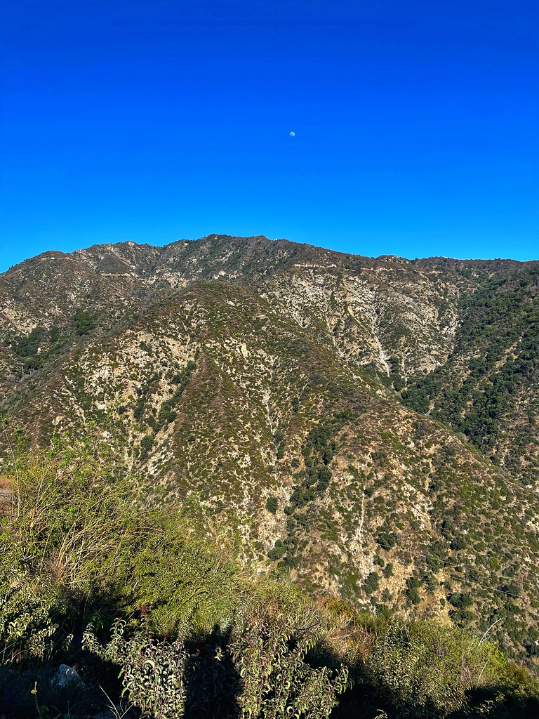 Chantry Flats Truck TrailHikingPhoto: JingKe888, CC BY 2.0 (via Flickr)1 mi
 West Fork San Gabriel RiverCanoeingPhoto: Eeekster, CC BY 3.0 (via Wikimedia Commons)4.8 mi
Source: Roamze catalog (indexable pages within 10 miles, PostGIS distance)
 Sturtevant LoopHiking · ~3 min drivePhoto: JingKe888, CC BY 2.0 (via Flickr)
 Zion TrailHiking · ~4 min drivePhoto: OctopusHat on Flickr, CC BY-SA 2.0 (via Wikimedia Commons)
 Monrovia Canyon Truck TrailHiking · ~5 min drivePhoto: roger4336, CC BY-SA 2.0 (via Wikimedia Commons)
 Winter Creek trailHiking · ~6 min drivePhoto: InSapphoWeTrust from Los Angeles, California, USA, CC BY-SA 2.0 (via Wikimedia Commons)
 Bastard RidgeHiking · ~4 min drivePhoto: D Sneiders from Temple City, USA, CC BY-SA 2.0 (via Wikimedia Commons)WINTER CREEKHiking · ~4 min drivePhoto: InSapphoWeTrust from Los Angeles, California, USA, CC BY-SA 2.0 (via Wikimedia Commons)Mount Wilson TrailHiking · ~6 min drivePhoto: InSapphoWeTrust from Los Angeles, California, USA, CC BY-SA 2.0 (via Wikimedia Commons)
 San Gabriel River TrailHiking · ~8 min drivePhoto: Sonysnob at English Wikipedia, CC BY-SA 3.0 (via Wikimedia Commons)SturtevantHiking · ~5 min drivePhoto: OctopusHat on Flickr, CC BY-SA 2.0 (via Wikimedia Commons)
Also worth it near here
 Winter Creek (Upper)Mountain biking · ~3 min drivePhoto: John Verive from Hollywood, USA, CC BY-SA 2.0 (via Wikimedia Commons)
 Mount WilsonSummit · ~7 min drivePhoto: The original uploader was Geographer at English Wikipedia., CC BY 1.0 (via Wikimedia Commons)
Best months: Year-round. Best months have typical highs of 55–85 °F, lows of 30 °F or warmer (32 °F where the station doesn't record snow), at most one snowy day and no more than 12 wet days.
Jan
56° / 38°
7 wet
Feb
55° / 37°
8 wet
Mar
59° / 39°
7 wet
Apr
63° / 42°
4 wet
May
70° / 48°
3 wet
Jun
79° / 58°
1 wet
Jul
84° / 64°
1 wet
Aug
85° / 64°
1 wet
Sep
81° / 59°
1 wet
Oct
72° / 51°
3 wet
Nov
63° / 43°
4 wet
Dec
55° / 37°
7 wet
Typical high / low (°F) and days with rain or snow, 1991–2020. Measured at Mt Wilson Cbs, CA, 4.9 mi away at 5,710 ft. The station sits about 900 ft higher than this place, so expect it a little warmer here. This station doesn't record snowfall. Source: NOAA NCEI U.S. Climate Normals 1991–2020.
Map and trail data © OpenStreetMap contributors
