Summit Trail
- 12.4 mi
- round trip
- 6,543 ft
- climb
- 7,432 ft
- high point
- Out and back
- route
Is Summit Trail open right now?
Closure in the area
There's a closure order in Shasta-Trinity National Forest. It doesn't name Summit Trail, so check the source for the area it covers (2 listed).
Mud and Ash Creek Area and Road Closure
Agency closure covering Shasta-Trinity National Forest · Order 14-26-13 · USFS · Shasta-Trinity National Forest
Road Closure on Wild Mad Road
Agency closure covering Shasta-Trinity National Forest · Order 14-25-09 · USFS · Shasta-Trinity National Forest
Trout Creek Bridge Closure Order
Agency alert covering Shasta-Trinity National Forest · Order 14-26-02 · USFS · Shasta-Trinity National Forest
South Fork Suspension Bridge Closure
Agency alert covering Shasta-Trinity National Forest · Order 14-25-30 · USFS · Shasta-Trinity National Forest
Ah-Di-Na Area Closure
Agency alert covering Shasta-Trinity National Forest · Order 14-25-10 · USFS · Shasta-Trinity National Forest
As of · Source: USFS · Shasta-Trinity National Forest. Agencies don't list every closure — check before you go.
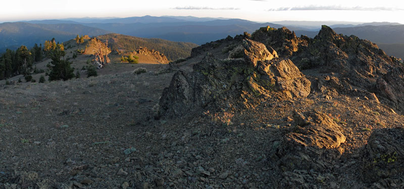
Summit Trail is a 24.7-mile out-and-back hike in the Yolla Bolly-Middle Eel Wilderness, part of the Shasta-Trinity National Forest in California. The trail crosses the line between the Covelo and Yolla Bolla ranger districts, and the Forest Service manages the land. The route starts at about 6,111 feet and climbs steadily to a high point of 7,432 feet. The total gain is 6,543 feet, and the steepest stretch comes at about 6.8 miles in, where the grade reaches 27%. Because the trail is an out-and-back, the total loss is the same as the gain. The Devils Hole Ridge hike lies just 0.1 mile away, and Long Ridge and Wrights Ridge Trail are both within about a mile. For an overnight base, Tomhead Saddle Campground is roughly 8 miles off.
Conditions and forecast on Hammerhorn Mountain
Daily highs and lows, wind and the chance of precipitation at the summit and route start for the next 7 days, from the Open-Meteo model.
- DEVILS HOLE RIDGEHiking0.1 mi
- LONG RIDGEHiking0.8 mi
- Wrights Ridge TrailHiking1 mi
- Buck CreekCanoeing3 mi
- Yolla Bolly-Middle Eel WildernessSaltwater fishing3.4 mi
- Balm of Gilead CreekCanoeing5 mi
- Tomhead Saddle Cg-FCamping7.9 mi
- Rat Trap Gap (trailhead)Camping7.9 mi
Source: Roamze catalog (indexable pages within 10 miles, PostGIS distance)
 Brooks Ridge TrailHiking · ~12 min drivePhoto: Pacific Southwest Region 5, Public domain (via Wikimedia Commons)
- Willow Basin CutoffHiking · ~3 min drive
- Devil's Hole Ridge TrailHiking · ~4 min drive
- Ides Cove Loop TrailHiking · ~11 min drive
- Brooks RidgeHiking · ~11 min drivePhoto: Pacific Southwest Region 5, Public domain (via Wikimedia Commons)
- Kingsley Lake ConnectorHiking · ~7 min drive
- Sugarloaf TrailHiking · ~5 min drive
- LONG RIDGEHiking · ~1 min drive
- DEAD PUPPY RIDGEHiking · ~10 min drive
- KINGSLEY LAKEHiking · ~7 min drive
Also worth it near here
- D CampCamping · ~5 min drive
- Yolla Bolly-Middle Eel WildernessSaltwater fishing · ~6 min drive
- Sanford RidgeMountain biking · ~9 min drive
 Mount LinnSummit · ~12 min drivePhoto: Mkauffmann, CC BY 3.0 (via Wikimedia Commons)
 Middle Fork Eel RiverCanoeing · ~13 min drivePhoto: humboldthead, CC BY 2.0 (via Wikimedia Commons)
Route details
- Distance
- 12.4 mi round trip
- Climbing
- About 6,543 ft
- Summit
- 7,560 ft
- Difficulty
- Expert
- Time
- About 5.5 hours
Other routes up Hammerhorn Mountain
Questions about this route
How long is the Summit Trail on Hammerhorn Mountain?
About 12.4 mi round trip.
How much elevation gain is on the Summit Trail?
About 6,543 ft of climbing round trip.
How hard is the Summit Trail?
It is rated expert.
How long does the Summit Trail take?
About 5.5 hours round trip.
How many routes go up Hammerhorn Mountain?
2: SUMMIT and Summit Trail.
Map and trail data © OpenStreetMap contributors
