Sugarloaf Trail
- 1.2 mi
- round trip
- 1,364 ft
- climb
- 7,339 ft
- high point
- Out and back
- route
Is Sugarloaf Trail open right now?
Alert in the area
The Forest Service lists 20 alerts for Mendocino National Forest.
Prescribed burning in Upper Lake Ranger District
Agency alert covering Mendocino National Forest · USFS · Mendocino National Forest
Pile burning on M5 Road in western Colusa County
Agency alert covering Mendocino National Forest · USFS · Mendocino National Forest
Heavy equipment in Three Prong Campground
Agency alert covering Mendocino National Forest · USFS · Mendocino National Forest
Chico Seed Orchard Public Use and Access Closure
Agency alert covering Mendocino National Forest · Order 08-26-02 · USFS · Mendocino National Forest
M10 Road Status - closure in place Mondays-Fridays
Agency alert covering Mendocino National Forest · USFS · Mendocino National Forest
As of · Source: USFS · Mendocino National Forest. Agencies don't list every closure — check before you go.
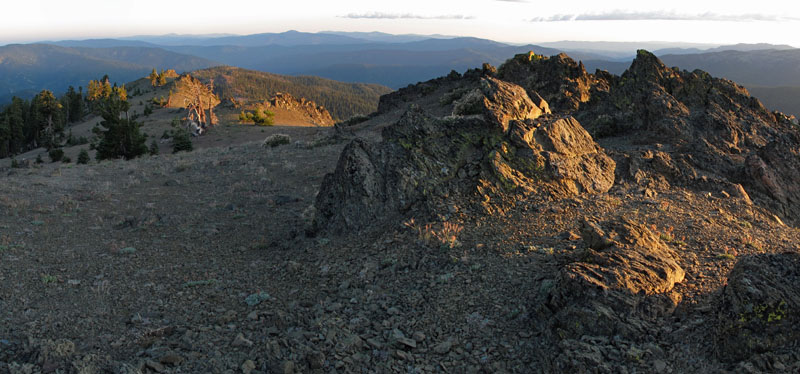
Sugarloaf Trail is a 1.2-mile moderate hike in the Yolla Bolly-Middle Eel Wilderness, part of the Grindstone Ranger District of Mendocino National Forest in California. The Forest Service manages the land. The trail is an out-and-back that covers about 2.4 miles round trip, with a total climb of 1,364 feet. The route starts at roughly 6,905 feet and reaches a high point of 7,339 feet. The steepest stretch comes at about 0.73 miles in, with a grade of 22 percent. The D-Camp Trail lies just 0.2 miles away, and the Kingsley Lake Connector and Kingsley Lake Trail are each about 1.2 miles off. For an overnight stay, Green Springs Campground is about 5.4 miles away.
Conditions and forecast on Sugarloaf Mountain
Daily highs and lows, wind and the chance of precipitation at the summit and route start for the next 7 days, from the Open-Meteo model.
- D-Camp TrailHiking0.2 mi
- Kingsley Lake ConnectorHiking1.2 mi
- Kingsley Lake TrailHiking1.2 mi
- Yolla Bolly-Middle Eel WildernessSaltwater fishing1.8 mi
- Buck CreekCanoeing3.5 mi
- Balm of Gilead CreekCanoeing4.4 mi
- Green Springs CampgroundCamping5.4 mi
- Hammerhorn LakeCamping7.3 mi
Source: Roamze catalog (indexable pages within 10 miles, PostGIS distance)
- Kingsley Lake ConnectorHiking · ~2 min drive
- KINGSLEY LAKEHiking · ~3 min drive
- Wrights Ridge TrailHiking · ~4 min drive
- Summit TrailHiking · ~5 min drive
- Willow Basin CutoffHiking · ~6 min drive
- Minnie Lake TrailHiking · ~4 min drive
- French Cove TrailHiking · ~4 min drive
- Ides Cove Loop TrailHiking · ~8 min drive
- Burnt Camp Loop Connector TrailHiking · ~9 min drive
- Salmon Peak CutoffHiking · ~4 min drive

Route details
- Distance
- 1.2 mi round trip
- Climbing
- About 1,364 ft
- Summit
- 7,370 ft
- Difficulty
- Moderate
- Time
- About 0.5 hours
Questions about this route
How long is the Sugarloaf Trail on Sugarloaf Mountain?
About 1.2 mi round trip.
How much elevation gain is on the Sugarloaf Trail?
About 1,364 ft of climbing round trip.
How hard is the Sugarloaf Trail?
It is rated moderate.
How long does the Sugarloaf Trail take?
About 0.5 hours round trip.
Map and trail data © OpenStreetMap contributors
