Lobo Group
Campground
Campground · 2.4 mi from the trail
 Photo: morrisonbrett, CC BY 2.0 (via Flickr)
Closure in the area
There's a closure order in Mountaintop Ranger District. It doesn't name Sugarlump Trail, so check the source for the area it covers.
Radford Fire Closure Area
Agency closure covering Mountaintop Ranger District · Order 05-12-52-24-06 · USFS · Mountaintop Ranger District
Safety Alert - Falling Rocks at Bonita Falls
Agency alert covering San Bernardino National Forest · USFS · San Bernardino National Forest
Fire Restrictions
Agency alert covering San Bernardino National Forest · Order 05-12-00-26-05 · USFS · San Bernardino National Forest
As of · Source: USFS · Mountaintop Ranger District. Agencies don't list every closure — check before you go.
Sugarlump Trail is a 4.5-mile out-and-back hike in the Mountaintop Ranger District of San Bernardino National Forest in California, managed by the Forest Service. The trail rises from about 8,775 feet to a high point of 9,270 feet, with a total elevation gain of 1,716 feet over the round trip. The climb is steady, and the steepest stretch comes within the first 0.07 miles, where the grade reaches 27 percent. The hike is rated moderate, and the round trip takes about 2.5 hours. The trail starts at a low point of 8,566 feet, so plan for a day that includes both ascent and descent. Nearby, Showtime Trail lies about 1.2 miles away and Skyline Trail about 1.5 miles. For an overnight stay, Lobo Group campground is about 2.4 miles off, and the Buckthorn Boulder climbing area is about 2.7 miles away.
Lobo Group
Campground
 If it rainsBeyond My Ken, CC BY-SA 4.0 · Wikimedia Commons
Deep Creek Hot Springs
Hot spring
Natural hot springs located in San Bernardino National Forest, California, United States
Places © OpenStreetMap contributors, Places © Overture Maps Foundation · Photos: Beyond My Ken, CC BY-SA 4.0 (commons)
More in Lucerne Valley Showtime TrailHikingPhoto: miheco, CC BY-SA 2.0 (via Flickr)1.2 mi
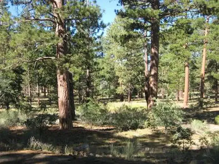 Lobo GroupCampingPhoto: Recreation.gov (RIDB) / public domain2.4 mi
 Buttercup Group CampCampingPhoto: Recreation.gov (RIDB) / public domain2.5 mi
 San GorgonioSaltwater fishing2.7 mi
Source: Roamze catalog (indexable pages within 10 miles, PostGIS distance)
Showtime TrailHiking · ~2 min drivePhoto: miheco, CC BY-SA 2.0 (via Flickr) Radford Truck TrailHiking · ~3 min drivePhoto: kallahar, CC BY 3.0 (via Wikimedia Commons)
 Fall LineHiking · ~3 min drivePhoto: Moo.The.Cow, CC BY 2.0 (via Flickr)
 FORSEE CREEKHiking · ~8 min drivePhoto: inkknife_2000 (7.5 million views +), CC BY-SA 2.0 (via Wikimedia Commons)Fall Line ConnectorHiking · ~3 min drivePhoto: Moo.The.Cow, CC BY 2.0 (via Flickr)
 Santa Ana River TrailHiking · ~5 min drivePhoto: inkknife_2000 (7.5 million views +), CC BY-SA 2.0 (via Wikimedia Commons)
 Miracle Mile TrailHiking · ~4 min drivePhoto: Olivier Pasco, CC BY 2.0 (via Flickr)
 PiratesHiking · ~3 min drivePhoto: Moo.The.Cow, CC BY 2.0 (via Flickr)SANTA ANA RIVER TRAIL A SPURHiking · ~4 min drivePhoto: inkknife_2000 (7.5 million views +), CC BY-SA 2.0 (via Wikimedia Commons)
Map and trail data © OpenStreetMap contributors
