Elam Camp
Campground
Campground · 2.5 mi from the trail
Closure in the area
There's a closure order in Redwood National Park. It doesn't name Redwood Creek Trail, so check the source for the area it covers.
Closure: Newton B. Drury Scenic Parkway
Park closure covering Redwood National Park · NPS · Redwood National Park
Delays along Highway 101
Park alert covering Redwood National Park · NPS · Redwood National Park
As of · Source: NPS · Redwood National Park. Agencies don't list every closure — check before you go.
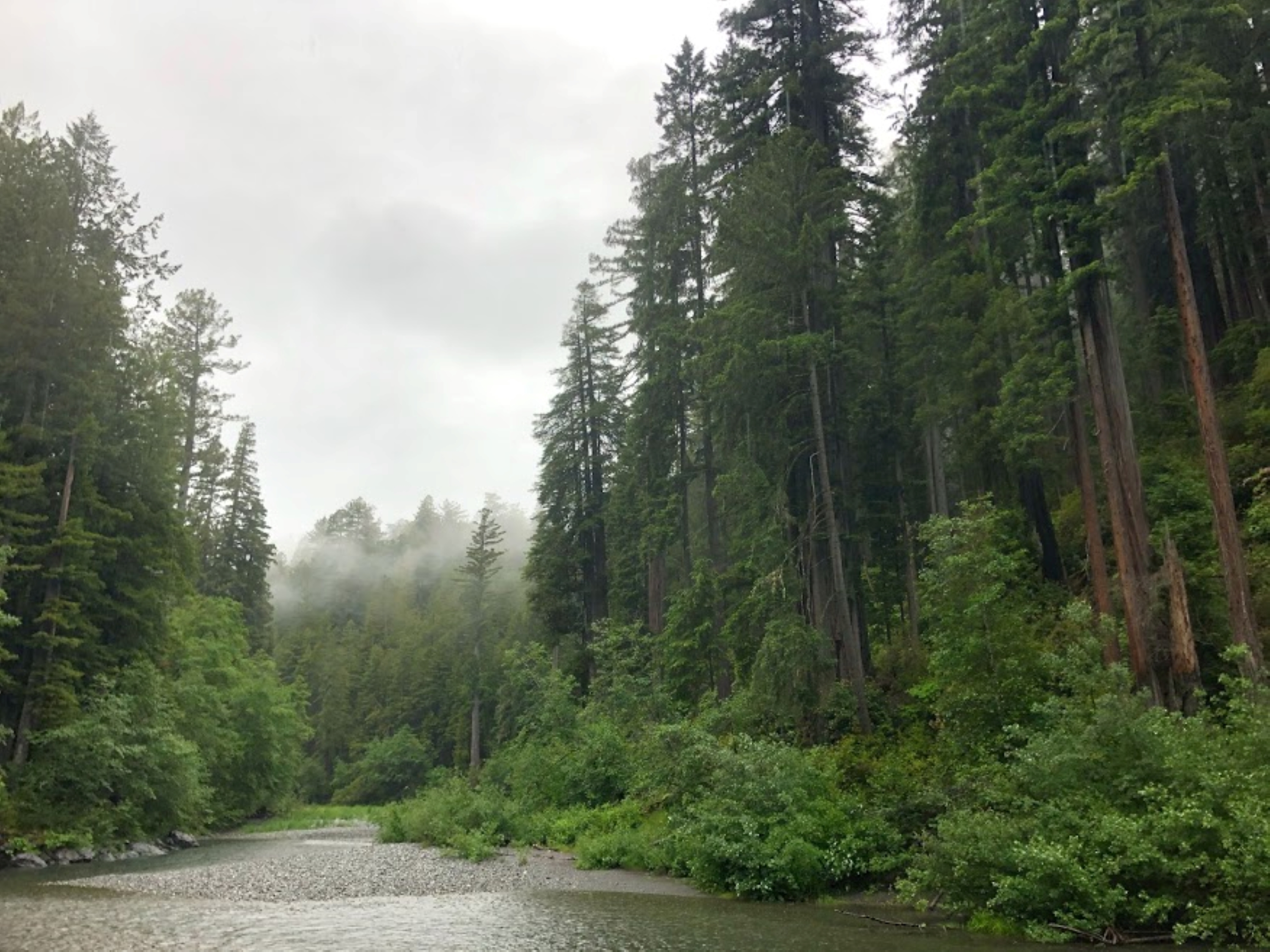
• Location: Redwood National Park • Trailhead: Marked trailhead is off Bald Hills Road. Trail can also be accessed via Tall Trees Grove Trail and Dolason Prairie Trail. • Mileage: 8 to Tall Trees Grove Trail, and an additional 6 to Dolason Prairie Trail • Difficulty Level: Up to the bridge crossing, Redwood Creek Trail is wide and fairly level on loosely compacted dirt, and may require stepping on rocks to cross small streams. Beyond the bridge, the hike to Dolason Prairie is all up hill and strenuous. • Winter Hiking:(December - May) Redwood Creek runs high and fast during the winter. Foot bridges across the creek are removed until the summer season. There are no gravel bars available for camping. Check at the visitor centers before planning your trip for current conditions. • Parking: There is parking for RVs and trailers at the Redwood Creek Trailhead. There is no RV or trailer parking at the Tall Trees Trailhead. Just outside of Orick in the southern end of the park, this trail leads to Redwood Creek. In summer, seasonal footbridges are in place to allow hiking further into redwood groves. Hike a section of this trail as a day hike, or hike it and connecting trails as a multi-day backpacking trip. For thousands of years, giant redwoods, big-leaf maples, and other moisture-loving plants have flourished in this cool, wind-protected stream valley leading to the Tall Trees Grove. The trees have been sustained by nutrients in the rich soils along the creek. Beginning in the early 1950s, large-scale timber harvesting and road building on the surrounding hillslopes caused extensive erosion and landsliding in the Redwood Creek watershed during floods. One storm in 1964 sent 20 feet of sediment into the creek channel near the headwaters, threatening tall trees, plants, and animals. As the slug of sediment slowly moves from the headwaters to the river mouth, Redwood Creek is beginning to recover, though it may take decades for park staff and nature to complete the restoration process. Safety Tips • Use a good map and trail guide for your adventures in Redwood National and State Parks. Don’t rely on online maps. • To protect the habitats, leave no trace also means staying on the developed trail. Please don’t go off trail or make any new trails. These forests grow by the inch, and will die by your foot. • To protect the wildlife (and you and other visitors), pets are not allowed on park trails. • Cell coverage is very limited and cannot be relied on in an emergency. Have a plan for checking in and checking out with a friend when you are here.
Elam Camp
Campground
EdeBee's Snack Shack
Burger restaurant
Places © OpenStreetMap contributors, Places © Overture Maps Foundation
More in Hoopa Ridge LoopHikingPhoto: Wsiegmund, CC BY 2.5 (via Wikimedia Commons)0.6 miOrick Horse TrailHikingPhoto: Wsiegmund, CC BY 2.5 (via Wikimedia Commons)0.6 mi
 Lady Bird Johnson Nature Trail Stop #6HikingPhoto: NPS Photo / James Tiffany0.8 mi
 Prairie CreekCanoeingPhoto: Thewellman, CC0 (via Wikimedia Commons)3.9 mi
 Cormorant Rock and Awkward TurtleRock climbingPhoto: lamblukas, CC BY 2.0 (via Flickr)6.9 mi
Source: Roamze catalog (indexable pages within 10 miles, PostGIS distance)
 Redwood Creek TrailHiking · Next doorPhoto: Ken Lund, CC BY-SA 2.0 (via Flickr)Ridge LoopHiking · Next doorPhoto: Wsiegmund, CC BY 2.5 (via Wikimedia Commons)Orick Horse TrailHiking · Next doorPhoto: Wsiegmund, CC BY 2.5 (via Wikimedia Commons)
 Berry Glen TrailHiking · ~2 min drivePhoto: Aleksandr Zykov, CC BY-SA 2.0 (via Flickr)Davidson TrailHiking · ~3 min drivePhoto: Aleksandr Zykov, CC BY-SA 2.0 (via Flickr)
Also worth it near here
Best months: March–November. Best months have typical highs of 55–85 °F, lows of 30 °F or warmer (32 °F where the station doesn't record snow), at most one snowy day and no more than 12 wet days.
Jan
52° / 36°
Feb
54° / 37°
Mar
56° / 37°
Apr
58° / 39°
May
61° / 43°
Jun
64° / 46°
Jul
67° / 49°
Aug
69° / 49°
Sep
69° / 45°
Oct
65° / 42°
Nov
56° / 39°
Dec
51° / 36°
Typical high / low (°F) and days with rain or snow, 1991–2020. Measured at Orick Prairie Creek Park, CA, 4.4 mi away at 160 ft. This station doesn't record snowfall. Source: NOAA NCEI U.S. Climate Normals 1991–2020.
