Elam Camp
Campground
Campground · 3.4 mi from the trail
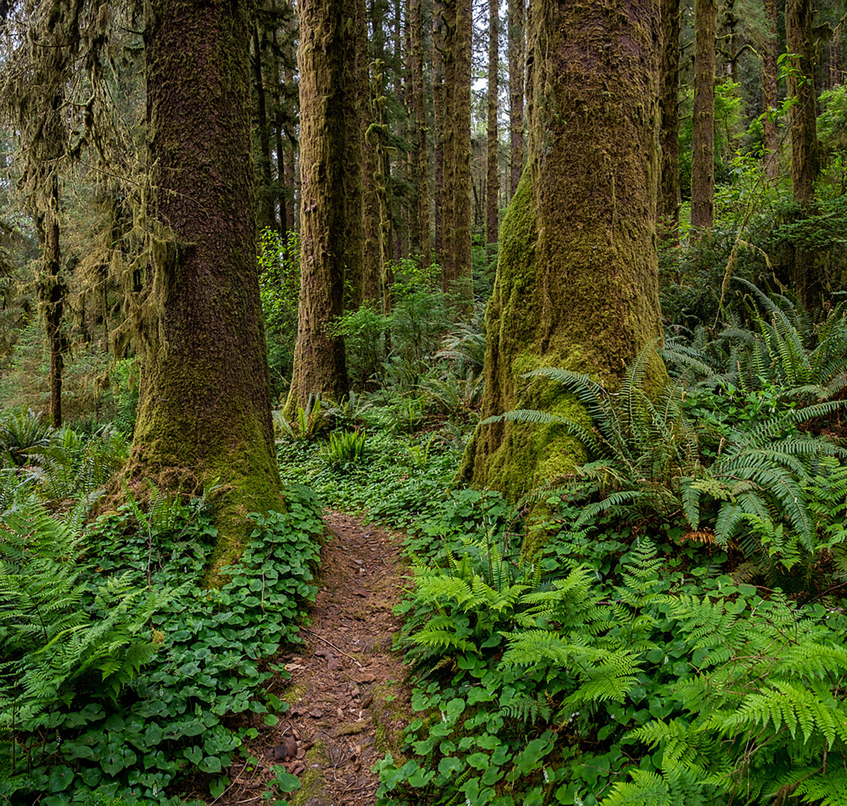 Photo: Photo / Dave Van de Mark
Alert in the area
The National Park Service lists an alert for Redwood National Park.
Delays along Highway 101
Park alert covering Redwood National Park · NPS · Redwood National Park
As of · Source: NPS · Redwood National Park. Agencies don't list every closure — check before you go.
Located off HWY 101 on Robinson Road, this is the southern trailhead for the 7.5 long Skunk Cabbage Trail. The northern trailhead is on Gold Bluffs Beach - just north of the entrance kiosk. The Skunk Cabbage Trail is part of the California Coastal Trail system. The Skunk Cabbage Trail climbs and descends about five hundred feet as it crosses sandy beaches, coastal brush and sitka spruce forests. There are very few redwood trees on this trail, and some large redwood stumps will be passed. The main attraction of this trail is to wander under huge Douglas fir and spruce trees, past ferns, and of course see (and smell) the Skunk Cabbage. This large plant thrives in riparian areas and it's broad leaves are unmistakable. For many visitors, the inland parts of this trail is like hiking in Washington state's Olympic National Park - just with a lot fewer people. Much of the old-growth redwood forests around this trail were logged before Redwood National Park was established in 1968. The sitka spruce forests on the coast were left untouched by logging companies. Nowadays, the coastal overlooks that are shown on older trail maps are overgrown. Safety Tips • We recommend you purchase and use a good map and trail guide for your adventures in Redwood National and State Parks. Don’t rely on online maps when you are here. • To protect the habitats, leave no trace also means staying on the developed trail. Please don’t go off-trail and make any new trails. These forests grow by the inch, and will die by your foot. • To protect the wildlife (and you and other visitors), pets are not allowed on park trails. • Cell coverage is very limited and cannot be relied on in an emergency. Have a plan for checking in and checking out with a friend when you are here.
Elam Camp
Campground
EdeBee's Snack Shack
Burger restaurant
Patrick's Point Visitor Center
Museum
Places © OpenStreetMap contributors, Places © Overture Maps Foundation
More in Hoopa Ridge LoopHikingPhoto: Wsiegmund, CC BY 2.5 (via Wikimedia Commons)0.9 miOrick Horse TrailHikingPhoto: Wsiegmund, CC BY 2.5 (via Wikimedia Commons)0.9 mi
 Berry Glen TrailHikingPhoto: Aleksandr Zykov, CC BY-SA 2.0 (via Flickr)1.1 mi
 Prairie CreekCanoeingPhoto: Thewellman, CC0 (via Wikimedia Commons)3.5 mi
 Cormorant Rock and Awkward TurtleRock climbingPhoto: lamblukas, CC BY 2.0 (via Flickr)6.7 mi
Source: Roamze catalog (indexable pages within 10 miles, PostGIS distance)
Orick Horse TrailHiking · ~2 min drivePhoto: Wsiegmund, CC BY 2.5 (via Wikimedia Commons)Ridge LoopHiking · ~2 min drivePhoto: Wsiegmund, CC BY 2.5 (via Wikimedia Commons)Davidson TrailHiking · ~2 min drivePhoto: Aleksandr Zykov, CC BY-SA 2.0 (via Flickr)Berry Glen TrailHiking · ~2 min drivePhoto: Aleksandr Zykov, CC BY-SA 2.0 (via Flickr) Streelow Creek TrailHiking · ~5 min drivePhoto: Robert Ashworth from Bellingham, WA., USA, CC BY 2.0 (via Wikimedia Commons)
Also worth it near here
Best months: March–November. Best months have typical highs of 55–85 °F, lows of 30 °F or warmer (32 °F where the station doesn't record snow), at most one snowy day and no more than 12 wet days.
Jan
52° / 36°
Feb
54° / 37°
Mar
56° / 37°
Apr
58° / 39°
May
61° / 43°
Jun
64° / 46°
Jul
67° / 49°
Aug
69° / 49°
Sep
69° / 45°
Oct
65° / 42°
Nov
56° / 39°
Dec
51° / 36°
Typical high / low (°F) and days with rain or snow, 1991–2020. Measured at Orick Prairie Creek Park, CA, 4.2 mi away at 160 ft. This station doesn't record snowfall. Source: NOAA NCEI U.S. Climate Normals 1991–2020.
