Poore Lake
 Photo: A Silly Person from Sonora, CA, United States, CC BY-SA 2.0 (via Wikimedia Commons)
- 9.3 mi
- round trip
- 725 ft
- climb
- 7,275 ft
- high point
- Out and back
- route
- May–Sep
- best months
Caution at last check
Agency alerts are in effect for this area; weather is good · USFS, OpenWeather · checked 15 h ago
Is Poore Lake open right now?
Closure in the area
There's a closure order in Humboldt-Toiyabe National Forest. It doesn't name Poore Lake, so check the source for the area it covers.
Elephant Fire Closure
Agency closure covering Humboldt-Toiyabe National Forest · Order 04-17-26-01-04 · USFS · Humboldt-Toiyabe National Forest
Area, Road, and Trail Closures (Spring Mountains National Recreation Area)
Agency alert covering Humboldt-Toiyabe National Forest · Order 04-17-25-04 · USFS · Humboldt-Toiyabe National Forest
Year-Round Fire Restrictions (Spring Mountains National Recreation Area)
Agency alert covering Humboldt-Toiyabe National Forest · Order 04-17-24-01 · USFS · Humboldt-Toiyabe National Forest
Vehicle Snow Chain Requirements during Inclement Weather (Spring Mountains National Recreation Area)
Agency alert covering Humboldt-Toiyabe National Forest · Order 04-17-23-01 · USFS · Humboldt-Toiyabe National Forest
Rainbow Canyon Flood Diversion Structure Closure (Spring Mountains National Recreation Area)
Agency alert covering Humboldt-Toiyabe National Forest · Order 04-17-15-01 · USFS · Humboldt-Toiyabe National Forest
As of · Source: USFS · Humboldt-Toiyabe National Forest. Agencies don't list every closure — check before you go.
Poore Lake is a 9.3-mile out-and-back hike in California's Humboldt-Toiyabe National Forest, within the Bridgeport Ranger District and the Pickel Meadow Wildlife Area. The trail gains about 725 feet in elevation from a low point of 6,747 feet to a high of 7,275 feet, and it is managed by State Fish and Wildlife. The route is rated hard, and the natural surface allows for horses and bikes. It is open year-round, and the nearest town is Bridgeport, about 18 miles away. Summer is the most comfortable time to go. Typical July averages from the nearby Bridgeport weather station run to a high of 85°F and a low of 43°F, while winter brings highs in the mid-40s and frequent snow days. Nearby options include Leavitt Meadows Campground, the Little Wolf Trail and Secret Lake, and the Lta climbing area, all within about a mile and a half. Kennedy Creek, a paddling spot, lies roughly 9 miles away.
Best time to go · May–Sep
Best time to visit Poore Lake
Best months: May–September. Best months have typical highs of 55–85 °F, lows of 30 °F or warmer (32 °F where the station doesn't record snow), at most one snowy day and no more than 12 wet days.
Jan
43° / 10°
5 wet · 4 snow
Feb
45° / 13°
5 wet · 3 snow
Mar
52° / 20°
4 wet · 3 snow
Apr
59° / 25°
3 wet · 1 snow
May
67° / 32°
3 wet · 1 snow
Jun
77° / 39°
2 wet
Jul
85° / 43°
3 wet
Aug
84° / 41°
2 wet
Sep
78° / 34°
2 wet
Oct
66° / 24°
2 wet
Nov
55° / 17°
3 wet · 1 snow
Dec
45° / 12°
5 wet · 3 snow
Typical high / low (°F) and days with rain or snow, 1991–2020. Measured at Bridgeport, CA, 17.7 mi away at 6,470 ft. The station sits about 800 ft lower than this place, so expect it a little cooler here. Source: NOAA NCEI U.S. Climate Normals 1991–2020.
Keep exploring — more trails worth the drive
 Photo: Capt' Gorgeous, CC BY 2.0 (via Flickr)
Little Wolf Trail
~2 min drive
3.58-mile out-and-back hike in California with 1,208 ft gain and loss.
Photo: A Silly Person from Sonora, CA, United States, CC BY-SA 2.0 (via Wikimedia Commons)Poore Lake Connector
~2 min drive
0.96-mile out-and-back trail with 171 ft gain in California
 Photo: dogplusplus, CC BY 2.0 (via Flickr)
West Walker River Trail
~3 min drive
3.94-mile out-and-back hike in California with 1,606 ft gain and 7,458 ft max elevation.
HIKE
Pacific Crest National Scenic Trail #2000
~14 min drive
46.78-mile out-and-back on the Pacific Crest Trail in California with 8,414 ft gain/loss
 Photo: J Doll, CC BY-SA 3.0 (via Wikimedia Commons)
Chain of Lakes
~11 min drive
4.40-mile out-and-back trail in California with 705 ft gain.
 Photo: simonov, CC BY-SA 2.0 (via Flickr)
Rickey Cabin Trail
~11 min drive
2.48-mile out-and-back hike in California with 575 ft elevation gain
 Photo: RuggyBearLA, CC BY 2.0 (via Flickr)
Leavitt Trail
~3 min drive
4.54-mile out-and-back trail in California with 2,386 ft elevation gain and loss.
HIKE
Pacific Crest National Scenic Trail #2000
~15 min drive
22.98-mile out-and-back on the Pacific Crest Trail in California with 3,891 ft gain
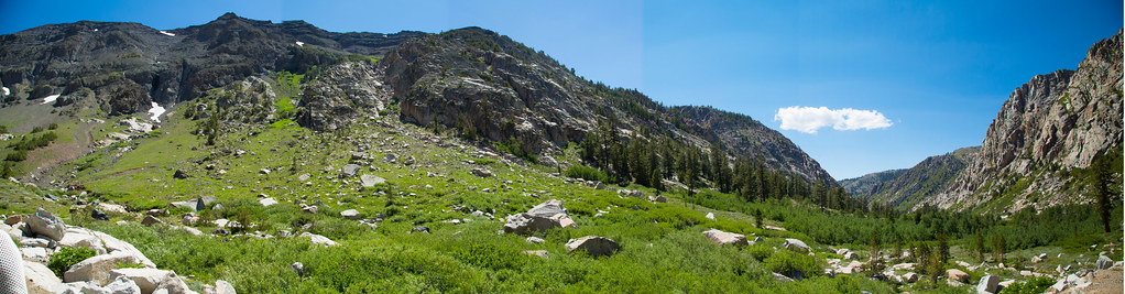 Photo: zoxcleb, CC BY-SA 2.0 (via Flickr)
Blue Canyon
~13 min drive
3.31-mile out-and-back trail in California with 1,288 ft of elevation gain.
Photo: J Doll, CC BY-SA 3.0 (via Wikimedia Commons)Fremont Lake
~12 min drive
2.56-mile out-and-back trail to Fremont Lake in California with 575 ft gain.


