Pine Creek Valley
- 31.2 mi
- loop
- 1,967 ft
- climb
- 6,252 ft
- high point
- Loop
- route
- May–Oct
- best months
Is PINE CREEK VALLEY open right now?
Closure in the area
There's a closure order in Lassen National Forest. It doesn't name PINE CREEK VALLEY, so check the source for the area it covers (3 listed).
Harmful Algal Blooms
Agency closure covering Lassen National Forest · USFS · Lassen National Forest
Forest Road Closure Order
Agency closure covering Lassen National Forest · Order 06-26-01 · USFS · Lassen National Forest
SAFETY ALERT - South Antelope Bridge out, Do Not Cross
Agency closure covering Lassen National Forest · USFS · Lassen National Forest
As of · Source: USFS · Lassen National Forest. Agencies don't list every closure — check before you go.
Pine Creek Valley is a 31-mile loop hike in California's Lassen National Forest, within the Eagle Lake Ranger District. The trail starts and ends at about 5,268 feet, and the climb to the high point of 6,252 feet is front-loaded, with the most gain happening early in the trip. The route is rated hard, and the total elevation gain of 1,967 feet makes it a full-day or overnight outing rather than a short walk. Summer is the most comfortable time to go. Typical averages from the nearby Manzanita Lake weather station put July highs around 79°F with lows near 46°F, while winter months see highs in the low 40s and lows around 22°F. The station sits about 500 feet below the trail's high point, so temperatures on the ridge run a little cooler. Christie Campground, 2.5 miles away, is the closest place to camp. Whaleback Mountain and Sno-Whaleback Mountain are both about 3 miles off, and Gallatin Marina, roughly 4.6 miles away, offers lake fishing.
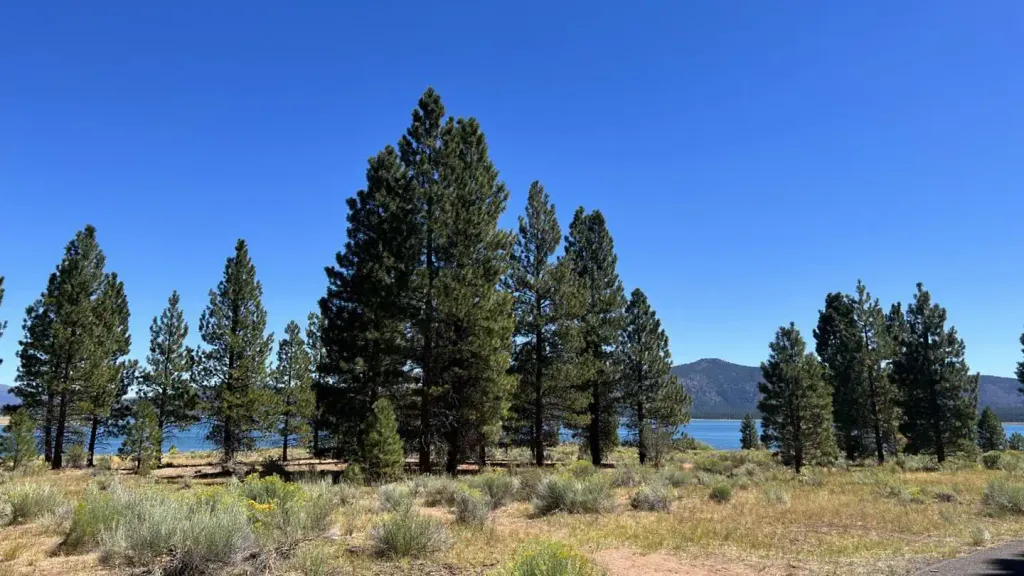 Christie CampgroundCampingPhoto: Recreation.gov (RIDB) / public domain2.5 mi
- SNO-WHALEBACK MOUNTAINHiking3.1 mi
- WHALEBACK MOUNTAINHiking3.1 mi
- MerrillCamping4.1 mi
- Hidden Change Interp. TrailHiking4.3 mi
- Gallatin MarinaLake fishing4.6 mi
- GallatinHiking4.9 mi
- West EagleCamping4.9 mi
Source: Roamze catalog (indexable pages within 10 miles, PostGIS distance)
 Emerald-Cypress CaribouHiking · ~33 min drivePhoto: Seth Tisue, CC BY-SA 2.0 (via Flickr)
- Gem Lake CaribouHiking · ~33 min drivePhoto: Seth Tisue, CC BY-SA 2.0 (via Flickr)
- Bizz Johnson TrailHiking · ~24 min drive
- FREDONYER SHORT LOOPHiking · ~28 min drive
 Caribou-N. Divide CaribouHiking · ~31 min drivePhoto: Seth Tisue, CC BY-SA 2.0 (via Flickr)
- WHALEBACK MOUNTAINHiking · ~5 min drive
- Cone-Hay Mdws CaribouHiking · ~33 min drive
- BUTTE LAKEHiking · ~34 min drive
- Jewel LakeHiking · ~32 min drivePhoto: Seth Tisue, CC BY-SA 2.0 (via Flickr)
- SNO-WHALEBACK MOUNTAINHiking · ~5 min drive
Best time to visit PINE CREEK VALLEY
Best months: May–October. Best months have typical highs of 55–85 °F, lows of 30 °F or warmer (32 °F where the station doesn't record snow), at most one snowy day and no more than 12 wet days.
Jan
41° / 22°
Feb
42° / 22°
Mar
46° / 24°
Apr
50° / 27°
May
61° / 35°
Jun
70° / 41°
Jul
79° / 46°
Aug
78° / 45°
Sep
72° / 41°
Oct
59° / 33°
Nov
47° / 26°
Dec
39° / 22°
Typical high / low (°F) and days with rain or snow, 1991–2020. Measured at Manzanita Lake, CA, 38.5 mi away at 5,750 ft. The station sits about 500 ft lower than this place, so expect it a little cooler here. This station doesn't record snowfall. Source: NOAA NCEI U.S. Climate Normals 1991–2020.
