Mammoth Lakes Pack Outfit
Hiking business nearby (~38 mi away) — hasn't claimed their Roamze page yet
Free — you'll pick up right here.
Watch this trail
Sign up to watch it — saving subscribes you to gate, closure and report changes.
California
1.5 mi
Distance
829 ft
Gain
Weather is good
1 factor · 1 source
Observed 1 h ago
clear: Weather
Clear, high 77°F / low 51°F, 0% precip — 98/100 for hike
OpenWeather1 h ago
Been out here in the last few days? One report keeps this current for everyone.
Why you'll love it
Old Wawona Road
AI-suggested draft · review before you go
Old Wawona Road is a 1.53-mile out-and-back trail in California's Yosemite National Park with 829 feet of elevation gain. The trail reaches a maximum elevation of 4,929 feet.
 Photo: Anke Meskens, CC BY-SA 3.0 (via Wikimedia Commons)
Bridalveil Fall Trail
~3 min drive
0.67-mile out-and-back to Bridalveil Fall in California, 98 ft gain
 Photo: Richard Wood, CC BY-SA 3.0 (via Wikimedia Commons)
#18 Dewey Point Meadow Trail
~3 min drive
#18 Dewey Point Meadow Trail is a 4.88-mile out-and-back hike in California with 1,246 feet of elevation gain.
 Photo: Richard Wood, CC BY-SA 3.0 (via Wikimedia Commons)
Pohono Trail
~6 min drive
11.82-mile out-and-back hike in California with 4,148 ft gain and 7,754 ft max elevation.
 Photo: Richard Wood, CC BY-SA 3.0 (via Wikimedia Commons)
John Muir Trail
~14 min drive
24.06-mile out-and-back trail in California with 6,836 ft elevation gain
McGurk Meadow Trailhead
~7 min drive
McGurk Meadow The trail leads downhill to McGurk Meadow and the site of an old cabin that belonged to sheepherder John McGurk. During early summer, look for a tremendous show of wildflowers. Distance: 1.6 miles (2.5 km) round-trip Elevation gain: 150 ft (45 m) on return Time…
 Photo: inkknife_2000 (7.5 million views +), CC BY-SA 2.0 (via Wikimedia Commons)
Chinquapin Trail
~8 min drive
4.98-mile out-and-back hike in California with 1,724 ft elevation gain.
Four Mile Trailhead
~8 min drive
The Four Mile Trail features remarkable, panoramic views of Yosemite Falls, El Capitan, Sentinel Rock, Half Dome, and Tenaya Canyon. This steep trail is challenging, all-day hike. The Four Mile Trail leads to Glacier Point, where restrooms and a snack stand are available in…
Sentinel Dome and Taft Point Trailhead
~9 min drive
Sentinel Dome This wide trail leads mostly across open granite with little shade. Scramble up Sentinel Dome's granite slope to enjoy 360-degree views of Yosemite Valley and the high Sierra. Consider taking this hike at sunset or during a full moon, but remember to bring a…
 Photo: Fabio Achilli, CC BY 2.0 (via Wikimedia Commons)
Panorama Trail
~10 min drive
4.86-mile out-and-back hike in California with 2,717 ft gain/loss and 7,314 ft max elevation.
Valley Shuttle Stop 11: Four Mile Trailhead
~8 min drive
This shuttle stop is served by the Valleywide Shuttle route only. There is no covered shelter or benches at this shuttle stop. Yosemite Valley shuttles are free and operate from 7 am to 10 pm daily. During hours of operation, the Valleywide Shuttle runs approximately every…
Also worth it near here
 Photo: Richard Wood, CC BY-SA 3.0 (via Wikimedia Commons)
Ax. Pulpit Rock
~1 min drive
 Photo: David Hornor, CC BY 2.5 (via Wikimedia Commons)
Silver Strand Falls
~2 min drive
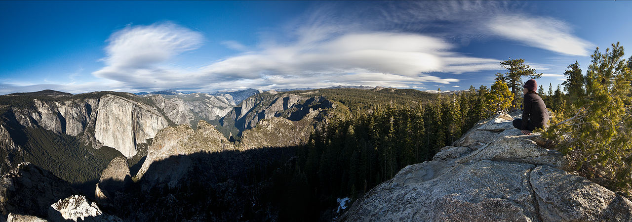 Photo: Jeffrey Pang from Berkeley, CA, USA, CC BY 2.0 (via Wikimedia Commons)
Dewey Point
~3 min drive
Glacier Point Road
~6 min drive
 Photo: Eeekster, CC BY 3.0 (via Wikimedia Commons)
Tamarack Flat Campground
~7 min drive
Local operatorsoffering guided trips. You book directly with them — Roamze doesn’t take a cut.
Mammoth Lakes Pack Outfit
Hiking business nearby (~38 mi away) — hasn't claimed their Roamze page yet
