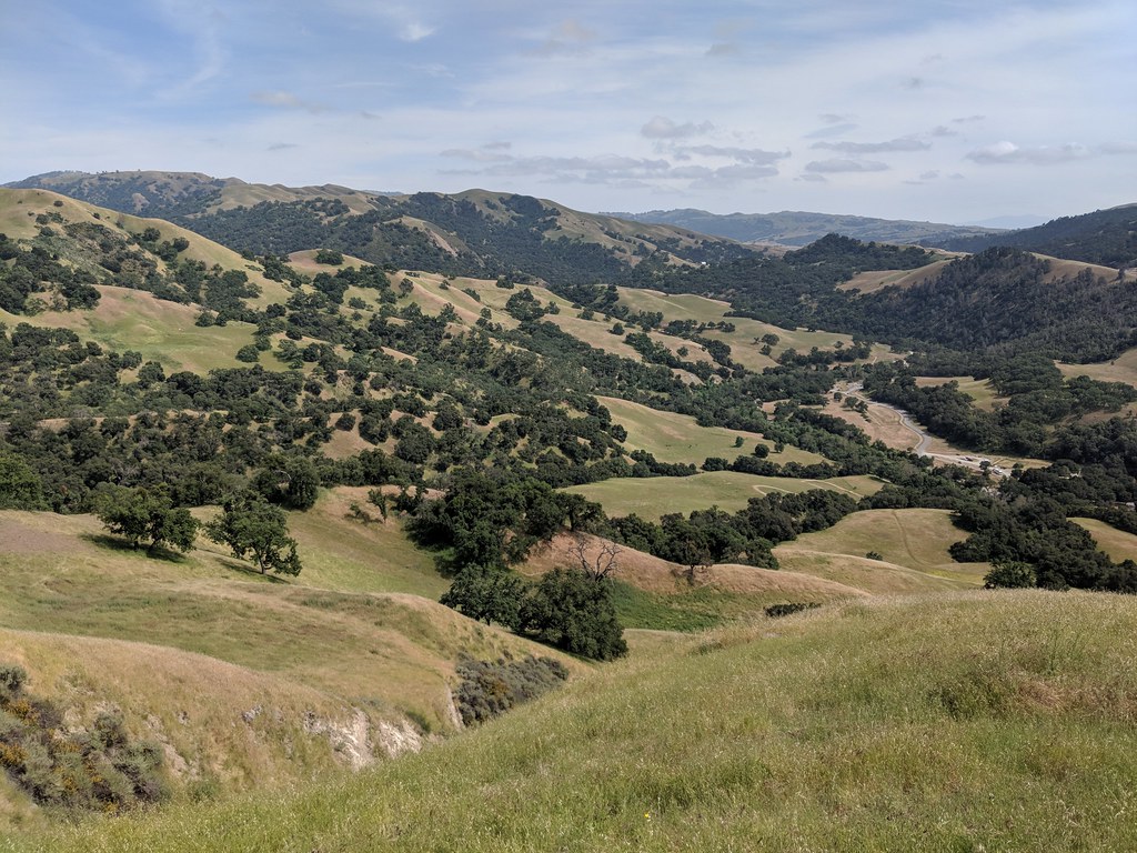
Ohlone Wilderness Trail
 Photo: ilya_ktsn, CC BY 2.0 (via Flickr)
- 1.4 mi
- round trip
- 1,231 ft
- climb
- 2,165 ft
- high point
- Out and back
- route
The Ohlone Wilderness Trail is a 2.7-mile out-and-back hike in the Sunol Regional Wilderness, a unit of California's regional agency land. The trail starts at about 1,622 feet and climbs to a high point of 2,165 feet, with a total elevation gain of 1,231 feet over the round trip. The route is rolling, and the steepest stretch comes early, around 0.44 miles in, with a grade of about 21 percent. The hike is rated moderate, and the estimated time is about 1.5 hours. The trail is an out-and-back, so the 1.35-mile one-way distance listed in the place facts is half the full route. McCorkle Trail lies just 0.3 miles away, and Canyon View Trail and Eagle View Trail are both within about 1.4 miles. Climbers can find Indian Joe Caves roughly 1.7 miles off.
- McCorkle TrailHikingPhoto: ilya_ktsn, CC BY 2.0 (via Flickr)0.3 mi
 Canyon View TrailHikingPhoto: Arvel Hernandez, CC BY-SA 4.0 (via Wikimedia Commons)1.3 mi
 Eagle View TrailHikingPhoto: dbaron, CC BY-SA 2.0 (via Flickr)1.4 mi
 Indian Joe CavesRock climbingPhoto: npdoty, CC BY 2.0 (via Flickr)1.7 mi
- Cleavage RockRock climbing1.7 mi
- Indian Joe Caves boulderingRock climbingPhoto: npdoty, CC BY 2.0 (via Flickr)1.7 mi
 Alameda CreekCanoeingPhoto: Pi.1415926535, CC BY-SA 4.0 (via Wikimedia Commons)2.9 mi
- Calaveras CreekCanoeing3.4 mi
Source: Roamze catalog (indexable pages within 10 miles, PostGIS distance)
- McCorkle TrailHiking · Next doorPhoto: ilya_ktsn, CC BY 2.0 (via Flickr)
- Ohlone Wilderness TrailHiking · Next doorPhoto: ilya_ktsn, CC BY 2.0 (via Flickr)
- McCorkle TrailHiking · ~2 min drivePhoto: Arvel Hernandez, CC BY-SA 4.0 (via Wikimedia Commons)
 Ohlone Wilderness TrailHiking · ~1 min drivePhoto: scorpio-tiger, CC BY-SA 2.0 (via Flickr)
 Buckboard TrailHiking · ~4 min drivePhoto: ilya_ktsn, CC BY 2.0 (via Flickr)
- Canyon View TrailHiking · ~2 min drivePhoto: Arvel Hernandez, CC BY-SA 4.0 (via Wikimedia Commons)
 Flag Hill TrailHiking · ~4 min drivePhoto: dbaron, CC BY-SA 2.0 (via Flickr)
- Eagle View TrailHiking · ~2 min drivePhoto: dbaron, CC BY-SA 2.0 (via Flickr)
 Maguire Peak TrailHiking · ~5 min drivePhoto: dbaron, CC BY-SA 2.0 (via Flickr)
- Indian Joe Creek TrailHiking · ~3 min drivePhoto: dbaron, CC BY-SA 2.0 (via Flickr)
Also worth it near here

Map and trail data © OpenStreetMap contributors
