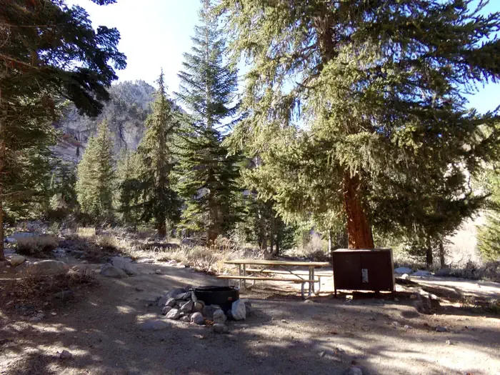
Wheelbarrow Camp
Campground
Campground · 5.6 mi from the trail
No closures listed
The National Park Service lists no closures for Sequoia National Park.
As of · Source: NPS · Sequoia National Park. Agencies don't list every closure — check before you go.
Lake South America is a hard hike in California's Sequoia National Park, within the Sequoia-Kings Canyon Wilderness. The route is an out-and-back of about 10 miles, with a total elevation gain of about 2,086 feet. The trail starts at a low point of about 10,654 feet and climbs to a high point of about 12,180 feet. The National Park Service manages the land, and the hike lies within the park's wilderness boundaries. The route is long and steep, so plan on a full day on foot. The Upper Kern - Tyndall Cutoff and Upper Kern Canyon both start about 0.1 mile away. The John Dean Cutoff is about 2.2 miles off, and the Mt. Tyndall climbing area is about 5.4 miles away.
Wheelbarrow Camp
Campground
 If it rainsDavid Fulmer, CC BY 2.0 · Wikimedia Commons
Giant Forest Museum
Museum
Places © OpenStreetMap contributors · Photos: David Fulmer, CC BY 2.0 (commons)
More in Silver CityNot on Roamze yet. Their page has how to reach them.
 Mt. TyndallRock climbingPhoto: glenngould, CC BY 2.0 (via Wikimedia Commons)5.4 mi
 Onion ValleyCampingPhoto: Recreation.gov (RIDB) / public domain10 mi
Source: Roamze catalog (indexable pages within 10 miles, PostGIS distance)
 Tyndall Ranger StationHiking · ~4 min drivePhoto: ilya_ktsn on Flickr, CC BY 2.0 (via Wikimedia Commons)
 Forester Pass SouthHiking · ~4 min drivePhoto: Matt Lavin, CC BY-SA 2.0 (via Flickr)Wright CreekHiking · ~7 min drivePhoto: ilya_ktsn on Flickr, CC BY 2.0 (via Wikimedia Commons)
 Kern KaweahHiking · ~7 min drivePhoto: ilya_ktsn on Flickr, CC BY 2.0 (via Wikimedia Commons)
 Wallace CreekHiking · ~7 min drivePhoto: ilya_ktsn on Flickr, CC BY 2.0 (via Wikimedia Commons)Shepherd PassHiking · ~4 min drivePhoto: Matt Lavin, CC BY-SA 2.0 (via Flickr)
 Vidette MeadowHiking · ~11 min drivePhoto: Matt Lavin, CC BY-SA 2.0 (via Flickr)
 Colby Pass NorthHiking · ~10 min drivePhoto: ilya_ktsn, CC BY 2.0 (via Wikimedia Commons)
 Junction Pass TrailHiking · ~12 min drivePhoto: Matt Lavin, CC BY-SA 2.0 (via Flickr)
 Bubbs CreekHiking · ~13 min drivePhoto: ilya_ktsn, CC BY 2.0 (via Flickr)

