Loading…

James K. Carr Trail to Whiskeytown Falls
Free — you'll pick up right here.
Watch this trail
Sign up to watch it — saving subscribes you to gate, closure and report changes.
California
We won't guess. Here is exactly what we do and don't know.
What we do know
Inside Whiskeytown-Shasta-Trinity National Recreation Area
National Park unit boundary is mapped — agency alerts for it feed this page automatically.
Boundary data
What's missing
No access route mapped
We don't yet know which road reaches this trailhead, so we can't tell you if it's gated.
Nobody's filed a report here yet — be the first.
James K. Carr Trail to Whiskeytown Falls
AI-suggested draft · review before you go
No elevation data on file for this trail.
No permit or access details on file for this trail — check with the local land manager before you go.
<p><span style="color:null;">The age of discovery continues into the present at Whiskeytown National Recreation Area...<br /> <br /> While studying aerial photographs of the park in 2004, long-time park natural resource manager Russ Weatherbee discovered a waterfall. Russ then visited the site and may have even pinched himself to make sure he wasn't dreaming the vision of this 220-foot-tall, three-part waterfall. Russ had discovered, or perhaps rediscovered, the tallest waterfall in the park.<br /> <br /> After the story of the waterfall's discovery got out, it came to light that for over 40 years the falls was known about by a few local residents. For a variety of reasons, these specific individuals decided not to share the falls' existence with others.</span></p> <p><span style="color:null;">Two summers of trail construction work ensued and park staff opened the trail to Whiskeytown Falls for others to see and enjoy.<br /> <br /> The trail to the falls is named in honor of James K. Carr, one of Redding's native sons and an instrumental figure in the establishment of what is officially known as Whiskeytown-Shasta-Trinity National Recreation Area. A state and national reclamation official, Carr served as President John F. Kennedy's Undersecretary of the Interior, the number two position in the department behind Interior Secretary Stewart Udall.<br /> <br /> The James K. Carr Trail to Whiskeytown Falls is 3.4 miles roundtrip and is strenuous. There is over 600 feet of elevation gain and some steep sections of trail on the way to the waterfall. At minimum, wear sturdy shoes and carry plenty of water to drink.<br /> <br /> While evidence of the Carr Fire can be found along the trail, ample shade remains. Because of the steep topography, colder climate, and unique vegetation of this drainage, the area was much less affected by the unprecedented fire than other areas of the park.<br /> <br /> At the base of the waterfall, be sure and head up the cement stairs to see the upper sections of this three-tiered waterfall.</span></p>
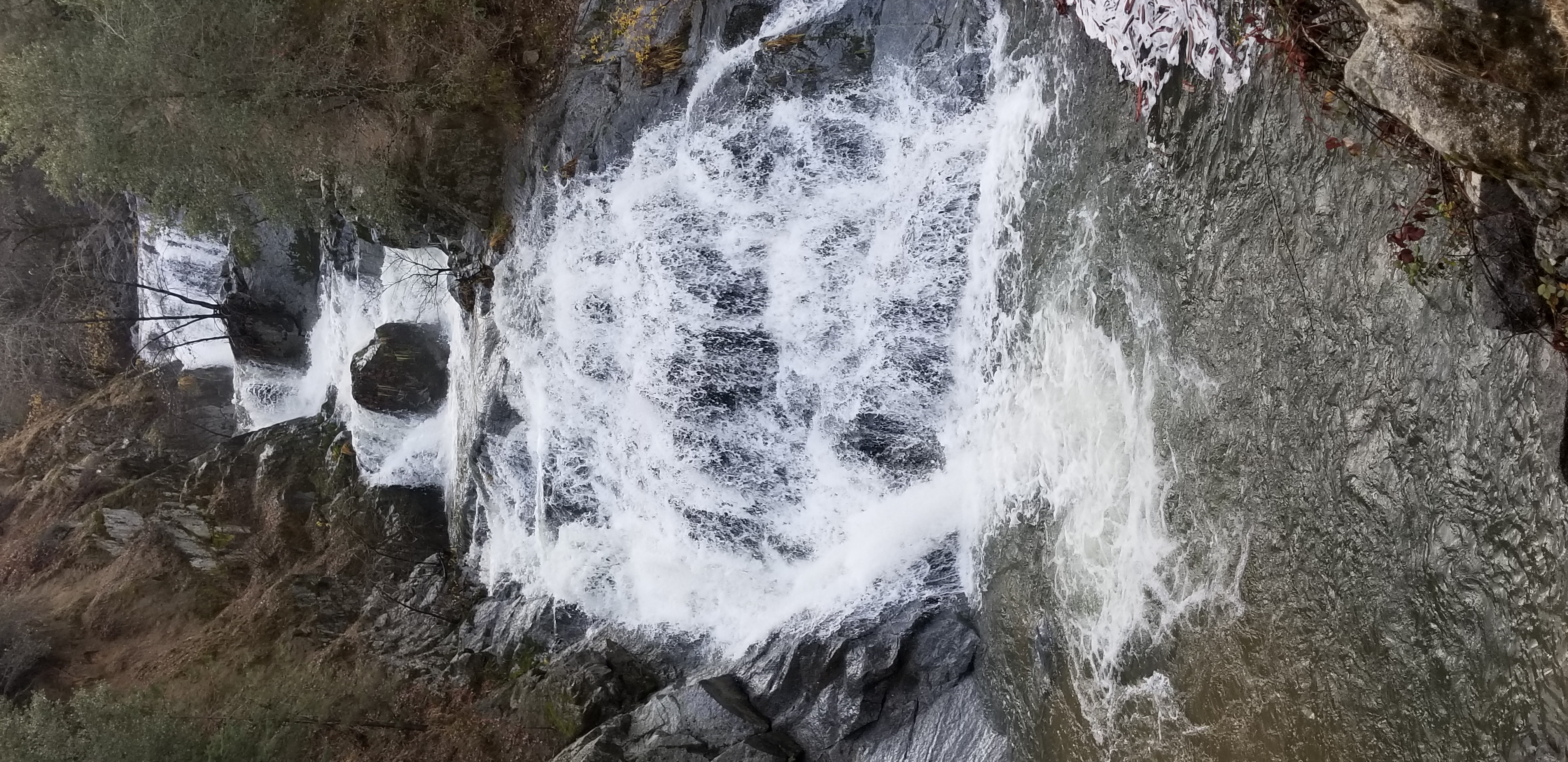
Crystal Creek Falls
~1 min drive
<p>The short 0.3 mile trail to Crystal Creek Falls is paved, flat, and accessible. The shallow natural pool at the base of the cascade is a popular spot for swimming and wading in the summer. There is ample shade.<br /> <br /> Crystal Creek Falls was moved to its present locat…
Lewiston Lakeshore
~20 min drive
Easy lakeside walk with minimal elevation gain and scenic alpine views.
Dry Fork Creek
~22 min drive
Moderate creek-side trail with steady climbing and riparian scenery.
Jerk
~28 min drive
Steep 2.4-mile climb with 741 ft gain—a quick, intense workout.
Musser Hill
~26 min drive
Quick 3-mile foothills climb with 563 ft elevation gain near Musser Hill.
Weaver Basin
~28 min drive
Moderate 7.5-mile basin hike with 910 ft elevation gain.
Sugarloaf Peak
~30 min drive
Quick and easy summit hike with modest elevation gain near Sugarloaf Peak.
Musser Homested
~27 min drive
Historic homestead hike with steady elevation gain and cultural heritage appeal.
Trinity Lakeshore
~29 min drive
Moderate lakeside hike with scenic views of Trinity Lake and mixed forest terrain.
Upper Chanchelulla
~30 min drive
Steep 1.81-mile alpine climb with 766 ft elevation gain.