Gray Butte
 Photo: Pacific Southwest Region 5, Public domain (via Wikimedia Commons)
- 1.3 mi
- round trip
- 254 ft
- climb
- 7,707 ft
- high point
- Out and back
- route
Is Gray Butte open right now?
Closure in the area
There's a closure order in Shasta-Trinity National Forest. It doesn't name Gray Butte, so check the source for the area it covers (2 listed).
Mud and Ash Creek Area and Road Closure
Agency closure covering Shasta-Trinity National Forest · Order 14-26-13 · USFS · Shasta-Trinity National Forest
Road Closure on Wild Mad Road
Agency closure covering Shasta-Trinity National Forest · Order 14-25-09 · USFS · Shasta-Trinity National Forest
Bailey Cove Road Closure Order
Agency alert covering Shasta-Trinity National Forest · Order 14-25-11 · USFS · Shasta-Trinity National Forest
Trout Creek Bridge Closure Order
Agency alert covering Shasta-Trinity National Forest · Order 14-26-02 · USFS · Shasta-Trinity National Forest
South Fork Suspension Bridge Closure
Agency alert covering Shasta-Trinity National Forest · Order 14-25-30 · USFS · Shasta-Trinity National Forest
As of · Source: USFS · Shasta-Trinity National Forest. Agencies don't list every closure — check before you go.
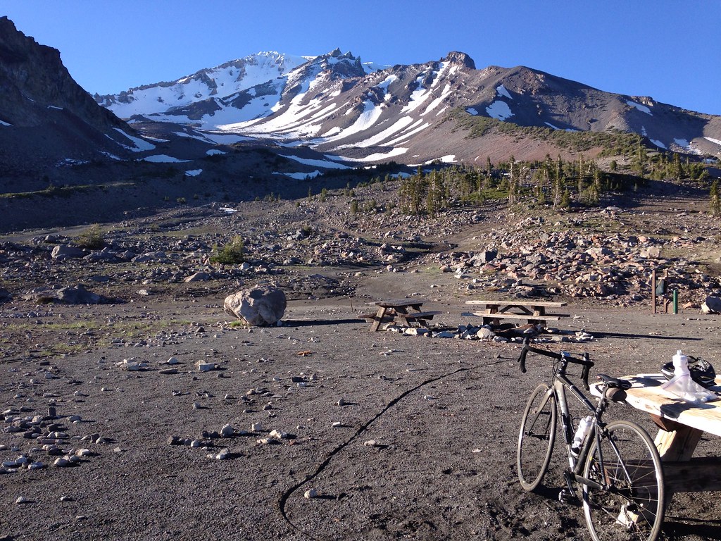
Gray Butte is a short, easy hike in the Mt. Shasta Ranger District of Shasta-Trinity National Forest in California, managed by the Forest Service. The trail is about 1.3 miles long, with a one-way elevation gain of 254 feet, and it follows a natural surface. It is an out-and-back route, starting and ending at the same point, with the high point at 7,707 feet and the low at 7,438 feet. The trail is open from June 15 through October 31, and it is a popular base for exploring the surrounding area. Panther Meadows and Panther Meadows Campground sit about 0.1 mile away, and the Gray Butte Trail is also close by. For a longer outing, Mount Shasta lies about 2.3 miles off.
- Panther MeadowsHikingPhoto: Pacific Southwest Region 5, Public domain (via Wikimedia Commons)0.1 mi
- Panther Meadows CgCamping0.1 mi
- Gray Butte TrailHiking0.1 mi
- Mount ShastaMountaineering2.3 mi
- Byron’s BoulderRock climbing3.8 mi
- Panther CreekCanoeing4.1 mi
- Mcbride Springs Cg-FCamping4.1 mi
- Mud CreekCanoeing7.2 mi
Source: Roamze catalog (indexable pages within 10 miles, PostGIS distance)
- Panther MeadowsHiking · Next doorPhoto: Pacific Southwest Region 5, Public domain (via Wikimedia Commons)
 Green ButteHiking · Next doorPhoto: Moo.The.Cow, CC BY 2.0 (via Flickr)
 Muirs AscensionHiking · ~6 min drivePhoto: deanetr, CC BY 2.0 (via Flickr)
- South Gate Meadow Trail (Stewart Trail)Hiking · Next doorPhoto: Pacific Southwest Region 5, Public domain (via Wikimedia Commons)
 Snow Bunny Trail (Stewart Trail)Hiking · ~3 min drivePhoto: wikiphotographer, CC BY-SA 2.0 (via Flickr)
 GatewayHiking · ~10 min drivePhoto: Misshaleyrobinson, CC BY-SA 4.0 (via Wikimedia Commons)
 Gray Butte-The Gate TrailHiking · Next doorPhoto: alexik, CC BY-SA 2.0 (via Flickr)
- Horse Camp Trail (Sisson's Trail) NO DOGSHiking · ~3 min drivePhoto: wikiphotographer, CC BY-SA 2.0 (via Flickr)
- Clear Creek Climbing Route (Stewart Trail)Hiking · ~5 min drive
 South Gate Meadows Trail (Stewart Trail)Hiking · ~2 min drivePhoto: Moo.The.Cow, CC BY 2.0 (via Flickr)

