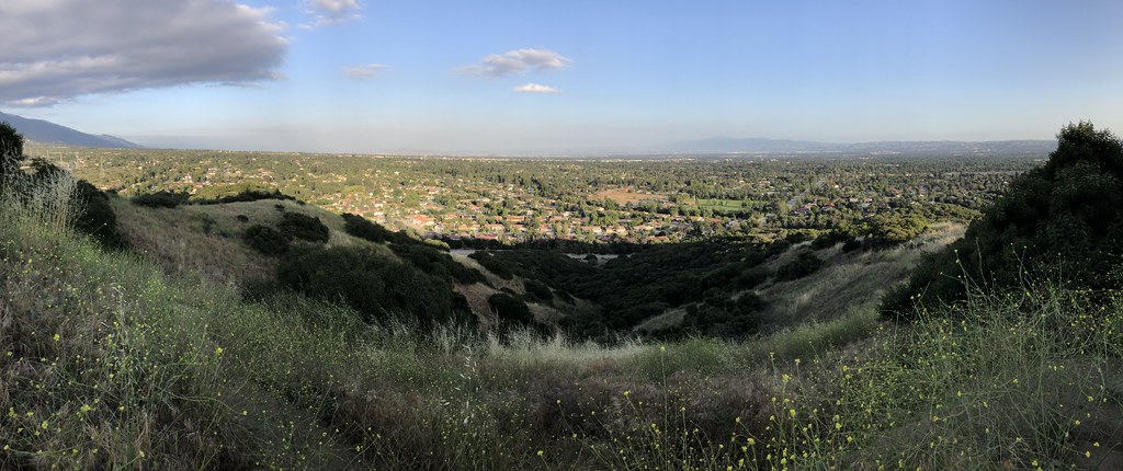
Burbank Trail
 Photo: roguelazer, CC BY-SA 2.0 (via Flickr)
- 1.6 mi
- round trip
- 2,048 ft
- climb
- 2,270 ft
- high point
- Out and back
- route
- Oct–Jun
- best months
Burbank Trail is a 3.1-mile out-and-back hike in Claremont Hills Wilderness Park, a city-managed park in California. The trail starts at 2,270 feet and climbs to a high point of 2,270 feet, which makes it a back-loaded route with the steepest stretch at about 0.36 miles in. The total elevation gain is 2,048 feet, and the trail is rated hard. Spring and fall are the most comfortable times to go. Typical averages from a nearby weather station in Pomona show April highs around 76°F and October highs around 80°F, while July and August average in the low 90s. That station sits well below the trail, so temperatures on the route run cooler. The trip takes about two hours. Gale Trail lies just 0.2 miles away, and Miller Lateral Trail and East Pomello Trail are within a mile. Cobal Canyon Trail, a mountain biking route, is also about 0.8 miles off.
- Gale TrailHikingPhoto: roguelazer, CC BY-SA 2.0 (via Flickr)0.2 mi
- Miller Lateral TrailHikingPhoto: roguelazer, CC BY-SA 2.0 (via Flickr)0.6 mi
- East Pomello TrailHiking0.8 mi
- Cobal Canyon TrailMountain biking0.8 mi
 San Gabriel RiverCanoeingPhoto: Emarateyya, Muna Al Zaabi, CC BY-SA 3.0 (via Wikimedia Commons)7.6 mi
- Mount Baldy RoadRock climbing9.1 mi
- Icehouse CanyonRock climbing9.2 mi
- Manker FlatCamping9.7 mi
Source: Roamze catalog (indexable pages within 10 miles, PostGIS distance)
- Gale TrailHiking · Next doorPhoto: roguelazer, CC BY-SA 2.0 (via Flickr)
- Miller Lateral TrailHiking · ~1 min drivePhoto: roguelazer, CC BY-SA 2.0 (via Flickr)
 Cobal Canyon TrailHiking · ~2 min drivePhoto: GSEC, CC BY 2.0 (via Flickr)
 Sunset Ridge Truck TrailHiking · ~4 min drivePhoto: waterarchives, CC BY-SA 2.0 (via Flickr)
- Marshall Canyon TrailHiking · ~2 min drivePhoto: roguelazer, CC BY-SA 2.0 (via Flickr)
 Marshall Miller Connector TrailHiking · ~1 min drivePhoto: roguelazer, CC BY-SA 2.0 (via Flickr)
 Palmer Evey TrailHiking · ~3 min drivePhoto: Moo.The.Cow, CC BY 2.0 (via Flickr)
- Upper Monroe Truck TrailHiking · ~11 min drive
 Wren Meacham TrailHiking · ~10 min drivePhoto: InSapphoWeTrust from Los Angeles, California, USA, CC BY-SA 2.0 (via Wikimedia Commons)
- Sycamore Canyon TrailHiking · ~1 min drivePhoto: GSEC, CC BY 2.0 (via Flickr)
Best time to visit Burbank Trail
Best months: October–June. Best months have typical highs of 55–85 °F, lows of 30 °F or warmer (32 °F where the station doesn't record snow), at most one snowy day and no more than 12 wet days.
Jan
68° / 43°
5 wet
Feb
67° / 45°
6 wet
Mar
72° / 47°
4 wet
Apr
76° / 50°
2 wet
May
78° / 54°
1 wet
Jun
84° / 57°
0 wet
Jul
90° / 62°
0 wet
Aug
92° / 63°
0 wet
Sep
89° / 60°
1 wet
Oct
80° / 54°
3 wet
Nov
73° / 47°
4 wet
Dec
67° / 42°
5 wet
Typical high / low (°F) and days with rain or snow, 1991–2020. Measured at Pomona/Fairplex, CA, 5.1 mi away at 999 ft. The station sits about 1,300 ft lower than this place, so expect it a little cooler here. Source: NOAA NCEI U.S. Climate Normals 1991–2020.
Map and trail data © OpenStreetMap contributors
