Boy Scout Tree Trailhead
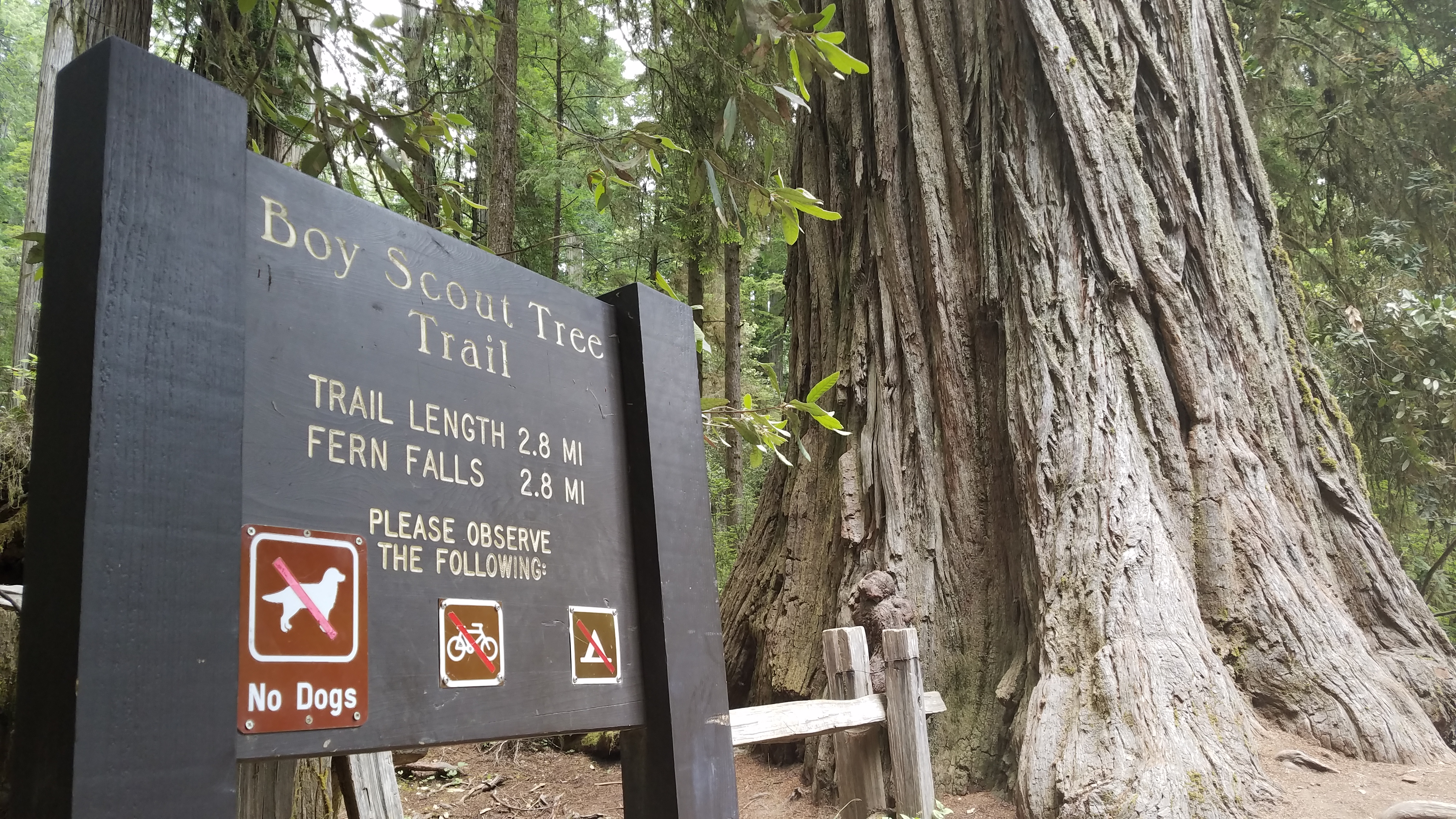 Photo: NPS Photo / B. Marciniec.
- 1.5 mi
- round trip
- 251 ft
- climb
- 475 ft
- high point
- Out and back
- route
- May–Oct
- best months
Is Boy Scout Tree Trailhead open right now?
Alert in the area
The National Park Service lists an alert for Redwood National Park.
Delays along Highway 101
Park alert covering Redwood National Park · NPS · Redwood National Park
As of · Source: NPS · Redwood National Park. Agencies don't list every closure — check before you go.
A Moderate Hike In The North This rewarding hike though old-growth redwoods is popular for those near Crescent City wanting a bit of a challenge - both physically and logistically. Located in Jedediah Smith Redwoods State Park, visitors should consider this as a half-day experience to access and walk this 5.5 mile round trip trail. During this hike you will follow riparian areas, see Fern Falls, and of course lots of big trees. This trail ends at the base of Fern Falls. To protect the habitats - and for your safety - do not attempt to climb on, or near any waterfall. Logistically, this is a good hiking option if you are near Crescent City with a smaller vehicle and you are unable to drive an hour south to the other longer hiking trails in the parks. Parking at the trailhead may be limited, and in summer your vehicle will get very dusty. Check the road conditions before beginning this trip - sometimes Howland Hill Road is closed. The shortest drive to the trailhead starts southeast of Crescent City at the Elk Valley Road. From this road you will need to take your vehicle east for 3.5 miles along the Howland Hill Road which is narrow, winding dirt road. Howland Hill Road is not suitable for trailers or motor homes. Safety Tips • We recommend you purchase and use a good map and trail guide for your adventures in Redwood National and State Parks. Don’t rely on online maps when you are here. • To protect the habitats, leave no trace also means staying on the developed trail. Please don’t go off trail or make any new trails. These forests grow by the inch, and will die by your foot. • To protect the wildlife (and you and other visitors), pets are not allowed on park trails. • Cell coverage is very limited and cannot be relied on in an emergency. Have a plan for checking in and checking out with a friend when you are here.
Local outfitters
- Turtle Rock RV Resort46 mi away
Not on Roamze yet. Their page has how to reach them.
 Mill Creek TrailHikingPhoto: Šarūnas Burdulis from USA, CC BY-SA 2.0 (via Wikimedia Commons)0.3 mi
 Nickerson Ranch TrailHikingPhoto: Tori Sloane, CC BY-SA 3.0 (via Wikimedia Commons)0.5 mi
- Mill CreekCanoeing0.6 mi
- Mill Creek Horse Trail (North)HikingPhoto: Tori Sloane, CC BY-SA 3.0 (via Wikimedia Commons)1 mi
- Boy Scout Tree TrailHikingPhoto: Šarūnas Burdulis from USA, CC BY-SA 2.0 (via Wikimedia Commons)1.1 mi
- East Fork Mill CreekCanoeing3.6 mi
 Smith RiverCanoeingPhoto: BigT67, CC BY-SA 3.0 (via Wikimedia Commons)4.8 mi
- Rock CreekCanoeing7.7 mi
Source: Roamze catalog (indexable pages within 10 miles, PostGIS distance)
- Mill Creek TrailHiking · Next doorPhoto: Šarūnas Burdulis from USA, CC BY-SA 2.0 (via Wikimedia Commons)
- Mill Creek Horse Trail (North)Hiking · ~2 min drivePhoto: Tori Sloane, CC BY-SA 3.0 (via Wikimedia Commons)
 Craigs Creek TrailHiking · ~6 min drivePhoto: Ken Lund, CC BY-SA 2.0 (via Flickr)
- Lieffer Loop TrailHiking · ~6 min drive
- Nickerson Ranch TrailHiking · Next doorPhoto: Tori Sloane, CC BY-SA 3.0 (via Wikimedia Commons)
- Boy Scout Tree TrailHiking · ~2 min drivePhoto: Šarūnas Burdulis from USA, CC BY-SA 2.0 (via Wikimedia Commons)
- Hiouchi TrailHiking · ~4 min drive
- Coastal Trail: Last Chance Grade (North)Hiking · ~8 min drive
- Mill Creek Horse Trail (West Loop)Hiking · ~2 min drivePhoto: Tori Sloane, CC BY-SA 3.0 (via Wikimedia Commons)
 Mill Creek TrailHiking · ~2 min drivePhoto: Tori Sloane, CC BY-SA 3.0 (via Wikimedia Commons)
Best time to visit Boy Scout Tree Trailhead
Best months: May–October. Best months have typical highs of 55–85 °F, lows of 30 °F or warmer (32 °F where the station doesn't record snow), at most one snowy day and no more than 12 wet days.
Jan
54° / 40°
16 wet
Feb
55° / 40°
14 wet
Mar
56° / 41°
16 wet
Apr
58° / 43°
13 wet
May
61° / 46°
9 wet
Jun
63° / 48°
5 wet
Jul
65° / 51°
3 wet
Aug
66° / 52°
3 wet
Sep
66° / 48°
4 wet
Oct
62° / 46°
9 wet
Nov
57° / 42°
15 wet
Dec
53° / 39°
17 wet
Typical high / low (°F) and days with rain or snow, 1991–2020. Measured at Crescent City 3 Nnw, CA, 5.7 mi away at 43 ft. Source: NOAA NCEI U.S. Climate Normals 1991–2020.
