Black Bear Loop Trail
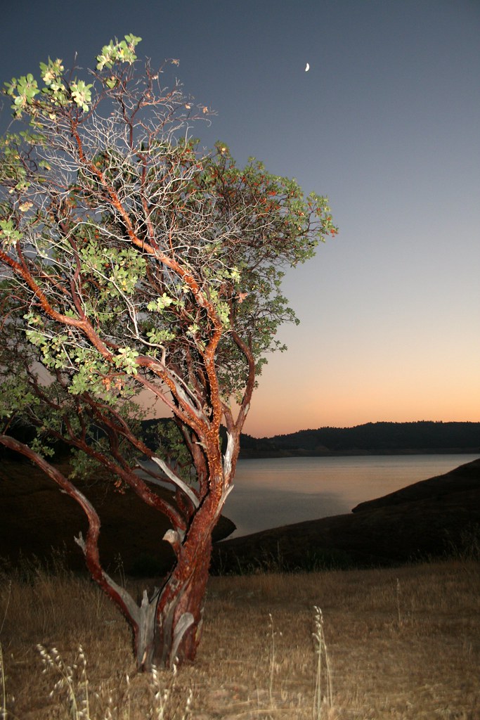 Photo: Genista, CC BY-SA 2.0 (via Flickr)
- 1.1 mi
- loop
- 279 ft
- climb
- 1,290 ft
- high point
- Loop
- route
- Feb–May, Oct–Dec
- best months
Black Bear Loop Trail is a short, easy loop on the New Melones site in California, managed by the Bureau of Reclamation. The trail is about 1.1 miles long, with a steady climb of 279 feet over the course of the loop. It starts at around 1,241 feet and reaches a high point of about 1,290 feet, with the steepest stretch coming roughly 0.37 miles into the route at a 10% grade. The trail also loses the same amount of elevation on the way back, so the total gain and loss for the full loop are both about 279 feet. Spring and fall are the most comfortable times to go. Typical averages from the nearby New Melones Dam HQ weather station, which sits about 330 feet lower than the trail, show May highs near 79°F and October highs around 80°F. July and August average in the mid-90s, and winter brings the most wet days, about 11 to 13 a month from December through February. The trip takes about half an hour, and the trail is close to several other short routes. Fox Ravine Trail and Kingsnake Loop Trail are each about 0.2 miles away, and Ringneck Run Trail is about 0.3 miles off. Climbers can find Ort Wall about 4.7 miles away.
 Fox Ravine TrailHikingPhoto: Genista, CC BY-SA 2.0 (via Flickr)0.2 mi
- Kingsnake Loop TrailHikingPhoto: Genista, CC BY-SA 2.0 (via Flickr)0.2 mi
 Ringneck Run TrailHikingPhoto: adrielhampton, CC BY 2.0 (via Flickr)0.3 mi
- Redtail TrailHikingPhoto: Genista, CC BY-SA 2.0 (via Flickr)0.6 mi
 Ort WallRock climbingPhoto: jfdervin, CC BY-SA 2.0 (via Flickr)4.7 mi
 Table MountainRock climbingPhoto: jfdervin, CC BY-SA 2.0 (via Flickr)4.7 mi
- The Eastern FrontRock climbingPhoto: jfdervin, CC BY-SA 2.0 (via Flickr)4.7 mi
- Sullivan CreekCanoeing7.6 mi
Source: Roamze catalog (indexable pages within 10 miles, PostGIS distance)
- Fox Ravine TrailHiking · Next doorPhoto: Genista, CC BY-SA 2.0 (via Flickr)
- Heron Point TrailHiking · ~1 min drivePhoto: Genista, CC BY-SA 2.0 (via Flickr)
 Carson Creek TrailHiking · ~4 min drivePhoto: cogdogblog, CC BY 2.0 (via Flickr)
- Kingsnake Loop TrailHiking · Next doorPhoto: Genista, CC BY-SA 2.0 (via Flickr)
 Soaproot Ridge TrailHiking · ~19 min drivePhoto: Adam Schultz, CC BY 3.0 (via Wikimedia Commons)
 Elliots CabinHiking · ~17 min drivePhoto: Northwest Rafting Company, CC BY 2.0 (via Flickr)
- Ringneck Run TrailHiking · Next doorPhoto: adrielhampton, CC BY 2.0 (via Flickr)
- Summit TrailHiking · ~10 min drive
 Twain Harte HorsemenHiking · ~28 min drivePhoto: srsmedly, CC BY-SA 3.0 (via Wikimedia Commons)
- Redtail TrailHiking · Next doorPhoto: Genista, CC BY-SA 2.0 (via Flickr)
Best time to visit Black Bear Loop Trail
Best months: February–May and October–December. Best months have typical highs of 55–85 °F, lows of 30 °F or warmer (32 °F where the station doesn't record snow), at most one snowy day and no more than 12 wet days.
Jan
57° / 38°
13 wet
Feb
61° / 40°
11 wet
Mar
65° / 44°
11 wet
Apr
70° / 46°
7 wet
May
79° / 52°
5 wet
Jun
89° / 59°
2 wet
Jul
97° / 65°
1 wet
Aug
96° / 64°
0 wet
Sep
91° / 60°
1 wet
Oct
80° / 52°
4 wet
Nov
66° / 44°
8 wet
Dec
57° / 38°
12 wet
Typical high / low (°F) and days with rain or snow, 1991–2020. Measured at New Melones Dam Hq, CA, 1.7 mi away at 960 ft. Source: NOAA NCEI U.S. Climate Normals 1991–2020.
Map and trail data © OpenStreetMap contributors
