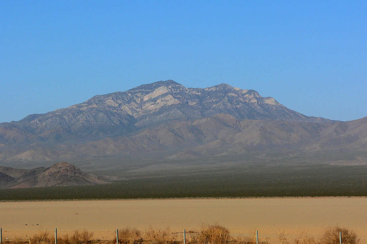
Barber Peak Loop Trail
 Photo: cifraser1, CC BY 2.0 (via Flickr)
- 4.7 mi
- round trip
- 604 ft
- climb
- 4,687 ft
- high point
- Out and back
- route
- Feb–May, Sep–Nov
- best months
Is Barber Peak Loop Trail open right now?
Closure in the area
There's a closure order in Mojave National Preserve. It doesn't name Barber Peak Loop Trail, so check the source for the area it covers (3 listed).
Road Closure South Kelbaker Road I-40 to Kelso and Kelso Dunes Road
Park closure covering Mojave National Preserve · NPS · Mojave National Preserve
Kelso Depot Visitor Center closed
Park closure covering Mojave National Preserve · NPS · Mojave National Preserve
Hart Mine Road Closed
Park closure covering Mojave National Preserve · NPS · Mojave National Preserve
Do not pick up hitchhikers
Park alert covering Mojave National Preserve · NPS · Mojave National Preserve
As of · Source: NPS · Mojave National Preserve. Agencies don't list every closure — check before you go.
Barber Peak Loop Trail is an easy out-and-back hike in Mojave National Preserve in California, managed by the National Park Service. The trail is about 9.4 miles long, with a one-way elevation gain of 604 feet, and it rises from a low point of about 4,158 feet to a high of about 4,687 feet. Spring and fall are the most comfortable times to go. Typical averages from a nearby weather station at Mitchell Caverns show April highs around 68°F and October highs around 74°F, while July and August average in the low 90s. The Barber Peak Connector Trail and Rings Loop both start about 0.2 miles away. Mid Hills to Hole-in-the-Wall Trail and Mid Hills Trail are each about 6 miles off.
Local outfitters
- Sunrise Adventures Ridgeview Resort49 mi away
Not on Roamze yet. Their page has how to reach them.
 Rings LoopHikingPhoto: B. Michel0.2 mi
- Barber Peak Connector TrailHiking0.2 mi
- Mid Hills to Hole-in-the-Wall TrailHiking5.8 mi
- Mid Hills TrailHiking5.9 mi
 Rock Springs TrailHikingPhoto: GSEC, CC BY 2.0 (via Flickr)8.6 mi
 Rock SpringHikingPhoto: NPS8.6 mi
 Mary Beal Nature TrailHikingPhoto: kallahar, CC BY 3.0 (via Wikimedia Commons)9.3 mi
Source: Roamze catalog (indexable pages within 10 miles, PostGIS distance)
- Rings LoopHiking · Next door
- Rock SpringHiking · ~15 min drive
- Mid Hills to Hole-in-the-Wall TrailHiking · ~10 min drive
- Hummingbird Spring TrailHiking · ~35 min drive
- Rock Springs TrailHiking · ~15 min drivePhoto: GSEC, CC BY 2.0 (via Flickr)
- The Lava TubeHiking · ~40 min drive
- Quail SpringHiking · ~31 min drive
- Old Cable TrailHiking · ~44 min drive
- Mary Beal Nature TrailHiking · ~16 min drivePhoto: kallahar, CC BY 3.0 (via Wikimedia Commons)
- Bonanza Spring TrailHiking · ~42 min drive
Best time to visit Barber Peak Loop Trail
Best months: February–May and September–November. Best months have typical highs of 55–85 °F, lows of 30 °F or warmer (32 °F where the station doesn't record snow), at most one snowy day and no more than 12 wet days.
Jan
54° / 40°
5 wet
Feb
55° / 41°
5 wet
Mar
62° / 45°
4 wet
Apr
68° / 50°
2 wet
May
77° / 58°
1 wet
Jun
87° / 69°
1 wet
Jul
92° / 73°
2 wet
Aug
91° / 72°
3 wet
Sep
85° / 68°
3 wet
Oct
74° / 57°
2 wet
Nov
62° / 47°
3 wet
Dec
53° / 40°
4 wet
Typical high / low (°F) and days with rain or snow, 1991–2020. Measured at Mitchell Caverns, CA, 10.8 mi away at 4,350 ft. This station doesn't record snowfall. Source: NOAA NCEI U.S. Climate Normals 1991–2020.