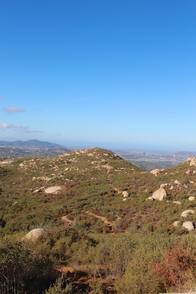
Avovado Trail
 Photo: PhelanRiessen, CC BY-SA 2.0 (via Flickr)
- 0.3 mi
- distance
- 92 ft
- climb
- 856 ft
- high point
- Lollipop
- route
- Jan–Dec
- best months
The Avovado Trail is a short, easy hike in California, about 1.8 miles from the town of Poway. It is a short walk of roughly a third of a mile, rising about 92 feet from a low point of 763 feet to a high of 856 feet. The climb is gentle, with the steepest stretch at about 0.19 miles in, where the grade reaches 8 percent. Spring and fall are the most comfortable times to go. Typical averages from a nearby weather station in Rancho Bernardo show May highs around 72°F and October highs around 77°F, while July and August average in the low 80s. The trail is close to several other routes. The Del Poniente Trail and the Avocado Trail are each about 0.3 miles away, and the Twin Peaks Trail is about half a mile off. Climbers can find Approach Hills about 2.9 miles away.
Local outfitters
- Hike Bike Kayak Adventure Tours16 mi away
- Borrego Outfitters42 mi away
Not on Roamze yet. Their page has how to reach them.
- Del Poniente TrailHiking0.3 mi
- Avocado TrailHiking0.3 mi
- Twin Peaks TrailHiking0.5 mi
- Approach HillsRock climbing2.9 mi
- Joystick BoulderRock climbing3.4 mi
- Shirley and the GangRock climbing3.4 mi
- San Dieguito RiverCanoeing6.6 mi
- San Diego RiverCanoeing9.7 mi
Source: Roamze catalog (indexable pages within 10 miles, PostGIS distance)
- Del Poniente TrailHiking · ~1 min drivePhoto: PhelanRiessen, CC BY-SA 2.0 (via Flickr)
 Lake Poway TrailHiking · ~3 min drivePhoto: daveynin, CC BY 2.0 (via Flickr)
- South Poway TrailHiking · ~5 min drive
- Espola TrailHiking · ~2 min drivePhoto: PhelanRiessen, CC BY-SA 2.0 (via Flickr)
 Green Valley Truck TrailHiking · ~3 min drivePhoto: Officer Phil, CC BY 2.0 (via Flickr)
 Sumac TrailHiking · ~3 min drivePhoto: Antonio Zugaldia from Washington, D.C., United States, CC BY 2.0 (via Wikimedia Commons)
 Mount Woodson TrailHiking · ~4 min drivePhoto: daveynin, CC BY 2.0 (via Flickr)
- Creekside TrailHiking · ~4 min drivePhoto: Officer Phil, CC BY 2.0 (via Flickr)
 Old Fry/Koegel TrailHiking · ~5 min drivePhoto: daveynin, CC BY 2.0 (via Flickr)
 Learning Cave TrailHiking · ~7 min drivePhoto: daveynin, CC BY 2.0 (via Flickr)
Best time to visit Avovado Trail
Best months: Year-round. Best months have typical highs of 55–85 °F, lows of 30 °F or warmer (32 °F where the station doesn't record snow), at most one snowy day and no more than 12 wet days.
Jan
67° / 46°
Feb
66° / 46°
Mar
68° / 49°
Apr
70° / 51°
May
72° / 55°
Jun
76° / 58°
Jul
82° / 63°
Aug
83° / 64°
Sep
81° / 60°
Oct
77° / 57°
Nov
71° / 50°
Dec
66° / 44°
Typical high / low (°F) and days with rain or snow, 1991–2020. Measured at Rancho Bernardo, CA, 3.7 mi away at 690 ft. This station doesn't record snowfall. Source: NOAA NCEI U.S. Climate Normals 1991–2020.

Map and trail data © OpenStreetMap contributors
