
Hike Bike Kayak Adventure Tours
Hiking business nearby (~20 mi away) — hasn't claimed their Roamze page yet
0.6-mile out-and-back hike in California with 413 ft elevation gain
 Photo: daveynin, CC BY 2.0 (via Flickr)
Best months: October–June. Best months have typical highs of 55–85 °F, lows of 30 °F or warmer (32 °F where the station doesn't record snow), at most one snowy day and no more than 12 wet days.
Jan
68° / 38°
6 wet
Feb
68° / 39°
7 wet
Mar
69° / 41°
6 wet
Apr
73° / 43°
4 wet
May
77° / 49°
2 wet
Jun
84° / 52°
1 wet
Jul
90° / 57°
0 wet
Aug
92° / 59°
0 wet
Sep
90° / 55°
1 wet
Oct
82° / 49°
2 wet
Nov
74° / 43°
3 wet
Dec
67° / 37°
5 wet
Typical high / low (°F) and days with rain or snow, 1991–2020. Measured at Ramona Fire Dept, CA, 3.6 mi away at 1,470 ft. The station sits about 1,300 ft lower than this place, so expect it a little cooler here. Source: NOAA NCEI U.S. Climate Normals 1991–2020.
Learning Cave Trail is a 0.6-mile out-and-back hike in California with 413 feet of elevation gain and loss. The trail reaches a maximum elevation of 2,810 feet.
 Photo: chrisinphilly5448, CC BY-SA 2.0 (via Flickr)
Warren Canyon Trail
~1 min drive
4.54-mile out-and-back hike in California with 1,299 ft elevation gain
 Photo: Antonio Zugaldia from Washington, D.C., United States, CC BY 2.0 (via Wikimedia Commons)
Sumac Trail
~4 min drive
1.18-mile out-and-back hike in California with 237 ft elevation gain.
 Photo: daveynin, CC BY 2.0 (via Flickr)
Old Fry/Koegel Trail
~2 min drive
1.04-mile out-and-back trail in California with 1,163 ft gain.
 Photo: Officer Phil, CC BY 2.0 (via Flickr)
Creekside Trail
~5 min drive
0.6-mile out-and-back trail in California with 19 ft of elevation gain.
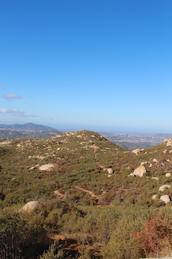 Photo: daveynin, CC BY 2.0 (via Flickr)
Mount Woodson Trail
~2 min drive
5.42-mile out-and-back hike in California with 1,974 ft elevation gain
 Photo: PhelanRiessen, CC BY-SA 2.0 (via Flickr)
Espola Trail
~6 min drive
Espola Trail is a 1.96-mile out-and-back hike in California with 519 feet of elevation gain.
 Photo: daveynin, CC BY 2.0 (via Flickr)
Lake Poway Trail
~4 min drive
3.4-mile out-and-back hike at Lake Poway Trail in California with 1,915 ft of elevation gain.
Photo: PhelanRiessen, CC BY-SA 2.0 (via Flickr)Avovado Trail
~7 min drive
0.33-mile lollipop trail in California with 92 ft gain and 856 ft max elevation.
 Photo: Robert DuHamel, CC BY-SA 3.0 (via Wikimedia Commons)
Iron Mountain Peak Trail
~4 min drive
5.46-mile out-and-back hike in California with 1,463 ft of elevation gain
Photo: PhelanRiessen, CC BY-SA 2.0 (via Flickr)Del Poniente Trail
~7 min drive
0.72-mile out-and-back hike in California with 151 ft elevation gain
About 0.3 mi round trip.
About 413 ft of climbing round trip.
It is rated easy.
About 0 hours round trip.
Daily highs and lows, wind and the chance of precipitation at the summit and route start for the next 7 days, from the Open-Meteo model.
Map and trail data © OpenStreetMap contributors
Outfitters and businesses. They haven’t set up their Roamze page yet.
Hike Bike Kayak Adventure Tours
Hiking business nearby (~20 mi away) — hasn't claimed their Roamze page yet
Borrego Outfitters
Hiking business nearby (~38 mi away) — hasn't claimed their Roamze page yet
