Arch Rock Trail
0.74-mile out-and-back hike to Arch Rock in California with 63 ft of elevation gain
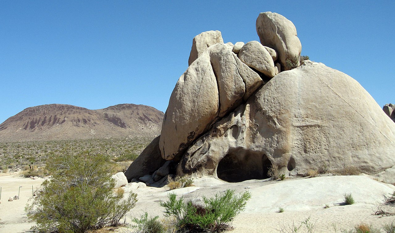
 Photo: dconvertini, CC BY-SA 2.0 (via Flickr)
- 0.4 mi
- round trip
- 63 ft
- climb
- 3,898 ft
- high point
- Out and back
- route
Is Arch Rock Trail open right now?
Alert in the area
The National Park Service lists 3 alerts for Joshua Tree National Park.
Partial Trail Closure of West Side Loop
Park alert covering Joshua Tree National Park · NPS · Joshua Tree National Park
Inaccurate Third-Party Apps
Park alert covering Joshua Tree National Park · NPS · Joshua Tree National Park
Oasis of Mara Trail Partial Closure
Park alert covering Joshua Tree National Park · NPS · Joshua Tree National Park
As of · Source: NPS · Joshua Tree National Park. Agencies don't list every closure — check before you go.
Best time to visit Arch Rock Trail
Best months: October–May. Best months have typical highs of 55–85 °F, lows of 30 °F or warmer (32 °F where the station doesn't record snow), at most one snowy day and no more than 12 wet days.
Jan
58° / 38°
4 wet
Feb
61° / 39°
3 wet
Mar
67° / 40°
3 wet
Apr
73° / 46°
2 wet
May
82° / 52°
1 wet
Jun
91° / 59°
0 wet
Jul
96° / 66°
2 wet
Aug
96° / 68°
2 wet
Sep
89° / 60°
2 wet
Oct
80° / 50°
1 wet
Nov
66° / 41°
2 wet
Dec
58° / 34°
4 wet
Typical high / low (°F) and days with rain or snow, 1991–2020. Measured at Yucca Valley, CA, 23.1 mi away at 3,249 ft. The station sits about 600 ft lower than this place, so expect it a little cooler here. This station doesn't record snowfall. Source: NOAA NCEI U.S. Climate Normals 1991–2020.
Arch Rock Trail is a short out-and-back hike in California covering 0.74 miles with 63 feet of elevation gain. The trail reaches a maximum elevation of 3,898 feet.
Keep exploring — more trails worth the drive
Geology (Skull Rock)
~4 min drive
Skull Rock is a popular destination along Park Boulevard just east of Jumbo Rocks Campground. Formed over many millennia, water drops have slowly eroded two large holes into the rock to make the rock resemble a skull. Skull Rock can be reached by the Skull Rock Nature Trail ju…
California Riding and Hiking Trail at Geology Tour Road
~6 min drive
Take a hike east or west from here on the California Riding and Hiking Trail. Carry water with you. The California Riding and Hiking Trail is 37 miles total, but smaller sections are popular day-hikes. This trailhead is in the middle of the California Riding and Hiking Trail…
 Photo: inkknife_2000 (7.5 million views +), CC BY-SA 2.0 (via Wikimedia Commons)
Hexehedron Main Trail
~7 min drive
3.26-mile out-and-back hike in California with 1,535 ft gain and 3,993 ft max elevation.
Desert Tortoise (Contact Mine)
~10 min drive
The Contact Mine Trail is an out-and-back hike to a historic mining site. It is 4-miles round trip with 700 feet of elevation gain. The trail begins in a sandy wash then ascends a rocky mountainside to the mine. The hike features expansive views of the surrounding mountains an…
 Photo: Tony Webster, CC BY 2.0 (via Flickr)
California Riding and Hiking Trail
~14 min drive
30.16-mile out-and-back trail in California with 3,694 ft elevation gain/loss
Discovery Trailhead
~4 min drive
The Discovery Trail is a 0.7-mile (1.1km) loop hike with 70ft (21.3m) of elevation gain and diverse views of the jumbo rocks area. Hike this trail through sandy washes, boulder piles, and unique rock formations. Along the trail, you will find educational signs that are great…
Boy Scout Trailhead
~17 min drive
Explore the Wonderland of Rocks on the Boy Scout Trail. The Boy Scout Trail runs for a total of 8 miles one way(16 miles round trip), but hikes of any length can be a great way to experience the Wonderland of Rocks. Start from the Keys West Wilderness Backpacking Board along P…
 Photo: inkknife_2000 (7.5 million views +), CC BY-SA 2.0 (via Wikimedia Commons)
Paac Kü̱vü̱hü̱’k Trail
~9 min drive
8.66-mile out-and-back trail in California with 1,061 ft elevation gain
Minerva Hoyt (Minerva Hoyt Trail)
~14 min drive
The Minerva Hoyt Trail is an out-and-back hike to the Hidden Valley picnic area. It is 3 miles roundtrip with 100 feet of elevation gain. From the parking lot, the trail follows an old road before it takes a sharp right towards Hidden Valley. The hike goes through a valley of…
Skull Rock and Discovery Trail Trailheads
~4 min drive
Located along Park Boulevard between Jumbo Rocks and Live Oak, these trailheads provide access to the Skull Rock Nature Trail and the Discovery Trail. The Skull Rock Nature Trail is a 1.7 mile loop that can be started from trailheads on either side of the road. The north side…

Map and trail data © OpenStreetMap contributors
