Alejandro
- 11.1 mi
- round trip
- 2,309 ft
- climb
- 2,560 ft
- high point
- Out and back
- route
- Oct–May
- best months
Caution today
Agency alerts are in effect for this area; weather is good · USFS, OpenWeather · checked 11 h ago
Is Alejandro open right now?
Alert in the area
The Forest Service lists 3 alerts for Los Padres National Forest.
Los Padres Fire Use and Firearm Restrictions
Agency alert covering Los Padres National Forest · Order 05-07-00-26-05 · USFS · Los Padres National Forest
Santa Barbara Front Country Fire Use Restrictions
Agency alert covering Los Padres National Forest · Order 05-07-5406-01 · USFS · Los Padres National Forest
West Cuesta Fire Use Restrictions
Agency alert covering Santa Lucia Ranger District · Order 05-07-53-24-19 · USFS · Santa Lucia Ranger District
As of · Source: USFS · Los Padres National Forest. Agencies don't list every closure — check before you go.
Alejandro is an out-and-back hike of about 11 miles in the Santa Lucia Ranger District of Los Padres National Forest in California, where the Forest Service manages the land. The route rises from a low point of 937 feet to a high of 2,560 feet, with a one-way elevation gain of 2,309 feet. The trail is rated hard, and the climb is steep. It is a natural-surface route, and both horses and bikes are allowed, so it works for riders and equestrians. Spring and fall are the most comfortable times to go. Typical averages from a nearby weather station in New Cuyama show highs around 71°F in April and 78°F in October, while July and August average highs in the mid-90s. That station sits about 400 feet lower than the trail's high point, so temperatures up top run cooler. The hike is open year round, and the closest neighbors are Horse Canyon La Brea, about a mile away, and Bear Canyon, about 1.8 miles off. La Brea Creek, a paddling spot, lies about 2.4 miles away, and Buckhorn Rigde is roughly 3.8 miles from the trail.
- HORSE CANYON LA BREAHiking0.9 mi
- Bear CanyonHiking1.8 mi
- La Brea CreekCanoeing2.4 mi
 Buckhorn RigdeHikingPhoto: Region 5 Photography, Public Domain Mark (via Flickr)3.8 mi
- Bear Canyon Conn.Hiking5.2 mi
- White ElephantHiking5.2 mi
- Kerry Canyon TrailHiking5.2 mi
- Roque CanyonHiking6.3 mi
Source: Roamze catalog (indexable pages within 10 miles, PostGIS distance)
- Buckhorn RigdeHiking · ~7 min drivePhoto: Region 5 Photography, Public Domain Mark (via Flickr)
 High Country TrailHiking · ~18 min drivePhoto: Damian Gadal, CC BY 2.0 (via Flickr)
- Senior Cabin CutoffHiking · ~18 min drivePhoto: Damian Gadal, CC BY 2.0 (via Flickr)
- Sisquoc TrailHiking · ~16 min drive
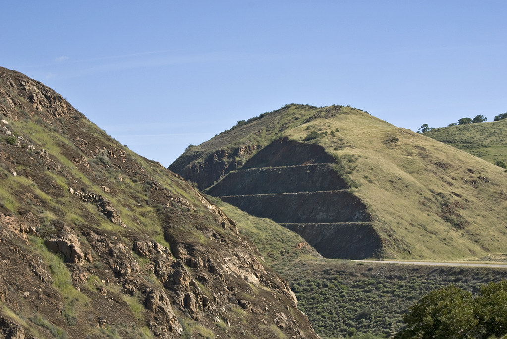 Willow SpringHiking · ~21 min drivePhoto: Damian Gadal, CC BY 2.0 (via Flickr)
- Maple Canyon TrailHiking · ~19 min drivePhoto: Damian Gadal, CC BY 2.0 (via Flickr)
 walk pathHiking · ~19 min drivePhoto: Damian Gadal, CC BY 2.0 (via Flickr)
- Horse Canyon - La Brea TrailHiking · ~16 min drive
 Willow Spur TrailHiking · ~22 min drivePhoto: Damian Gadal, CC BY 2.0 (via Wikimedia Commons)
 La JollaHiking · ~21 min drivePhoto: Damian Gadal, CC BY 2.0 (via Wikimedia Commons)
Also worth it near here
- Wagon FlatCamping · ~8 min drive
 Figueroa MountainSummit · ~23 min drivePhoto: Doc Searls from Santa Barbara, USA, CC BY 2.0 (via Wikimedia Commons)
 Willow Spring (Figueroa)Mountain biking · ~23 min drivePhoto: Damian Gadal, CC BY 2.0 (via Wikimedia Commons)
 Sisquoc RiverCanoeing · ~26 min drivePhoto: Unknown historical, Public domain (via Wikimedia Commons)
Best time to visit Alejandro
Best months: October–May. Best months have typical highs of 55–85 °F, lows of 30 °F or warmer (32 °F where the station doesn't record snow), at most one snowy day and no more than 12 wet days.
Jan
61° / 33°
6 wet
Feb
62° / 34°
6 wet
Mar
66° / 37°
5 wet
Apr
71° / 40°
3 wet
May
80° / 45°
2 wet
Jun
88° / 51°
0 wet
Jul
95° / 57°
0 wet
Aug
94° / 56°
0 wet
Sep
89° / 52°
1 wet
Oct
78° / 43°
1 wet
Nov
68° / 36°
3 wet
Dec
61° / 32°
5 wet
Typical high / low (°F) and days with rain or snow, 1991–2020. Measured at New Cuyama Fire Stn, CA, 26 mi away at 2,160 ft. This station doesn't record snowfall. Source: NOAA NCEI U.S. Climate Normals 1991–2020.
