Abbott Lake
- 2.0 mi
- round trip
- 814 ft
- climb
- 5,654 ft
- high point
- Out and back
- route
Is Abbott Lake open right now?
Alert in the area
The Forest Service lists 2 alerts for Klamath National Forest.
Temporarily closure of approximately 3.5 miles of National Forest System Roads 47N01
Agency alert covering Klamath National Forest · Order 05-05-00-26-08 · USFS · Klamath National Forest
Grayback Road Repairs
Agency alert covering Klamath National Forest · USFS · Klamath National Forest
As of · Source: USFS · Klamath National Forest. Agencies don't list every closure — check before you go.
Abbott Lake is a 2-mile out-and-back hike in the Marble Mountain Wilderness, part of the Salmon River Ranger District of Klamath National Forest in California. The Forest Service manages the land, and the trail is a natural-surface route with a one-way climb of about 814 feet, from a low point of roughly 4,822 feet to a high of about 5,654 feet. The trail is rated easy, and the route is short enough to fit into a day of exploring the surrounding wilderness. Upper Abbotts lies just 0.1 mile away, and Horse Range Lake Trail is about half a mile off, so the two can be linked easily. For more time outdoors, the North Fork Salmon River offers canoeing about 5.7 miles away, and Redbank campground sits about 9.3 miles from the trail.
Keep exploring — more trails worth the drive
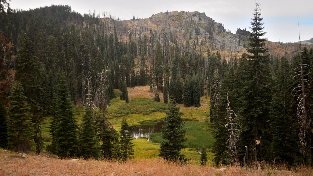 Photo: Tom Hilton, CC BY 2.0 (via Flickr)
Shadow Lake
~14 min drive
0.42-mile out-and-back trail to Shadow Lake in California with 270 ft of elevation gain.
 Photo: Tom Hilton, CC BY 2.0 (via Flickr)
Bull Meadows
~14 min drive
3.30-mile out-and-back trail in California with 615 ft elevation gain.
HIKE
Ethel
~1 min drive
Ethel is an 8.00-mile out-and-back trail in California with 1,660 feet of elevation gain.
HIKE
Portuguese Peak Trail
~13 min drive
14.56-mile out-and-back trail in California with 7,480 ft elevation gain/loss.
Photo: Tom Hilton, CC BY 2.0 (via Flickr)Cold Spring
~14 min drive
0.83-mile out-and-back trail in California with 42 ft of elevation gain.
HIKE
Horse Range Lake Trail
Next door
3.02-mile out-and-back trail to Horse Range Lake in California with 1,615 ft gain.
HIKE
Bug Gulch
~3 min drive
14.90-mile out-and-back trail in California with 2,362 ft elevation gain.
HIKE
North Fork Salmon Trail
~8 min drive
27.34-mile out-and-back trail in California with 6,361 ft elevation gain/loss.
Photo: Tom Hilton, CC BY 2.0 (via Flickr)Shadow Lake Trail
~14 min drive
0.88-mile out-and-back hike to Shadow Lake in California with 613 ft gain.
HIKE
Lake of Island
~2 min drive
4.80-mile out-and-back trail in California with 1,517 ft gain.
