A-17 Tank Trail
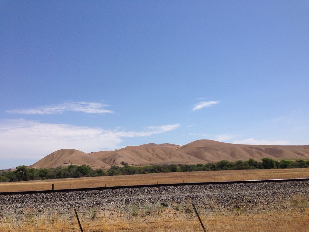 Photo: Clotee Allochuku-Albritton, CC BY 2.0 (via Flickr)
- 0.8 mi
- round trip
- 317 ft
- climb
- 806 ft
- high point
- Out and back
- route
- Oct–May
- best months
A-17 Tank Trail is a short, easy hike of about 0.8 miles, with a round trip of roughly 1.6 miles. It sits within the National Guard Maneuver Training Center - Heavy Camp Roberts in California, about 5 miles from Paso Robles. The trail is an out-and-back, and the climb is rolling, with the steepest stretch around 0.67 miles in, where the grade reaches about 14%. The trail starts at about 698 feet and reaches a high point near 806 feet before returning to the start. Spring and fall are the most comfortable times to visit. Typical averages from the nearby Paso Robles airport weather station show April highs around 73°F and October highs around 81°F. Summer is hot, with July and August highs in the low 90s. Nearby, the Salinas River offers canoeing about 5 miles away, and the Estrella River is about 9 miles off. For a longer walk, the 5K path is about 9 miles away.
Source: Roamze catalog (indexable pages within 10 miles, PostGIS distance)
 Oak Woodland Loop TrailHiking · ~38 min drivePhoto: docentjoyce, CC BY 2.0 (via Flickr)
 Secret TrailHiking · ~47 min drivePhoto: striatic, CC BY 2.0 (via Flickr)
- Town Creek Truck TrailHiking · ~31 min drive
- Rocky Butte Truck TrailHiking · ~43 min drive
- Madrone TrailHiking · ~38 min drivePhoto: docentjoyce, CC BY 2.0 (via Flickr)
 What TrailHiking · ~48 min drivePhoto: sloalan, Public Domain Dedication (CC0) (via Flickr)
- Rocky Canyon Truck TrailHiking · ~43 min drive
 Carmel LoopHiking · ~49 min drivePhoto: chucknado, CC BY 2.0 (via Flickr)
 Canet TrailHiking · ~51 min drivePhoto: sloalan, Public Domain Dedication (CC0) (via Flickr)
- Coalinga Mineral Springs National Recreation TrailHiking · ~47 min drive
Best time to visit A-17 Tank Trail
Best months: October–May. Best months have typical highs of 55–85 °F, lows of 30 °F or warmer (32 °F where the station doesn't record snow), at most one snowy day and no more than 12 wet days.
Jan
61° / 35°
7 wet
Feb
63° / 37°
8 wet
Mar
68° / 40°
7 wet
Apr
73° / 41°
4 wet
May
81° / 46°
2 wet
Jun
88° / 50°
1 wet
Jul
93° / 54°
0 wet
Aug
94° / 53°
0 wet
Sep
90° / 50°
1 wet
Oct
81° / 44°
2 wet
Nov
69° / 37°
4 wet
Dec
60° / 33°
7 wet
Typical high / low (°F) and days with rain or snow, 1991–2020. Measured at Paso Robles Muni Ap, CA, 9.6 mi away at 810 ft. Source: NOAA NCEI U.S. Climate Normals 1991–2020.
Map and trail data © OpenStreetMap contributors
