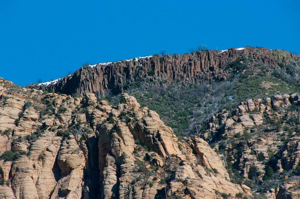
Manzanita.
Campground
Sites open the weekend of Dec 4 on Recreation.gov
 Photo: Coconino NF Photography, CC0 (via Wikimedia Commons)
Closure in the area
There's a closure order in Red Rock Ranger District. It doesn't name Tomahawk Tower, so check the source for the area it covers (2 listed).
Red Rock Ranger District affected by severe flooding; many closures in effect
Agency closure covering Red Rock Ranger District · USFS · Red Rock Ranger District
Banjo Bill Picnic Area Closure
Agency closure covering Red Rock Ranger District · Order 03-04-06-25-01 · USFS · Red Rock Ranger District
West Fork Temporary Area Closure - Extension to 2/27/27
Agency alert covering Coconino National Forest · Order 03-04-00-26-09 · USFS · Coconino National Forest
West Sedona Camping and Campfire Restrictions
Agency alert covering Red Rock Ranger District · Order 03-04-06-26-04 · USFS · Red Rock Ranger District
Sedona/ Oak Creek Canyon Camping and Campfire Restrictions
Agency alert covering Red Rock Ranger District · Order 03-04-06-23-03 · USFS · Red Rock Ranger District
As of · Source: USFS · Red Rock Ranger District. Agencies don't list every closure — check before you go.
Tomahawk Tower is a climbing area in the Red Rock-Secret Mountain Wilderness, part of the Red Rock Ranger District of Coconino National Forest in northern Arizona. The Forest Service manages the land. The area is a small cluster of routes with five in total, four of them traditional and one mixed. Grades run from 5.9- up to 5.11d, with the median around 5.11. The most prominent routes are Tomahawk Tower's Southeast Face at 5.11- and Blood Shot at 5.11d. Spring and fall are the most comfortable times to go. Typical averages from the nearby Oak Creek Canyon weather station show April highs around 70°F and October highs around 74°F, while July highs reach about 90°F. Other climbing is close by at Mormon Canyon, about 1.2 miles away, and The Fin, about 1.6 miles away. For a base, Manzanita campground sits about 2.9 miles away, and Oak Creek offers canoeing about 3.2 miles away.
Manzanita.
Campground
Places © OpenStreetMap contributors
More in Kachina VillageBest months: March–May and September–November. Best months have typical highs of 55–85 °F, lows of 30 °F or warmer (32 °F where the station doesn't record snow), at most one snowy day and no more than 12 wet days.
Jan
54° / 30°
Feb
57° / 31°
Mar
64° / 35°
Apr
70° / 39°
May
78° / 46°
Jun
88° / 54°
Jul
90° / 61°
Aug
88° / 60°
Sep
84° / 54°
Oct
74° / 44°
Nov
63° / 36°
Dec
53° / 30°
Typical high / low (°F) and days with rain or snow, 1991–2020. Measured at Oak Creek Canyon, AZ, 3.2 mi away at 5,118 ft. This station doesn't record snowfall. Source: NOAA NCEI U.S. Climate Normals 1991–2020.
 Photo: Coconino NF Photography, CC0 (via Wikimedia Commons)
Mormon Canyon
~2 min drive
Mormon Canyon in Arizona has 25 trad routes across 13 difficulty grades.
 Photo: davidpinter, CC BY 3.0 (via Wikimedia Commons)
The Fin
~3 min drive
The Fin is a climbing crag in Arizona with 5 routes.
 Photo: davidpinter, CC BY 3.0 (via Wikimedia Commons)
Sterling Pass
~3 min drive
Sterling Pass in Arizona has 13 climbing routes with 10 difficulty grades, offering sport and trad styles.
 Photo: Coconino National Forest, CC BY-SA 2.0 (via Wikimedia Commons)
Sphinx aka Cibola Mitten
~3 min drive
Climbing area in Arizona with 8 routes, mixed and trad styles.
 Photo: Don Graham from Redlands, CA, USA - God bless it!, CC BY-SA 2.0 (via Wikimedia Commons)
Oak Creek Canyon
~4 min drive
Oak Creek Canyon in Arizona has 15 climbing routes ranging across 11 difficulty grades.
 Photo: On^ste82, CC BY 3.0 (via Wikimedia Commons)
Midgley Bridge Area
~4 min drive
Midgley Bridge Area in Arizona has 13 traditional climbing routes across 10 grades.
 Photo: davidpinter, CC BY 3.0 (via Wikimedia Commons)
Lost Dry Creek Cirque
~4 min drive
Lost Dry Creek Cirque in Arizona has 8 trad climbing routes across 5 difficulty grades.
 Photo: Eric Johnson, CC BY-SA 3.0 (via Wikimedia Commons)
Coffeepot Rock Area
~4 min drive
Coffeepot Rock Area in Arizona has 16 traditional climbing routes across 11 difficulty grades.
Photo: On^ste82, CC BY 3.0 (via Wikimedia Commons)Super Crack Tower
~4 min drive
Super Crack Tower in Arizona has 19 climbing routes across 14 grades.
Photo: Eric Johnson, CC BY-SA 3.0 (via Wikimedia Commons)Summit Block Rock
~4 min drive
Summit Block Rock is a 5-route climbing area in Arizona with 4 difficulty grades.
Also worth it near here