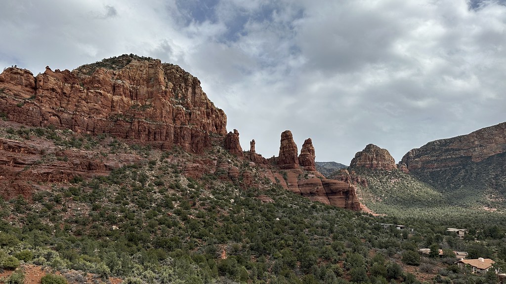
Chavez Crossing
Campground
Sites open the weekend of Dec 4 on Recreation.gov
 Photo: jasonwoodhead23, CC BY 2.0 (via Flickr)
Closure in the area
There's a closure order in Red Rock Ranger District. It doesn't name Lower Beach, so check the source for the area it covers (2 listed).
Red Rock Ranger District affected by severe flooding; many closures in effect
Agency closure covering Red Rock Ranger District · USFS · Red Rock Ranger District
Banjo Bill Picnic Area Closure
Agency closure covering Red Rock Ranger District · Order 03-04-06-25-01 · USFS · Red Rock Ranger District
West Fork Temporary Area Closure - Extension to 2/27/27
Agency alert covering Coconino National Forest · Order 03-04-00-26-09 · USFS · Coconino National Forest
West Sedona Camping and Campfire Restrictions
Agency alert covering Red Rock Ranger District · Order 03-04-06-26-04 · USFS · Red Rock Ranger District
Sedona/ Oak Creek Canyon Camping and Campfire Restrictions
Agency alert covering Red Rock Ranger District · Order 03-04-06-23-03 · USFS · Red Rock Ranger District
As of · Source: USFS · Red Rock Ranger District. Agencies don't list every closure — check before you go.
Lower Beach is a climbing area in the Red Rock Ranger District of Coconino National Forest in northern Arizona, managed by the Forest Service. It sits among a cluster of climbing and riding spots, with Upper Beach and The Planetarium both about 0.1 mile away. The area has five routes, ranging from 5.8+ to 5.11+. Scallop is a mixed route at 5.8+, and Typhoon is a sport route at 5.11+. The others are Javalina Highway (trad, 5.9), Reef Shark (trad, 5.10+) and Calm Water (sport, 5.10b). The first ascents of most of these were done by John Burcham, James Q Martin and Seth Dyer. Spring and fall are the most comfortable times to visit. Typical averages from the nearby Oak Creek Canyon weather station run from highs around 70°F in April to 74°F in October, while July highs average about 90°F. Chavez Crossing campground is 0.8 mile away, and Crescent Moon Ramada is 2.2 miles off. For paddling, Oak Creek is about 8.3 miles away.
Chavez Crossing
Campground
Mesa Grill
Restaurant
Stan Rose Images
Gallery
Places © OpenStreetMap contributors
More in Kachina VillageBest months: March–May and September–November. Best months have typical highs of 55–85 °F, lows of 30 °F or warmer (32 °F where the station doesn't record snow), at most one snowy day and no more than 12 wet days.
Jan
54° / 30°
Feb
57° / 31°
Mar
64° / 35°
Apr
70° / 39°
May
78° / 46°
Jun
88° / 54°
Jul
90° / 61°
Aug
88° / 60°
Sep
84° / 54°
Oct
74° / 44°
Nov
63° / 36°
Dec
53° / 30°
Typical high / low (°F) and days with rain or snow, 1991–2020. Measured at Oak Creek Canyon, AZ, 8.7 mi away at 5,118 ft. This station doesn't record snowfall. Source: NOAA NCEI U.S. Climate Normals 1991–2020.
 Photo: Andrew Gnias, CC BY-SA 4.0 (via Wikimedia Commons)
Upper Beach
Next door
Upper Beach in Arizona has 12 climbing routes across 8 grades.
 Photo: Coconino NF Photography, Public Domain Mark (via Flickr)
The Planetarium
Next door
Planetarium in Arizona has 15 climbing routes across 13 grades, offering sport and trad options.
 Photo: inkknife_2000 (7.5 million views +), CC BY-SA 2.0 (via Wikimedia Commons)
Genetic Wall
Next door
Genetic Wall in Arizona has 9 climbing routes across 8 grades, offering sport and trad options.
Photo: Andrew Gnias, CC BY-SA 4.0 (via Wikimedia Commons)Vatican
Next door
Vatican in Arizona has 6 climbing routes, 5.8 to 5.11c, sport and trad.
 Photo: cheddar- from Colorado Springs, USA, CC BY-SA 2.0 (via Wikimedia Commons)
West Twin Butte
Next door
West Twin Butte in Arizona has 6 climbing routes across 5 grades, offering sport and trad options.
 Photo: Coconino National Forest, CC BY-SA 2.0 (via Wikimedia Commons)
Church Wall
Next door
Church Wall in Arizona has 6 traditional climbing routes across 4 grades.
 Photo: Coconino National Forest, CC BY-SA 2.0 (via Wikimedia Commons)
Upper Religion Wall
Next door
Upper Religion Wall is a climbing crag in Arizona with 5 routes.
Photo: Coconino National Forest, CC BY-SA 2.0 (via Wikimedia Commons)East Twin Butte
~1 min drive
East Twin Butte is a climbing area in Arizona with 3 routes.
 Photo: Brady Smith; Coconino National Forest, CC BY-SA 2.0 (via Wikimedia Commons)
Church Spires Area
~1 min drive
Church Spires Area in Arizona has 4 trad climbing routes.
Photo: Brady Smith; Coconino National Forest, CC BY-SA 2.0 (via Wikimedia Commons)Blowjob Rock
~1 min drive
Blowjob Rock in Arizona has 6 trad routes spanning 4 difficulty grades.