Upper Rim Campgrounds
Campground
Campground · 0.8 mi from the trail
 Photo: 666isMONEY ☮ ♥ & ☠, CC BY-SA 2.0 (via Flickr)
Closure in the area
There's a closure order in Santa Catalina Ranger District. It doesn't name Jenga Tower and Your Mom's Basement, The, so check the source for the area it covers.
Marshall Gulch Closure Order
Agency closure covering Santa Catalina Ranger District · Order 03-05-05-26-009 · USFS · Santa Catalina Ranger District
Border Barrier Construction Closure
Agency alert covering Coronado National Forest · Order 03-05-00-26-011 · USFS · Coronado National Forest
No Fire Restrictions
Agency alert covering Coronado National Forest · USFS · Coronado National Forest
Barfoot Snake Closure Order 03-05-01-24-004
Agency alert covering Coronado National Forest · USFS · Coronado National Forest
As of · Source: USFS · Santa Catalina Ranger District. Agencies don't list every closure — check before you go.
The Jenga Tower and Your Mom's Basement is a climbing area in Arizona's Pusch Ridge Wilderness, within the Santa Catalina Ranger District of Coronado National Forest. The Forest Service manages the land, and the area sits among a cluster of climbing spots, with Your Mom's Basement just 0.1 mile away and Willow Canyon Crags and Cozzetti Crags within half a mile. The two routes here are both sport climbs, and they sit at the 5.8+ to 5.9+ level on the YDS scale. Razorblade alley and The Wave were both first ascended by Nick Martel and Kristina Bergdahl-Martel. Spring and fall are the most comfortable times to visit. Typical averages from the nearby Mt Lemmon Willow Canyon weather station, at 7,027 feet, run from highs around 50°F in winter to about 71°F in May and 68°F in October, with July and August near 80°F. Rose Canyon Lake, a mountain biking area, is 0.5 mile away, and Rose Canyon campground is 0.9 mile off. Bug Springs Trail and Palisade are both within about 1.6 miles.
Upper Rim Campgrounds
Campground
Butler Hall
Fast food
Wildlife Viewing Area
Viewpoint
Places © OpenStreetMap contributors
More in Oracle Your Mom's BasementRock climbingPhoto: Shepard4711, CC BY 2.0 (via Wikimedia Commons)0.1 mi
 Cozzetti CragsRock climbingPhoto: All Fronts Quiet, CC BY-SA 3.0 (via Wikimedia Commons)0.4 mi
 Bug Springs TrailHikingPhoto: theojones2, Public Domain Dedication (CC0) (via Flickr)1.4 mi
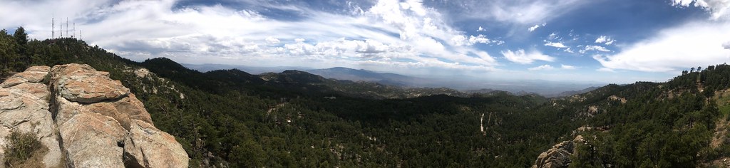 PalisadeHikingPhoto: 666isMONEY ☮ ♥ & ☠, CC BY 2.0 (via Flickr)1.6 mi
Source: Roamze catalog (indexable pages within 10 miles, PostGIS distance)
Your Mom's BasementRock climbing · Next doorPhoto: Shepard4711, CC BY 2.0 (via Wikimedia Commons)Cozzetti CragsRock climbing · Next doorPhoto: All Fronts Quiet, CC BY-SA 3.0 (via Wikimedia Commons) Wall of the Trundling TrollsRock climbing · Next doorPhoto: Shepard4711, CC BY 2.0 (via Wikimedia Commons)
 Lonesome PineRock climbing · Next doorPhoto: beglib, CC BY-SA 3.0 (via Wikimedia Commons)Lizard RockRock climbing · Next doorPhoto: All Fronts Quiet, CC BY-SA 3.0 (via Wikimedia Commons)
 Wall of the Dancing DwarfsRock climbing · Next doorPhoto: Shepard4711, CC BY 2.0 (via Wikimedia Commons)The TowersRock climbing · ~1 min drivePhoto: All Fronts Quiet, CC BY-SA 3.0 (via Wikimedia Commons)
 Peanut BouldersRock climbing · ~1 min drivePhoto: 666isMONEY ☮ ♥ & ☠, CC BY 2.0 (via Flickr)
 RollinstoneRock climbing · ~1 min drivePhoto: 666isMONEY ☮ ♥ & ☠, CC BY 2.0 (via Flickr)Lost HawkRock climbing · ~1 min drivePhoto: Shepard4711, CC BY 2.0 (via Wikimedia Commons)
Also worth it near here
Best months: March–November. Best months have typical highs of 55–85 °F, lows of 30 °F or warmer (32 °F where the station doesn't record snow), at most one snowy day and no more than 12 wet days.
Jan
50° / 34°
Feb
50° / 33°
Mar
55° / 37°
Apr
62° / 43°
May
71° / 51°
Jun
80° / 60°
Jul
80° / 63°
Aug
79° / 62°
Sep
75° / 59°
Oct
68° / 49°
Nov
59° / 40°
Dec
49° / 33°
Typical high / low (°F) and days with rain or snow, 1991–2020. Measured at Mt Lemmon Willow Canyon, AZ, 0.9 mi away at 7,027 ft. This station doesn't record snowfall. Source: NOAA NCEI U.S. Climate Normals 1991–2020.
