Spillway Group Cg
Campground
Campground · 0.8 mi from the trail
 Photo: davidpinter, CC BY 3.0 (via Wikimedia Commons)
Closure in the area
There's a closure order in Apache-Sitgreaves National Forests. It doesn't name Woods Canyon Nature Trail Conn, so check the source for the area it covers (2 listed).
Temporary Emergency Closure
Agency closure covering Apache-Sitgreaves National Forests · Order 03-01-26-004 · USFS · Apache-Sitgreaves National Forests
Benny Creek Campground/Southfork Day Use Area Closure Order - Springerville Ranger District
Agency closure covering Apache-Sitgreaves National Forests · Order 03-01-25-06-004 · USFS · Apache-Sitgreaves National Forests
Forest Road Conditions Alert
Agency alert covering Apache-Sitgreaves National Forests · USFS · Apache-Sitgreaves National Forests
No Fire Restrictions
Agency alert covering Apache-Sitgreaves National Forests · USFS · Apache-Sitgreaves National Forests
As of · Source: USFS · Apache-Sitgreaves National Forests. Agencies don't list every closure — check before you go.
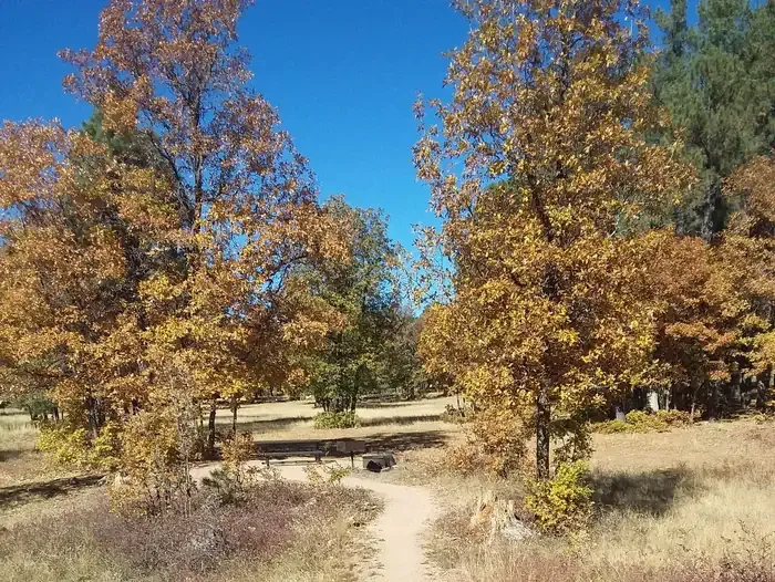
Woods Canyon Nature Trail Conn is a mountain biking route in the Black Mesa Ranger District of the Apache-Sitgreaves National Forests in eastern Arizona, managed by the Forest Service. The trail is a short, almost flat outing, with the high point at 7,574 feet and the low at 7,558 feet, and it covers about 0.06 miles. The most comfortable months for a ride are typically late spring and early fall. Typical averages from a nearby weather station run to highs around 70°F in May and 76°F in September, with summer highs in the low 80s. Woods Canyon Lake lies about 0.2 miles away, and the Woods Canyon Lake Area Boating Site is about 0.5 miles off. Spillway Group Campground and Aspen (AZ) campground are both within about a mile for an overnight stay.
Spillway Group Cg
Campground
Creekside Steakhouse
Restaurant
Places © OpenStreetMap contributors
More in Blue RidgeWoods Canyon NatureMountain bikingPhoto: davidpinter, CC BY 3.0 (via Wikimedia Commons)0.1 mi Woods Canyon LakeHikingPhoto: cogdogblog, CC BY 2.0 (via Flickr)0.2 mi
 Aspen (az)CampingPhoto: Recreation.gov (RIDB) / public domain0.9 mi
Source: Roamze catalog (indexable pages within 10 miles, PostGIS distance)
Woods Canyon NatureMountain biking · Next doorPhoto: davidpinter, CC BY 3.0 (via Wikimedia Commons) Mogollon Rim Snowmobile AMountain biking · Next doorPhoto: Šarūnas Burdulis from USA, CC BY-SA 2.0 (via Wikimedia Commons)
 Drew CanyonMountain biking · ~3 min drivePhoto: davidpinter, CC BY 3.0 (via Wikimedia Commons)
 MeadowMountain biking · ~3 min drivePhoto: davidpinter, CC BY 3.0 (via Wikimedia Commons)
 Rim Lakes VistaMountain biking · ~3 min drivePhoto: cogdogblog, CC BY 2.0 (via Wikimedia Commons)
 Boulder HopMountain biking · ~3 min drivePhoto: davidpinter, CC BY 3.0 (via Wikimedia Commons)DrewMountain biking · ~3 min drivePhoto: davidpinter, CC BY 3.0 (via Wikimedia Commons)
 AspenMountain biking · ~3 min drivePhoto: davidpinter, CC BY 3.0 (via Wikimedia Commons)Military SinkholeMountain biking · ~4 min drivePhoto: cogdogblog, CC BY 2.0 (via Wikimedia Commons)
 Carr LakeMountain biking · ~5 min drivePhoto: davidpinter, CC BY 3.0 (via Wikimedia Commons)
Best months: May–October. Best months have typical highs of 55–85 °F, lows of 30 °F or warmer (32 °F where the station doesn't record snow), at most one snowy day and no more than 12 wet days.
Jan
45° / 17°
Feb
49° / 20°
Mar
55° / 25°
Apr
61° / 30°
May
70° / 38°
Jun
80° / 47°
Jul
83° / 55°
Aug
81° / 53°
Sep
76° / 46°
Oct
67° / 34°
Nov
55° / 24°
Dec
45° / 17°
Typical high / low (°F) and days with rain or snow, 1991–2020. Measured at Blue Ridge Rs, AZ, 23.2 mi away at 6,880 ft. The station sits about 700 ft lower than this place, so expect it a little cooler here. This station doesn't record snowfall. Source: NOAA NCEI U.S. Climate Normals 1991–2020.
Map and trail data © OpenStreetMap contributors
