Rancho Sedona RV Park
Campground
Campground · 1.5 mi from the trail
 Photo: inkknife_2000 (7.5 million views +), CC BY-SA 2.0 (via Wikimedia Commons)
Closure in the area
There's a closure order in Red Rock Ranger District. It doesn't name Pump Park, so check the source for the area it covers (3 listed).
Beaver Creek Picnic Site temporarily closed
Agency closure covering Red Rock Ranger District · Order 03-04-06-26-05 · USFS · Red Rock Ranger District
Red Rock Ranger District affected by severe flooding; many closures in effect
Agency closure covering Red Rock Ranger District · USFS · Red Rock Ranger District
Banjo Bill Picnic Area Closure
Agency closure covering Red Rock Ranger District · Order 03-04-06-25-01 · USFS · Red Rock Ranger District
West Fork Temporary Area Closure - Extension to 2/27/27
Agency alert covering Coconino National Forest · Order 03-04-00-26-09 · USFS · Coconino National Forest
West Sedona Camping and Campfire Restrictions
Agency alert covering Red Rock Ranger District · Order 03-04-06-26-04 · USFS · Red Rock Ranger District
As of · Source: USFS · Red Rock Ranger District. Agencies don't list every closure — check before you go.
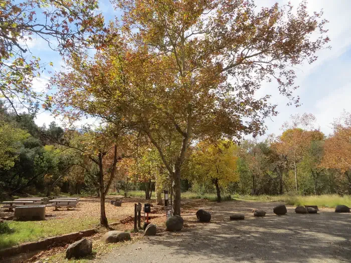
Pump Park is a short, flat stretch of city-managed land in the Red Rock Ranger District of Coconino National Forest, about 0.11 miles from the Carruth Trail. It sits at about 4,533 feet, with a negligible rise of just five feet over its length. Spring and fall bring the most comfortable weather. Typical averages from a nearby weather station in Sedona show highs around 75°F in April and 79°F in October, while July averages reach 97°F. The park is close to several other spots. The Carruth Trail and the Sugarloaf Trailhead's Dual Slalom Track and Bump & Jump Flow Trail are all within a tenth of a mile. Climbers can head to Gunshy wall about 1.2 miles away, and the Chavez Crossing campground is about 1.8 miles off.
Rancho Sedona RV Park
Campground
Navarro Gallery
Gallery
Places © OpenStreetMap contributors, Places © Overture Maps Foundation
More in Kachina VillageNot on Roamze yet. Their page has how to reach them.
Carruth TrailHikingPhoto: inkknife_2000 (7.5 million views +), CC BY-SA 2.0 (via Wikimedia Commons)0.1 miDual Slalom TrackMountain bikingPhoto: inkknife_2000 (7.5 million views +), CC BY-SA 2.0 (via Wikimedia Commons)0.1 mi Bump & Jump Flow TrailMountain bikingPhoto: Ken Thomas, Public domain (via Wikimedia Commons)0.1 mi
 Gunshy wallRock climbingPhoto: Leslie Seaton from Seattle, WA, USA, CC BY 2.0 (via Wikimedia Commons)1.2 miHeart of Marg's Draw.Rock climbingPhoto: Leslie Seaton from Seattle, WA, USA, CC BY 2.0 (via Wikimedia Commons)1.2 mi
 Chavez CrossingCampingPhoto: Recreation.gov (RIDB) / public domain1.8 mi
Source: Roamze catalog (indexable pages within 10 miles, PostGIS distance)
Bump & Jump Flow TrailMountain biking · Next doorPhoto: Ken Thomas, Public domain (via Wikimedia Commons) Wildcat Flow TrailMountain biking · Next doorPhoto: Christopher Steinle, CC BY 3.0 (via Wikimedia Commons)
 Lost And FoundMountain biking · Next doorPhoto: Don Graham from Redlands, CA, USA - God bless it!, CC BY-SA 2.0 (via Wikimedia Commons)Adobe JackMountain biking · ~1 min drivePhoto: Don Graham from Redlands, CA, USA - God bless it!, CC BY-SA 2.0 (via Wikimedia Commons)CoyoteMountain biking · ~1 min drivePhoto: Ken Thomas, Public domain (via Wikimedia Commons)CrustyMountain biking · ~1 min drivePhoto: Ken Thomas, Public domain (via Wikimedia Commons)
 ShortyMountain biking · ~1 min drivePhoto: Johnwayne Stroud, CC BY-SA 3.0 (via Wikimedia Commons)ManzanitaMountain biking · ~1 min drivePhoto: Johnwayne Stroud, CC BY-SA 3.0 (via Wikimedia Commons)
 Grand CentralMountain biking · ~1 min drivePhoto: Jay Thompson, CC BY-SA 2.0 (via Wikimedia Commons)
 Coconino LoopMountain biking · ~2 min drivePhoto: Ken Thomas, Public domain (via Wikimedia Commons)
Also worth it near here
Carruth TrailHiking · Next doorPhoto: inkknife_2000 (7.5 million views +), CC BY-SA 2.0 (via Wikimedia Commons) Summit Block RockRock climbing · ~2 min drivePhoto: Eric Johnson, CC BY-SA 3.0 (via Wikimedia Commons)
 Capitol ButteSummit · ~3 min drivePhoto: Eric Johnson, CC BY-SA 3.0 (via Wikimedia Commons)
Best months: October–May. Best months have typical highs of 55–85 °F, lows of 30 °F or warmer (32 °F where the station doesn't record snow), at most one snowy day and no more than 12 wet days.
Jan
58° / 34°
5 wet
Feb
61° / 36°
6 wet
Mar
67° / 40°
6 wet
Apr
75° / 44°
3 wet
May
84° / 53°
3 wet
Jun
94° / 61°
2 wet
Jul
97° / 68°
6 wet
Aug
94° / 67°
9 wet
Sep
89° / 61°
5 wet
Oct
79° / 51°
3 wet
Nov
67° / 41°
4 wet
Dec
58° / 33°
4 wet
Typical high / low (°F) and days with rain or snow, 1991–2020. Measured at Sedona, AZ, 2.2 mi away at 4,220 ft. This station doesn't record snowfall. Source: NOAA NCEI U.S. Climate Normals 1991–2020.
Map and trail data © OpenStreetMap contributors
