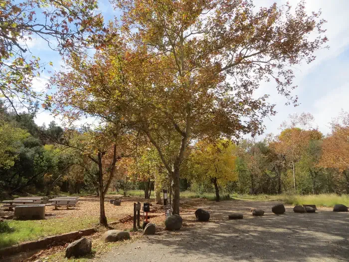
Rancho Sedona RV Park
Campground
Campground · 3.0 mi from the trail

Capitol Butte is a summit in Yavapai County, Arizona, at about 6,349 feet. It sits in the Red Rock-Secret Mountain Wilderness.
Summit elevation
6,349 ft
Land manager
Forest Service
Elevation from USGS 3D Elevation Program terrain data (about 10 m resolution).
Capitol Butte
Arizona
Name and location: U.S. Geological Survey, Geographic Names Information System (GNIS). Elevation: USGS 3D Elevation Program. View the GNIS record.
Rancho Sedona RV Park
Campground
Places © OpenStreetMap contributors
More in Kachina VillageBest time to go: May–Oct. The mildest months here, with typical highs of 66–83°F and lows of 31–50°F.
Typical monthly averages (not a forecast) from the Mund'S Park, AZ weather station, 10 mi away. High / low in °F.
Source: Wilderness.net boundaries; USFS EDW boundaries; USGS PAD-US 4.1; USGS GNIS populated places
Active alerts for Red Rock Ranger District as of Oct 9, 2026:
West Sedona Camping and Campfire Restrictions
fire-restriction · posted Aug 31, 2026
Fossil Creek Non-Permit Seasonal Camping, Fire and Glass Prohibition (October 2- March 31)
information · posted Aug 24, 2026
Verde River Fire and Waste Prohibitions
information · posted Aug 24, 2026
Verde Wild & Scenic River Fire, Occupancy and Use, and Waste Prohibitions
information · posted Aug 24, 2026
Oak Creek Glass Container Prohibition
information · posted Aug 24, 2026
Sedona/ Oak Creek Canyon Camping and Campfire Restrictions
fire-restriction · posted Aug 24, 2026
Fossil Creek Wild and Scenic River (Permit Season)(April 1 - October 1)
information · posted Aug 24, 2026
Fossil Creek Wild and Scenic River (Non-Permit Season)(October 2 - March 31)
information · posted Aug 24, 2026
Verde Wild and Scenic River Special Restrictions
information · posted Aug 24, 2026
Banjo Bill Picnic Area Closure
critical · posted Aug 24, 2026
Source: USFS forest alerts
 Fun ShipRock climbingPhoto: ConspiracyofHappiness at Flickr, CC BY 2.0 (via Wikimedia Commons)0.3 mi
 Dry Creek SpiresRock climbingPhoto: davidpinter, CC BY 3.0 (via Wikimedia Commons)0.4 miLizard Tail SpireRock climbingPhoto: ConspiracyofHappiness at Flickr, CC BY 2.0 (via Wikimedia Commons)0.4 mi
 Chimney Rock Pass #165BHikingPhoto: Nate Loper • #ArizonaGuide ️, CC BY 2.0 (via Flickr)0.6 mi
 Chavez CrossingCampingPhoto: Recreation.gov (RIDB) / public domain3.4 mi
Source: Roamze catalog (indexable pages within 10 miles, PostGIS distance)
Closure in the area
There's a closure order in Coconino National Forest. It doesn't name Capitol Butte, so check the source for the area it covers (2 listed).
West Fork Temporary Area Closure - Extension to 2/27/27
Agency closure covering Coconino National Forest · Order 03-04-00-26-09 · USFS · Coconino National Forest
Banjo Bill Picnic Area Closure
Agency closure covering Red Rock Ranger District · Order 03-04-06-25-01 · USFS · Red Rock Ranger District
West Sedona Camping and Campfire Restrictions
Agency alert covering Red Rock Ranger District · Order 03-04-06-26-04 · USFS · Red Rock Ranger District
Sedona/ Oak Creek Canyon Camping and Campfire Restrictions
Agency alert covering Red Rock Ranger District · Order 03-04-06-23-03 · USFS · Red Rock Ranger District
As of · Source: USFS · Coconino National Forest. Agencies don't list every closure — check before you go.
Best months: May–July and September. Best months have typical highs of 55–85 °F, lows of 30 °F or warmer (32 °F where the station doesn't record snow), at most one snowy day and no more than 12 wet days.
Jan
46° / 17°
7 wet
Feb
47° / 19°
7 wet
Mar
53° / 23°
7 wet
Apr
60° / 27°
4 wet
May
69° / 34°
3 wet
Jun
79° / 40°
3 wet
Jul
83° / 49°
9 wet
Aug
81° / 50°
13 wet
Sep
76° / 41°
8 wet
Oct
66° / 31°
5 wet
Nov
54° / 22°
5 wet
Dec
46° / 16°
7 wet
Typical high / low (°F) and days with rain or snow, 1991–2020. Measured at Mund'S Park, AZ, 10.1 mi away at 6,470 ft. This station doesn't record snowfall. Source: NOAA NCEI U.S. Climate Normals 1991–2020.
Tell Roamze when you're going and who's coming. It plans the days, gear and food around this place.
