Cave Springs
Campground
Campground · 1.7 mi from the trail
 Photo: Coconino NF Photography, Public Domain Dedication (CC0) (via Flickr)
Closure in the area
There's a closure order in Red Rock Ranger District. It doesn't name West Fork #108, so check the source for the area it covers (2 listed).
Red Rock Ranger District affected by severe flooding; many closures in effect
Agency closure covering Red Rock Ranger District · USFS · Red Rock Ranger District
Banjo Bill Picnic Area Closure
Agency closure covering Red Rock Ranger District · Order 03-04-06-25-01 · USFS · Red Rock Ranger District
West Fork Temporary Area Closure - Extension to 2/27/27
Agency alert covering Coconino National Forest · Order 03-04-00-26-09 · USFS · Coconino National Forest
West Sedona Camping and Campfire Restrictions
Agency alert covering Red Rock Ranger District · Order 03-04-06-26-04 · USFS · Red Rock Ranger District
Sedona/ Oak Creek Canyon Camping and Campfire Restrictions
Agency alert covering Red Rock Ranger District · Order 03-04-06-23-03 · USFS · Red Rock Ranger District
As of · Source: USFS · Red Rock Ranger District. Agencies don't list every closure — check before you go.
West Fork #108 is a 6.6-mile out-and-back hike in the Red Rock-Secret Mountain Wilderness, part of the Red Rock Ranger District of Coconino National Forest in northern Arizona. The Forest Service manages the land, and the trail runs alongside West Fork Oak Creek, crossing the intermittent stream at several points along the way. The route rises from about 5,290 feet to about 5,504 feet, with a total elevation gain of 29 feet. That makes it a low-key walk rather than a climb, and the trail is rated moderate. Spring and fall are the most comfortable times to go. Typical averages from a nearby weather station at Oak Creek Canyon show May highs around 78°F and October highs around 74°F, while July and August average about 90°F. The West Fork trailhead for mountain biking and the Insomnia Canyon climbing area both sit about 0.8 miles away. Cave Spring campground is about 1.7 miles off, and the Oak Creek canoeing route is about 3.6 miles away.
Cave Springs
Campground
Places © OpenStreetMap contributors
More in Kachina VillageNot on Roamze yet. Their page has how to reach them.
Best months: March–May and September–November. Best months have typical highs of 55–85 °F, lows of 30 °F or warmer (32 °F where the station doesn't record snow), at most one snowy day and no more than 12 wet days.
Jan
54° / 30°
Feb
57° / 31°
Mar
64° / 35°
Apr
70° / 39°
May
78° / 46°
Jun
88° / 54°
Jul
90° / 61°
Aug
88° / 60°
Sep
84° / 54°
Oct
74° / 44°
Nov
63° / 36°
Dec
53° / 30°
Typical high / low (°F) and days with rain or snow, 1991–2020. Measured at Oak Creek Canyon, AZ, 3 mi away at 5,118 ft. This station doesn't record snowfall. Source: NOAA NCEI U.S. Climate Normals 1991–2020.
 Photo: Coconino NF Photography, Public Domain Mark (via Flickr)
Oak Creek Spur C
~3 min drive
2.3-mile out-and-back trail in Arizona with 1,358 ft elevation gain
 Photo: Eric Friedebach, CC BY 2.0 (via Flickr)
Cave Springs
~3 min drive
0.36-mile loop trail in Arizona with 63 ft of elevation gain.
 Photo: deborah.soltesz, Public Domain Dedication (CC0) (via Flickr)
Secret Canyon
~9 min drive
3.81-mile out-and-back trail in Arizona with 654 ft of elevation gain.
 Photo: inkknife_2000 (7.5 million views +), CC BY-SA 2.0 (via Wikimedia Commons)
Harding Springs Trail #51
~3 min drive
1.79-mile out-and-back trail in Arizona with 800 ft elevation gain.
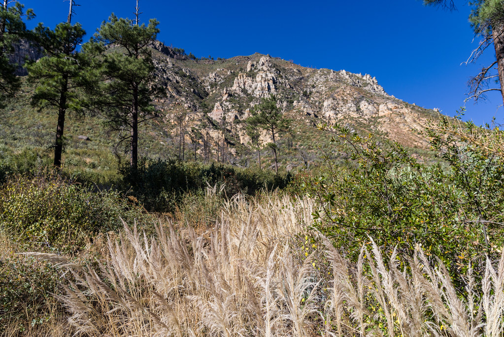 Photo: Coconino NF Photography, Public Domain Dedication (CC0) (via Flickr)
Purtyman #65
~4 min drive
1.08-mile out-and-back trail in Arizona with 781 ft elevation gain.
 Photo: inkknife_2000 (7.5 million views +), CC BY-SA 2.0 (via Wikimedia Commons)
North Wilson #123
~10 min drive
4.14-mile out-and-back trail in Arizona with 1,563 ft of elevation gain.
Photo: inkknife_2000 (7.5 million views +), CC BY-SA 2.0 (via Wikimedia Commons)Harding Springs
~3 min drive
1.71-mile out-and-back trail in Arizona with 954 ft elevation gain.
 Photo: inkknife_2000 (7.5 million views +), CC BY-SA 2.0 (via Wikimedia Commons)
Cookstove #143
~4 min drive
2.97-mile out-and-back trail in Arizona with 136 ft elevation gain.
 Photo: Coconino NF Photography, Public Domain Mark (via Flickr)
Howard
~11 min drive
12.06-mile out-and-back trail in Arizona with 380 ft gain
 Photo: inkknife_2000 (7.5 million views +), CC BY-SA 2.0 (via Wikimedia Commons)
Telephone
~3 min drive
1.74-mile out-and-back trail in Arizona with 1,075 ft elevation gain.
Map and trail data © OpenStreetMap contributors

